

Shower chances continue this weekend!
Seattle - Happy Friday!
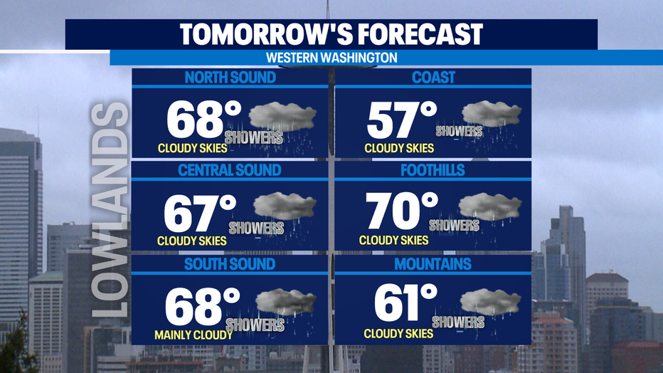
What a day. We ended our dry streak with some drizzle and light showers overnight and early this morning. The officially reading was taken at SeaTac 10 minutes before midnight at 0.01". The drizzle and shower activity will return tomorrow adding to the accumulation we saw this morning! Along with the precipitation, we can expect cooler temperatures and cloudy skies. Enjoy the changes because they will be short lived.
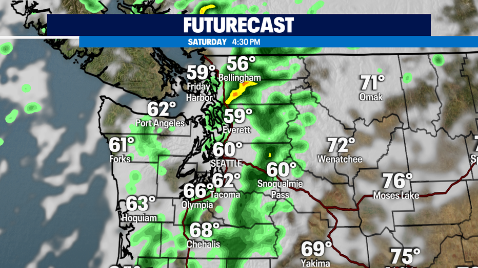
Tomorrow afternoon/evening is when the precipitation will peak this weekend. The timestamp below is for Saturday at 4:30pm. Expect less than .10" for most of the lowlands. Heavier accumulation will develop across the North Sound and throughout the Cascades.
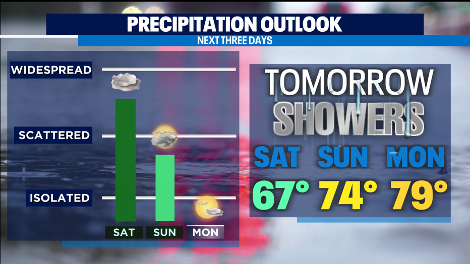
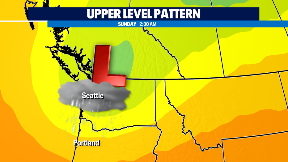
Shower and drizzle chances taper off Sunday afternoon. That'll be the time to make your outdoor plans! As we clear out, the temperatures will return into the 70s and the humidity will improve. An upper-level low pressure system will be responsible for the cooler weather and rain this weekend.
As that system tracks east, the temperatures will start to rise. Quickly! Expect a 26 temperature increase this week with our afternoon highs. That'll be dramatic!
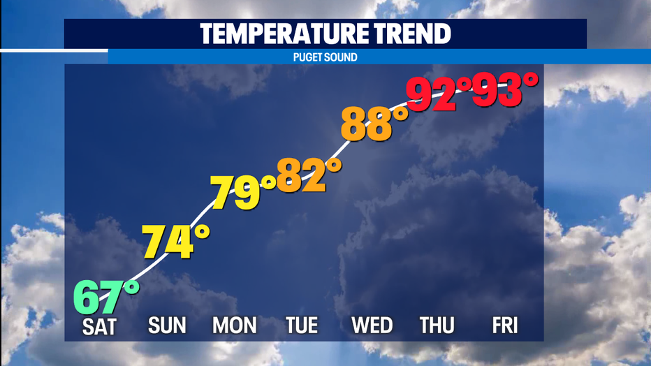
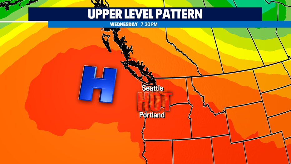
An upper-level high will build in our forecast allowing for the temperatures to peak in the 90s.
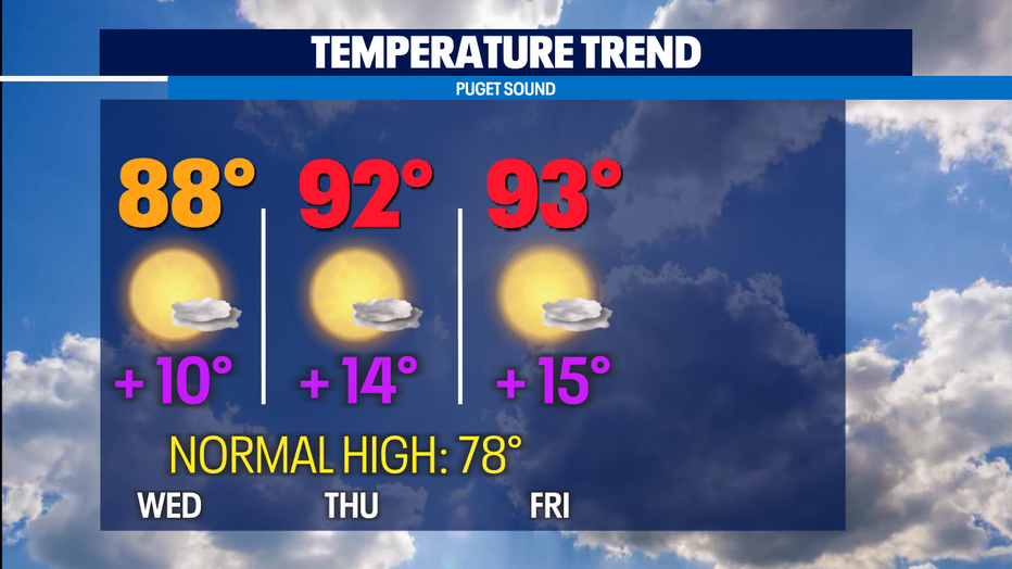
Expect us to be between 10-15 degrees above normal by the end of the 7-day forecast.
In fact, the temperature outlook for the next two weeks shows dry and hot continues.
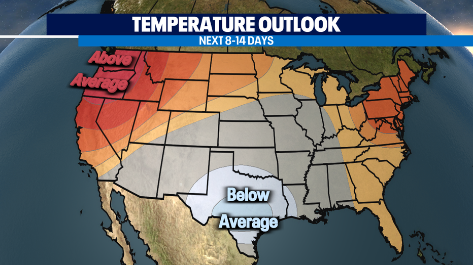
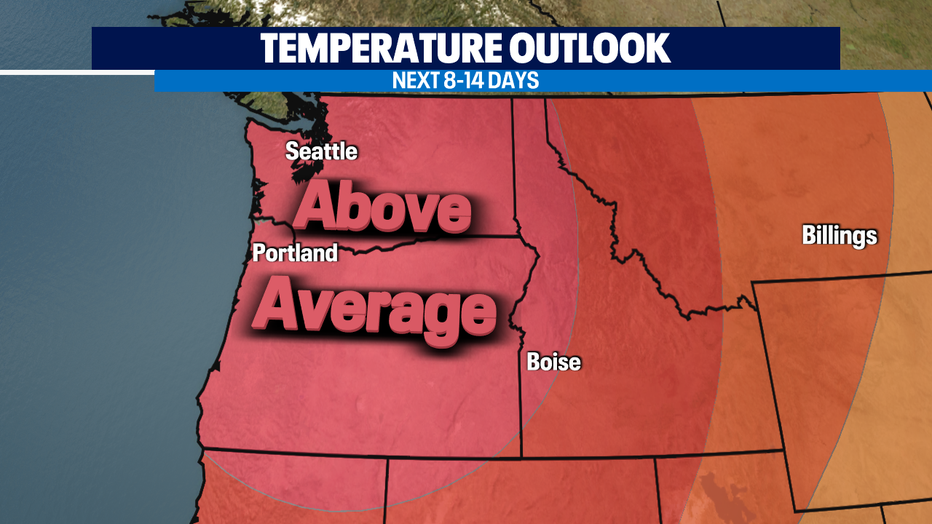
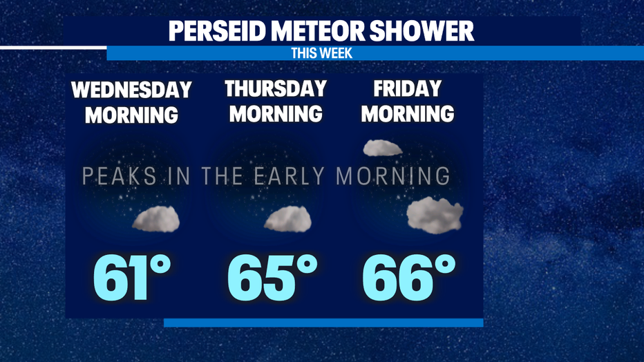
There's about a 70% chance that we'll be above average. Luckily for us, this will make for comfortable overnight lows and clear skies. This will make for nice conditions if you want to check out the Perseid meteor shower! This will officially peak next week in the early morning hours.
Have a good one and I'll see you on Q13FOX!