

Staying dry the rest of the workweek

Back to sunshine, cooler temps in Western Washington
It'll be cooler and dry through the end of the week before showers return this weekend.
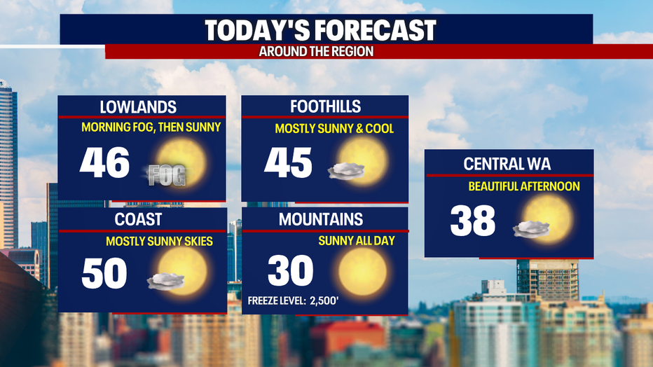
Seattle - Morning fog has mixed out and the sunshine is back for the rest of the day. Dry weather will continue through the workweek in Western Washington.
Dense fog impacted some areas around the south Puget Sound this morning, but northerly winds helped dissipate that quickly after sunrise. The rest of the day will be gorgeous with sunny skies and cooler high temps for the lowlands, in the mid 40s.
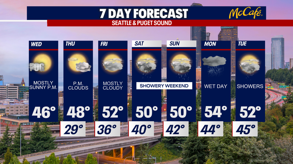
Clear skies will lead to chilly temperatures tonight. Temps will drop to the upper 20s and low 30s around the Puget Sound. Thursday and Friday will bring more clouds as a warm front moves into southern British Columbia.
The next chance for rain hits on Saturday and Sunday with on and off showers through the weekend.
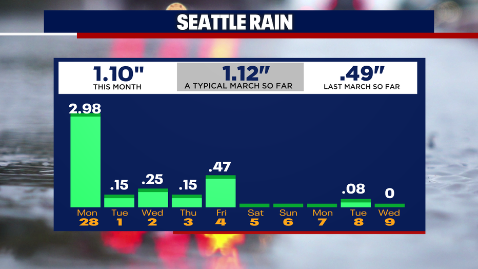
We are running right on track for rainfall this month so far. An atmospheric river on Monday could push us well above average.
Starting Sunday night, very wet and windy weather will hit Western Washington as widespread heavy rain moves through. Like other atmospheric river events recently, this could cause rivers to rise quickly. We will be tracking this storm as we get closer.
Enjoy the sunshine!
Get breaking news alerts in the FREE FOX 13 Seattle app. Download for Apple iOS or Android. And sign up for BREAKING NEWS emails delivered straight to your inbox.
Stay connected with FOX 13 News on all platforms:
DOWNLOAD: FOX 13 News and Weather Apps
WATCH: FOX 13 News Live
SUBSCRIBE: FOX 13 on YouTube
DAILY BRIEF: Sign Up For Our Newsletter
FOLLOW: Facebook | Twitter | Instagram