

Seattle weather: Summer ends strong with two more warm days
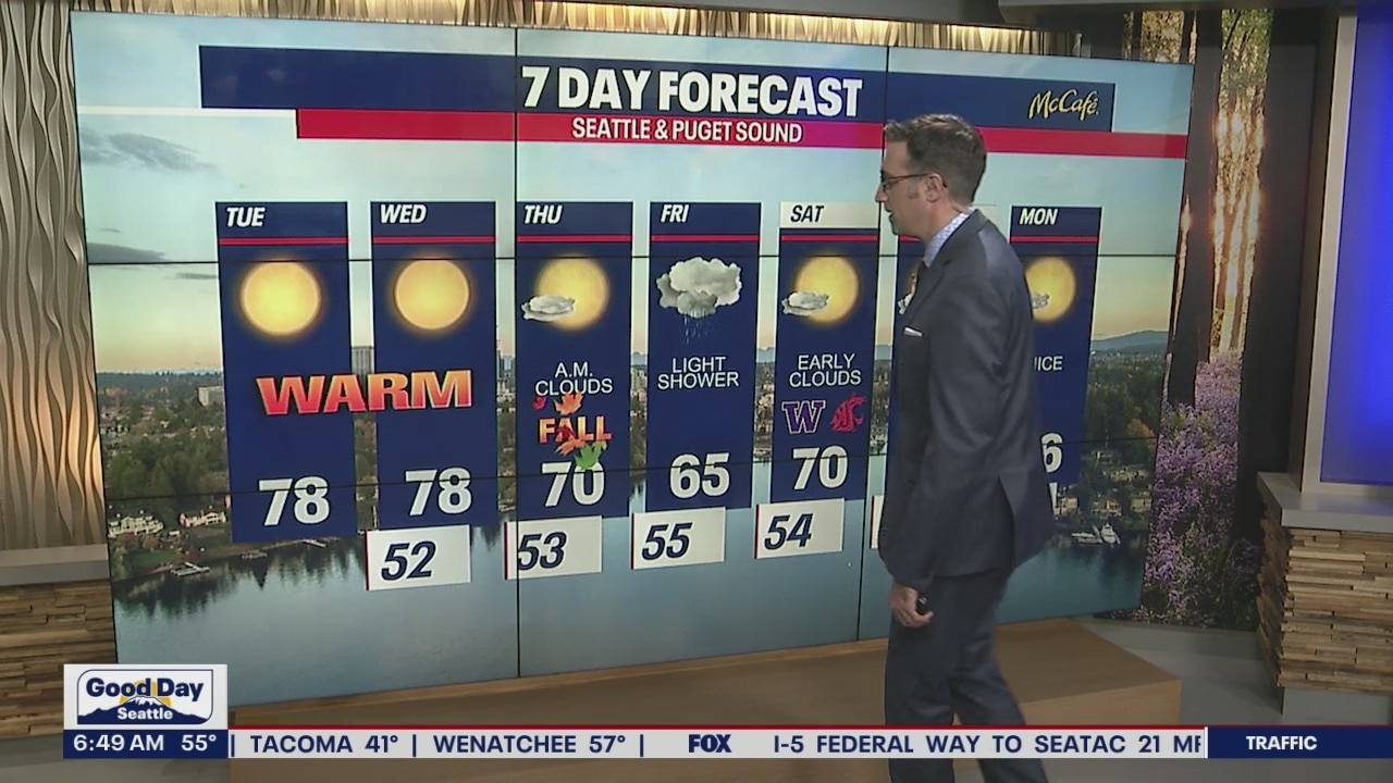
Warm temperatures before the first day of fall
Some of us will see hazy skies, especially over the North Sound with less haze over the Central Sound.
SEATTLE - Sunshine and warm temperatures return Tuesday and Wednesday, but smoke from area wildfires will also impact Western Washington.
High temps will be back into the upper 70s and low 80s for most locations in the central and south sound. Fraser outflow winds will be strong at times in the usual north sound areas.

Offshore northeast winds will continue to push smoke into the Puget Sound area. The central and south sound areas will be the most hazy today. You may notice impacts to air quality at times the next two days, especially in eastern Snohomish and King counties.
These east winds also bring elevated fire danger to the west slopes of the Cascades. Be careful with fire, especially the next two days.

A low pressure system will track into Oregon and Idaho late Wednesday. The pattern will shift to onshore flow by Thursday bringing in a layer of morning clouds. Temps will be much cooler for the first day of fall, around 70 degrees.
Friday brings a chance for light showers and our coolest day of the next week.
Next weekend looks fantastic, with morning clouds and afternoon sunshine and highs back in the 70s.
