

Summer is just around the corner
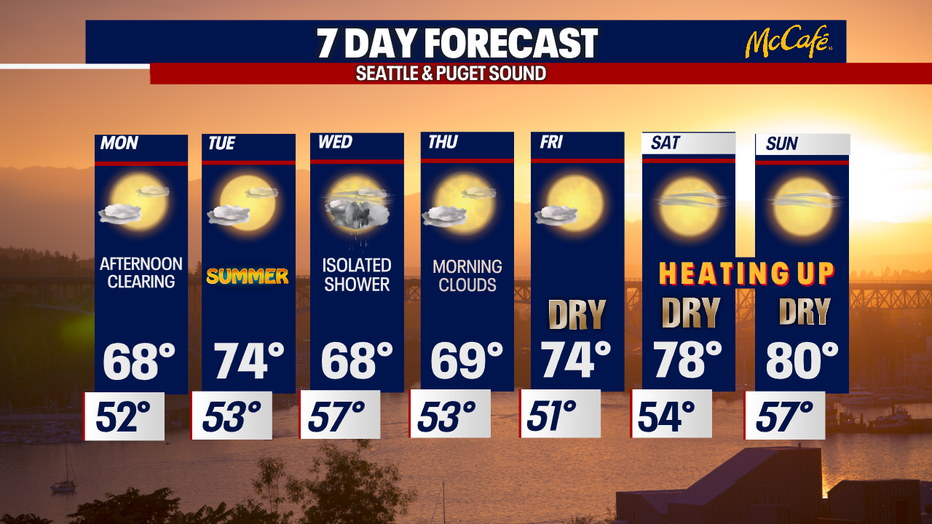
Seattle - This is the week we can expect the weather to take a turn! Temperatures are going to spike by the end of the week as we continue to dry out.
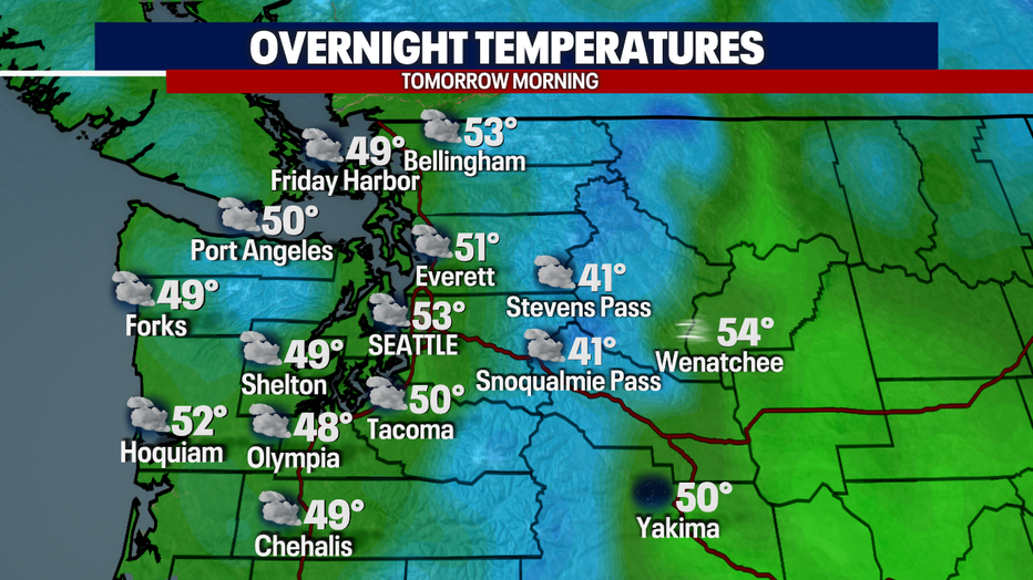
In the meantime, temperatures will drop into the lower 50s tomorrow morning as the clouds remain thick. Expect mainly dry skies on your morning commute.
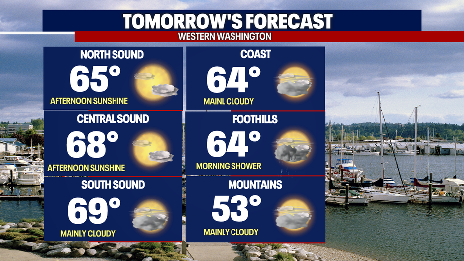
The sun will break through tomorrow afternoon and the temperatures will warm up into the upper 60s (normal high: 72F)
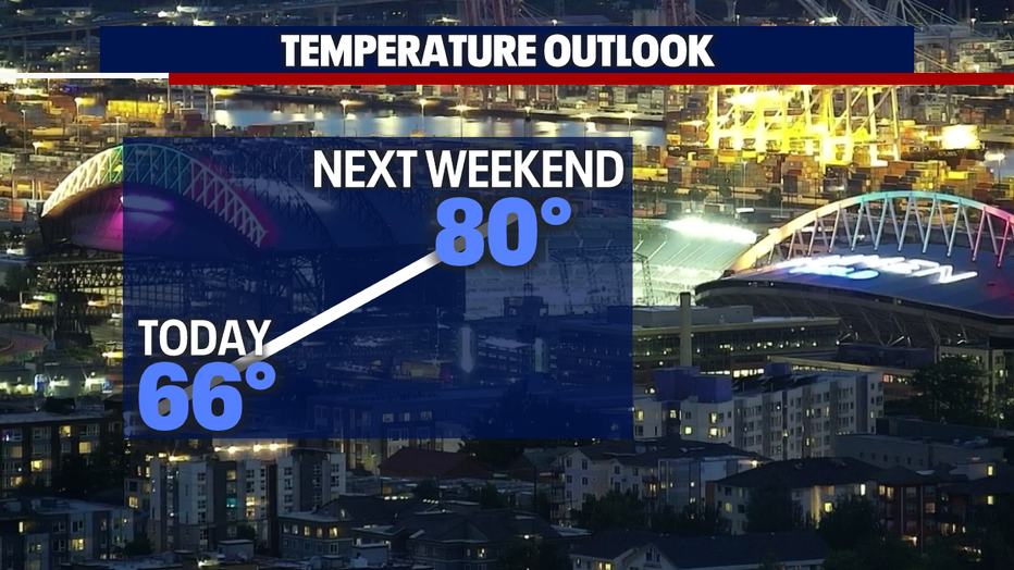
Temperatures will heat by the end of the week! It'll really start to feel like summer as high pressure build in!
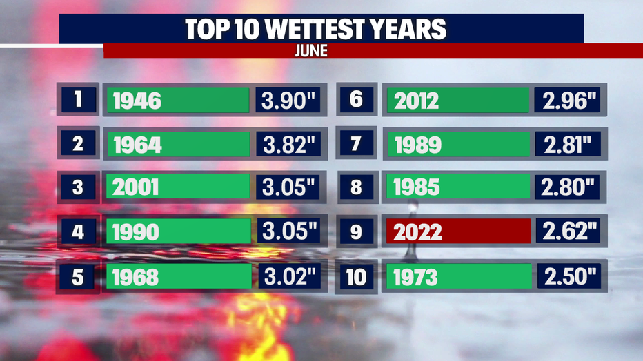
Until the warmer and dryer weather arrives, we'll see a mini disturbance. This will arrive on Wednesday, but we're only talking about an isolated shower! It shouldn't have a big influence on our rain accumulation for the week/month. We're already in 9th place for the wettest June on record! Here is a look at where we rank in the top 10 wettest years:
I'll leave you with a look at your 7-day forecast. Check out that nice warm-up by the weekend!
Have a good one :)