

Tuesday Weather: Showers, sunbreaks and gusty winds

Scattered rain expected for the next few days
FOX 13 chief meteorologist Lisa Villegas has the latest forecast.
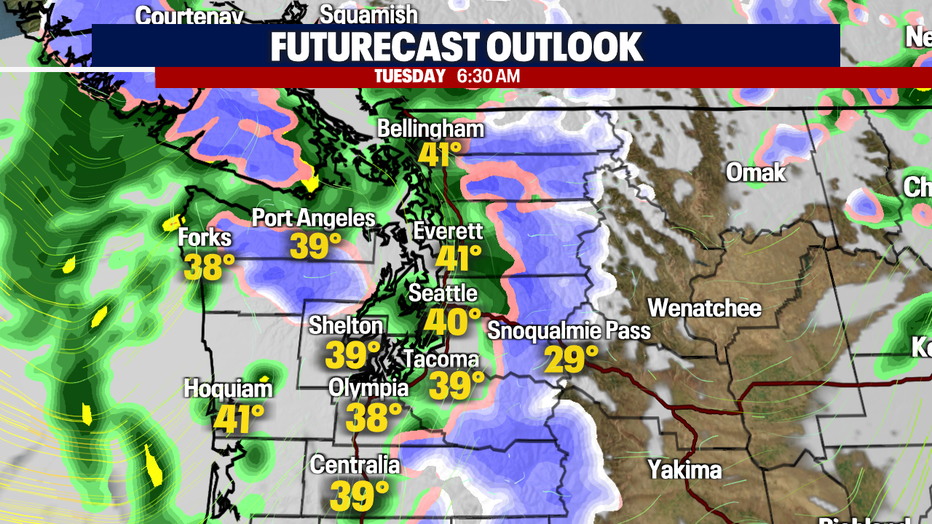
SEATTLE - Showers will continue to impact our forecast overnight. It'll be colder too! Snow levels will begin to drop (2,500' tonight), increasing snow showers vs. rain. Here is a look at your morning commute forecast:
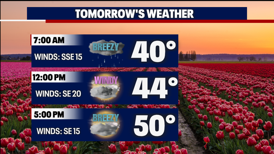
The two big changes tomorrow afternoon will be more sun breaks and gusty winds. Temperatures will peak into the lower 50s as scattered showers remain across Western Washington. An isolated thunderstorm can't be ruled out either. Get ready for it all tomorrow! Here is a breakdown of the forecast:
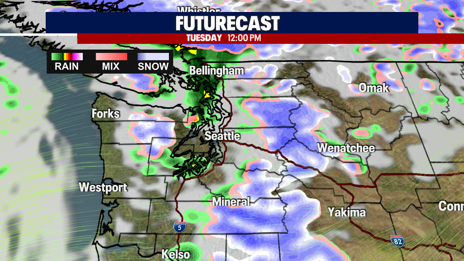
As we roll through the day, we could accumulate 2-6" of snow through the passes. Snow levels will remain below pass level, so the accumulation will continue through Wednesday. Here is a look at FutureCast showing the precipitation tomorrow afternoon:
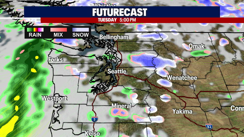
^See the sunbreak in FutureCast? More of that sunshine will fight through the clouds as we continue to move forward throughout the week. Yay!
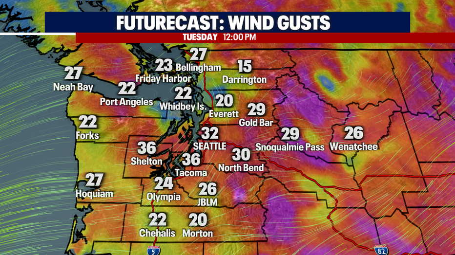
The winds will return tomorrow with sustained winds between 10-20 mph and gusts between 25-35 mph. Here is a look at tomorrow's wind forecast:
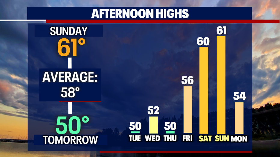
If you've been craving warmer weather - it's (briefly) coming! High pressure will increase in our forecast allowing for the temperatures to spike by the weekend. Here is a look at your temperature trend:
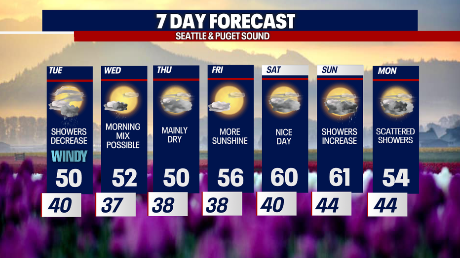
I'll leave you with a look at your 7-day forecast:
Have a good one!