

Weather Alert Days for rain, wind and the potential for weekend thunderstorms
Weather Alert Days for rain, wind and the potential for weekend thunderstorms
Q13 News Meteorologist M.J. McDermott has a rainy weekend forecast for Seattle
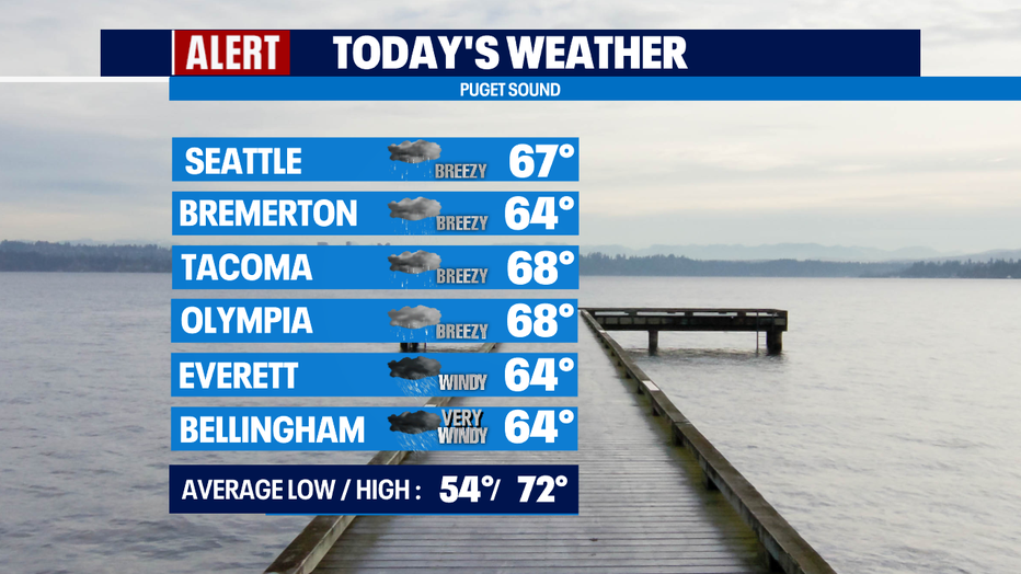
Seattle - Our Weather Department has designated three Weather Alerts Days - today through the weekend. Today, it's for the rain and breezy-to-windy conditions. For Saturday and Sunday, there is the potential for some thunderstorms.
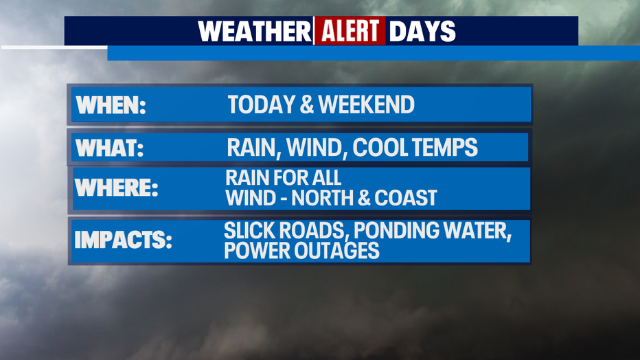
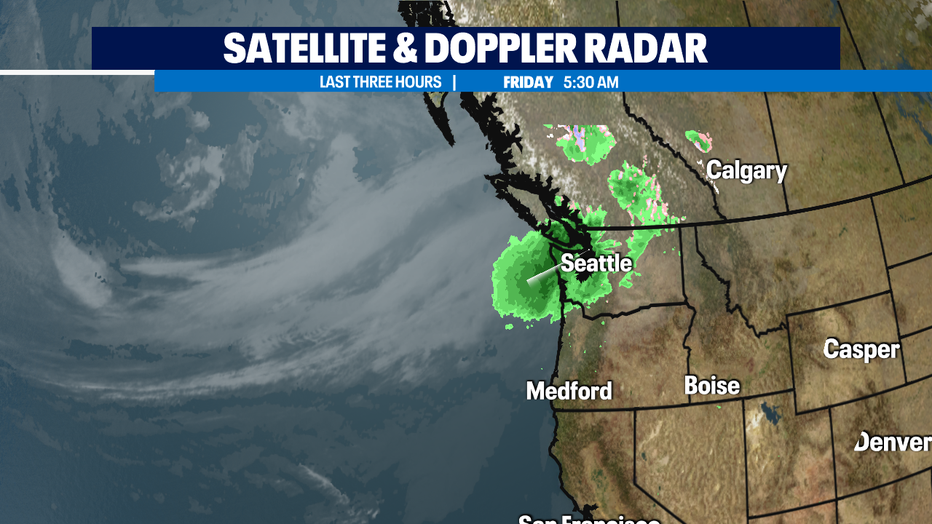
Our first fall storm is arriving a few days early. We're getting rain, heavy at times, pretty much everywhere in Western Washington, pretty much all day. It's an "atmospheric river" that is pointed right at the Pacific Northwest like a firehose. I'm calling this our "summer ender." Some people are calling it the "fire extinguisher!" I love that. we are getting some rain in Central and Eastern Washington too. Hopefully fires will be tamped down!
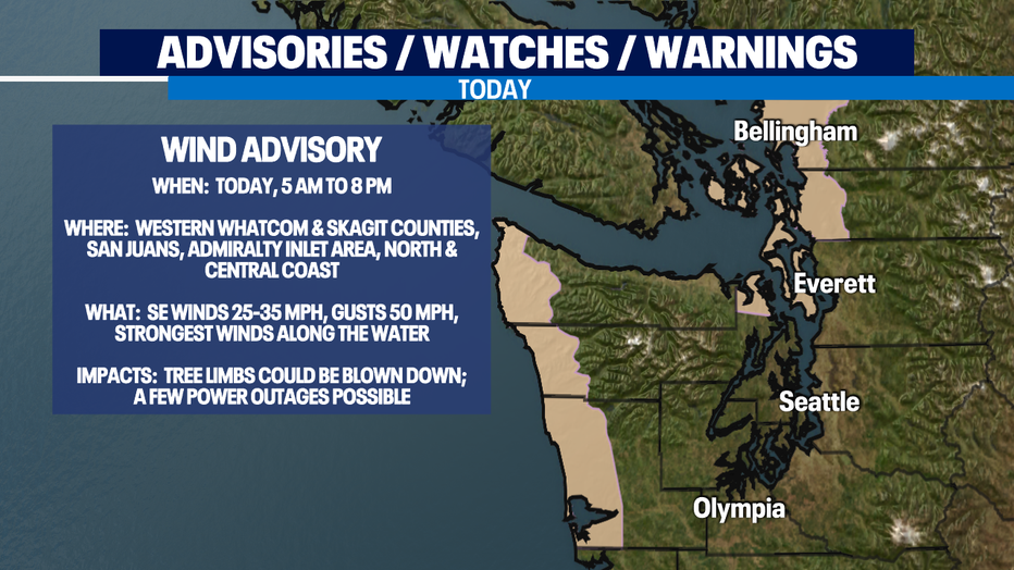
It will be breezy for most of us, windy to the north and on the coast. The National Weather Service has issued a Wind Advisory for those areas, details below.
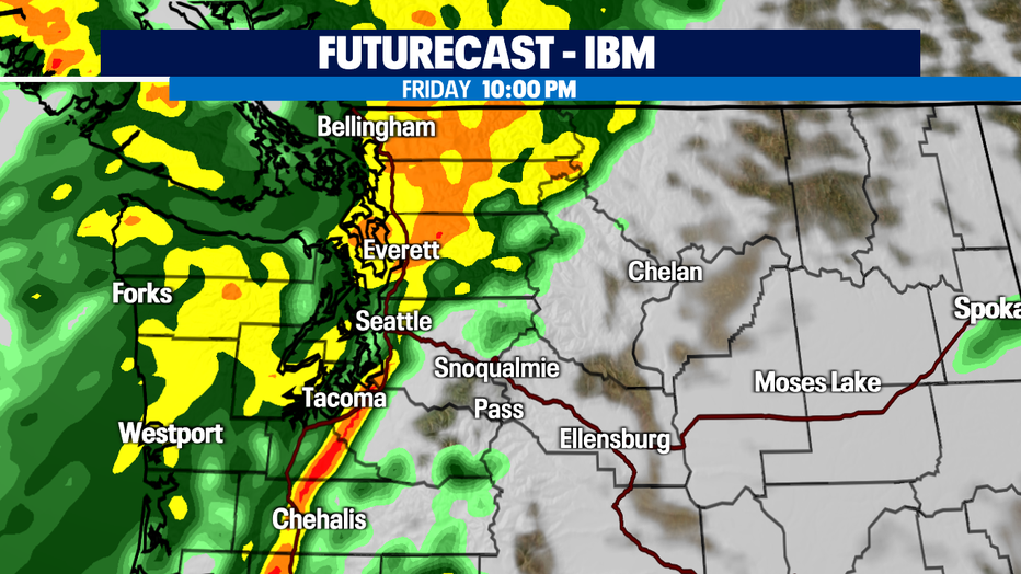
The heaviest rain looks likely to hit late tonight along I-5 with frontal passage. Check out the FutureCast forecast for around 10 p.m. below. You'll hear the pounding on the roof!
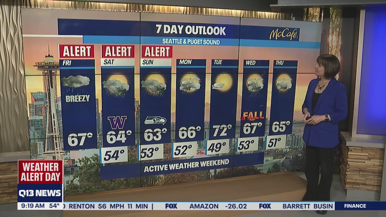
It will also be chillier than normal, with highs in the mid 60s. 72 is normal for this time of the year.
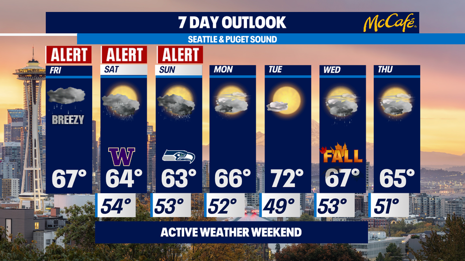
The weekend will be showery with perhaps a few sunbreaks. There is a potential for isolated thunderstorms Saturday and Sunday. It will be chillier, with highs only in the low-to-mid 60s.
Monday could have a lingering morning shower, then we'll dry up and have partly sunny skies and highs in the mid-to-upper 60s.
Tuesday is the last day of summer and it looks like summer is going to give us one more summery day. It'll be mostly sunny with highs around normal - low 70s.
Fall arrives on Wednesday and there's a chance of showers with highs in the upper 60s.
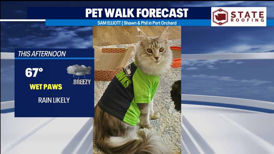
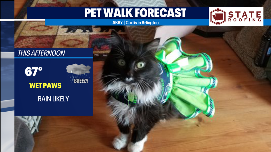
With rain likely, it's a Wet Paws Day for the Pet Walk Forecast. Here are a couple of 12 kitties on this Blue Friday!
Meteorologist M.J. McDermott