Seattle weather: Wednesday is the last dry day for a while

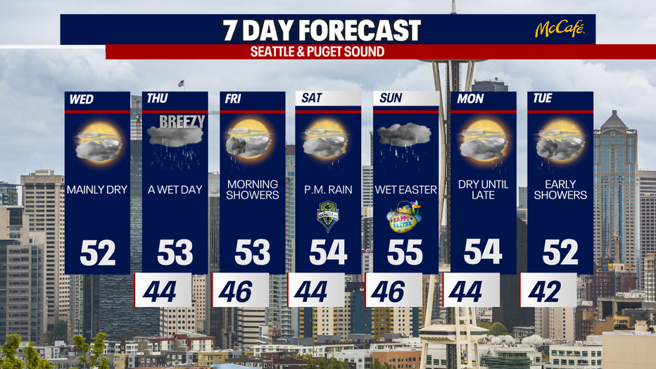
Wednesday mostly cloudy before showers return
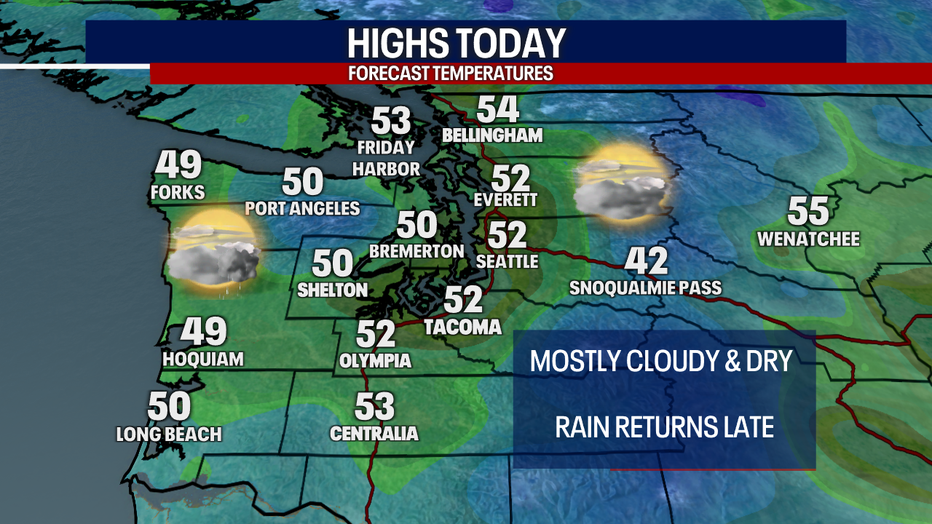
Some of the coldest spots as we wake up Wednesday are to the south in Pierce and Thurston Counties, along with folks in western Whatcom County.
SEATTLE - More clouds are in the forecast Wednesday as a slow moving wet system approaches the Pacific Northwest.
Highs today will be slightly warmer with temps in the low 50s this afternoon. The coast will start to see showers this afternoon and early evening.
Widespread rain will return to the Puget Sound area after sunset tonight. This will be a weak atmospheric river and Western Washington's first in over three months. Rain will become widespread by the morning commute and stick around all day long Thursday.
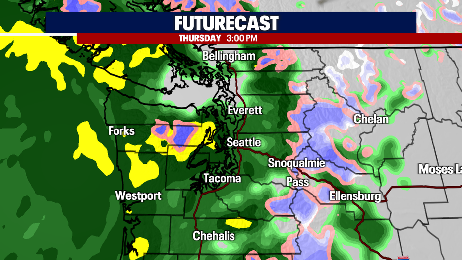
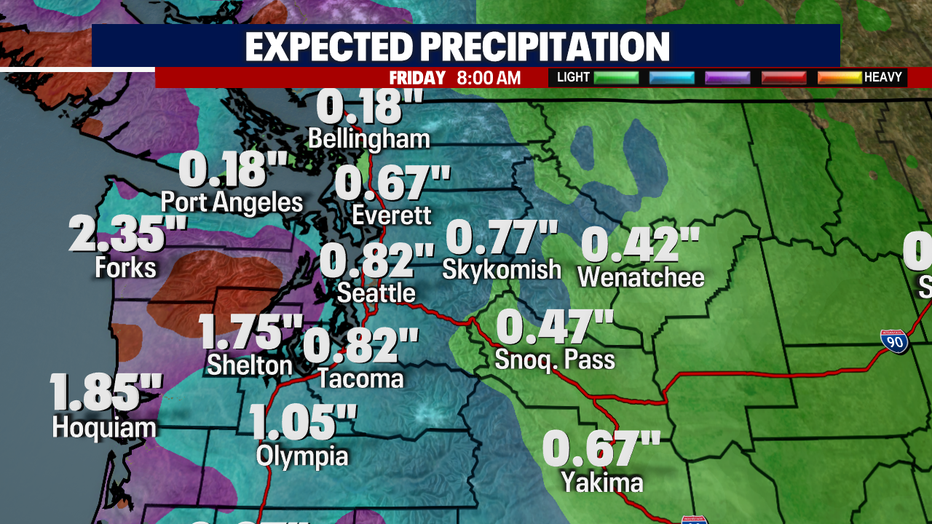
A half inch to an inch of precipitation is expected for most of the Puget Sound area, with an inch and a half to two and a half inches expected for the coast. This will be mainly rain at the pass level as snow levels rise above 4,000 feet Thursday.
Winds will also be strong in the usual spots Thursday. The Washington Coast and areas around the Northwest Interior could see wind gusts of 40 to 50 mph in the afternoon.
The next round of heavy rain hits on Easter Sunday, bringing another half inch to an inch of rain to the Puget Sound area by Monday morning.
Looking beyond the seven day forecast, I don't see any big warm up on the way through at least the middle of April.