

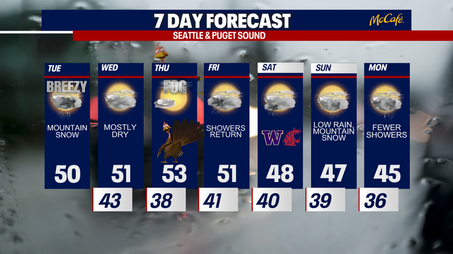
Wet weather Tuesday, drier by Thanksgiving

Rain returns after a record-breaking dry streak
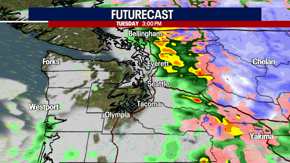
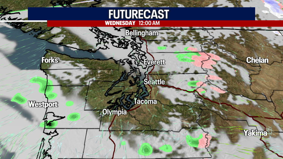
Widespread rain will increase throughout the morning as a frontal system hits our region.
Rain has returned to Western Washington today after a record-setting dry spell for November. Sea-Tac Airport had two weeks of dry weather in what's typically our wettest month of the entire year! Today will be damp, but things dry out by Wednesday morning.
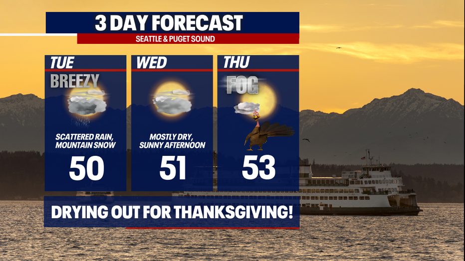
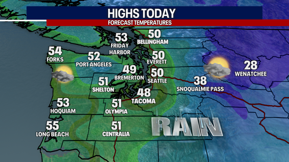
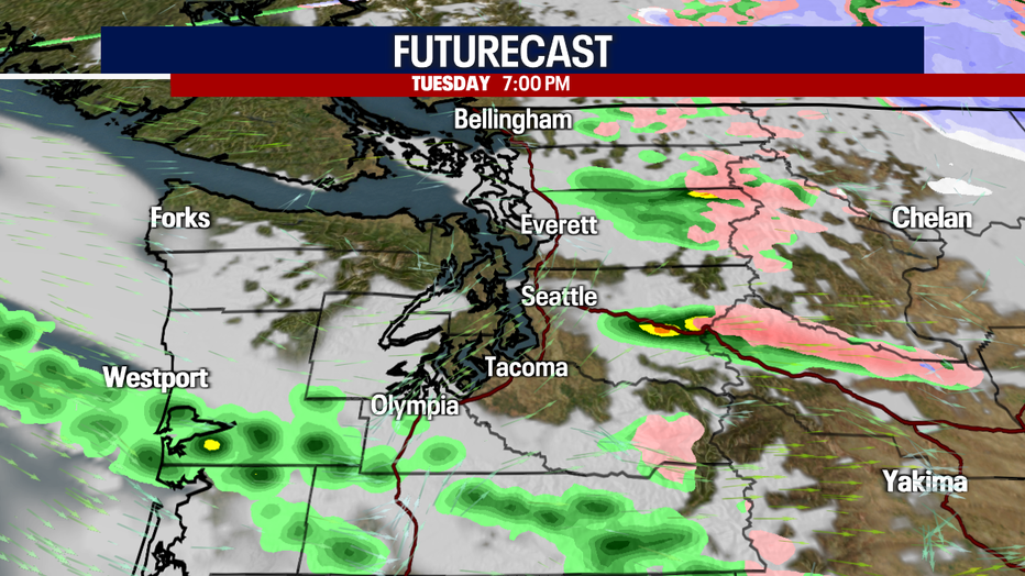
Highs today will range in the low 50s. Widespread rain will turn to fewer showers in the afternoon. A convergence zone could set up in parts of Puget Sound later today. We can't rule out small hail or graupel mixing with rain in the lowlands.
It will be breezy today as well, but winds aren't expected to be damaging. In general, gusts could blow to 20-35 mph, perhaps 40 mph in the typical spots (but even that may be a stretch).
Get ready for active weather over the passes today. At times, snow could be heavy over the Cascades. Between six and 12 inches of snow could stack up over Stevens Pass. A Winter Weather Advisory is in effect until early Wednesday morning.
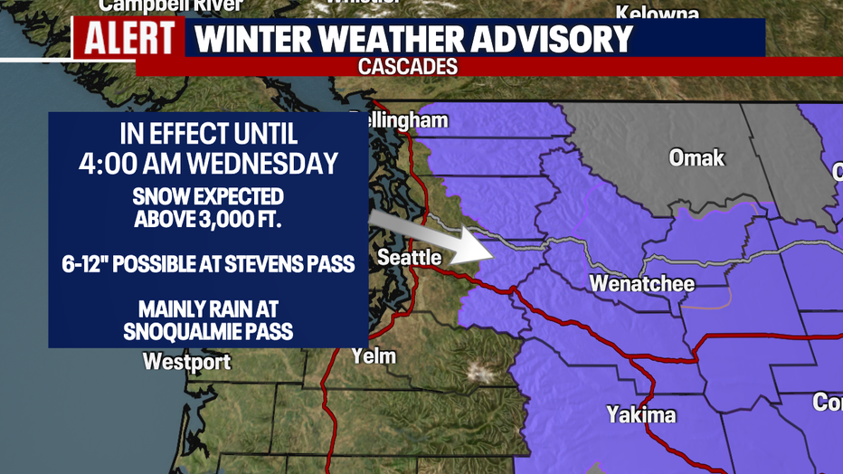
The forecast for Snoqualmie Pass today is rather fluid. Rain is most likely there, but precipitation could change to snow if cold easterly winds develop. This is an evolving forecast. Stick with us! We recommend that you check WSDOT conditions and the forecast before traveling over the higher elevations today.
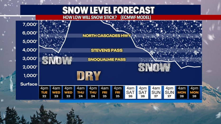
Holiday travelers can plan on drier weather along the passes Wednesday and Thursday. By Saturday and Sunday, snow could fire up again over the mountain highways. Right now, it doesn't look like accumulations would be significant this weekend, but even several inches of snow could snarl traffic. Stay tuned for updates!
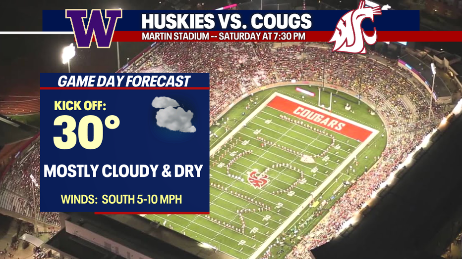
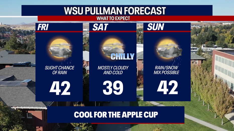
Mother Nature is serving up chilly temperatures for the Apple Cup Saturday in Pullman (Go Cougs!). The kickoff temp at 7:30 p.m. will be cold, hovering around 30 degrees. Saturday looks dry along the Palouse. There could be rain in Pullman on Friday. A rain/snow mix is a possibility for people driving out of Pullman on Sunday.
Thanksgiving in Western Washington could start foggy, but partly to mostly sunny skies should follow in the afternoon. It will be a gorgeous day around the area. Enjoy the beautiful weather!
Showers return on Friday. Lowland rain and mountain snow carry us into the weekend. Fewer showers are on the way Monday.
Thanks so much for choosing FOX 13! We will bring up continuous updates on the forecast all week.
Warmly,
Meteorologist Abby Acone
Follow me on Twitter @abbyaconetv, Facebook (Meteorologist Abby Acone), Instagram @abbyaconewx and TikTok @abbyaconetv