

Pineapple Express chugs into Washington, Pacific Northwest triggering flood fears

Flood fears in the Pacific Northwest are growing as rivers and streams in Washington and Oregon start to rise thanks to a series of atmospheric river storms that are delivering heavy rain to the region, which is now melting mountain snow and sending water into low-lying areas.
It was a wet and dangerous weekend across the region with snow falling in the Cascades, including more than a foot at Mr. Rainier’s Paradise Ranger Station.
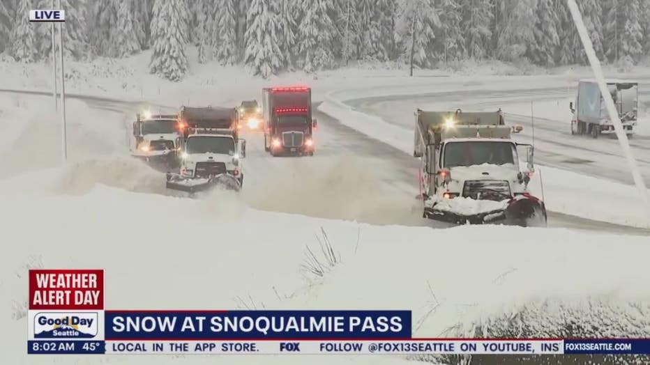
The snow also led to several crashes that forced officials to close a stretch of Interstate 90 through Snoqualmie Pass near Seattle on Friday.
One person was killed in a crash in Stevens County in northeastern Washington after the driver lost control on a snow-covered road and hit a tree, according to the Washington State Patrol.
All aboard the Pineapple Express

Live report: Tracking flooding conditions in Snohomish County
FOX 13 Seattle's Dan Griffin is tracking flooding conditions in Snohomish County.
An atmospheric river called the Pineapple Express slammed into the Pacific Northwest Monday on the heels of the atmospheric river that impacted the region over the weekend.
This is a warm flow of moisture that connects tropical moisture from Hawaii to the Pacific Coast. The river of moisture can hold up to three Mississippi Rivers worth of water vapor. Coming from the tropics, the air is mild and the heavy rain and warmer temperatures will start to melt all that new snow. Tuesday, a handful of cities are even expecting record highs.
That stream of moisture will weaken slightly on Tuesday, but the most impactful part of the storm – river flooding – will just be getting started.
Moderate to major flooding expected
(File / FOX 13)
At around 6:45 a.m. on Tuesday, the Snoqualmie River reached a phase 3 flood alert – meaning moderate flooding is expected in low-lying areas throughout the Snoqualmie Valley. Just before 2:30 a.m., the Tolt River reached a phase 2 flood alert, which warns the public that minor flooding may occur.
The FOX Forecast Center said the warm air surging off the Pacific will raise snow levels above 9,000 feet, which is higher than they were over the weekend.
"It started around 3,000 feet, and then the snow elevation went up to 6,000 feet," FOX Weather Meteorologist Michael Estime said. "The problem was that between 3,000 and 6,000 feet, we still have a conveyor belt of rain. So, what we had basically was rain on top of all that snow. All of that snow starts melting. It leads to runoff. And that’s what led to a big flood concern, especially in the western Cascade Mountains."
Featured

Snohomish County rivers flood dangerously close to where thousands of people live and work
Rising rivers and streams in Snohomish County are getting dangerously close to where thousands of people live and work.
The FOX Forecast Center said the combination of an additional 3-12 inches of rain and the melting of the 2-4 feet of snow on the ground in the Cascade and Olympic mountain ranges will send numerous rivers into flood stage, with some major flooding possible.
Because of the flooding threat, Flood Watches have been posted in the Pacific Northwest from western Washington through western Oregon. This includes major cities in the region like Seattle and Olympia in Washington and Portland, Salem, Eugene and Medford in Oregon.
The National Weather Service in Seattle said excessive rainfall is likely Monday and Tuesday, with 7-10 inches possible over the Olympics, 5-9 inches over the Cascades, 3-5 inches along the coast and up to 3 inches in the interior lowlands.
Because of this, excessive runoff may result in the flooding of rivers, streams and other low-lying and flood-prone areas.
There’s also a risk of urban and poor-drainage flooding with low-water crossings that could be flooded, as well as extensive street flooding and the flooding of rivers and creeks.
The FOX Forecast Center said water levels will begin rising significantly on Tuesday and could crest sometime between Tuesday night and Wednesday night.
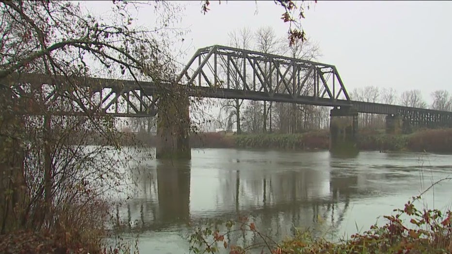
Moderate to major flooding is expected along the Skagit, Snohomish, Snoqualmie and Skokomish rivers. Communities along these rivers, like Carnation, Washington, will need to be on alert as numerous roads and structures could be flooded.
The Snoqualmie River at Carnation is expected to crest on Wednesday at 58.2 feet. That is below the record crest of 62.21 feet and is just over major flood stage.
At 51 feet, the river spills over its banks, and shallow flooding occurs. At 56 feet, widespread flooding from Fall City through Duvall occurs.
At 60 feet, swift floodwaters cause widespread inundation.
The flood alerts in effect in the Northwest will continue through at least Wednesday night.
However, the flash-flood risk will continue through at least Thursday morning, though it will be focused farther south in Oregon and parts of Northern California.