

Seattle weather: Cooling down slightly with temps in the mid 70s on Wednesday
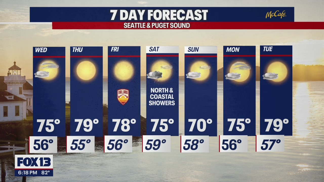
Temps cooling off slightly on Wednesday
Temperatures will get closer to 80 to round out the week before dropping again on Sunday.
SEATTLE - We hit the 80s again today for some around Western Washington-- that's the third time we've warmed into the 80s this year at the Sea-Tac Airport.

As our ridge of high pressure starts to shift east Wednesday, this will open the door for marine air to push inland causing temperatures to cool into the mid-70s inland with upper 60s along the coast. Morning skies start our partly cloudy with plenty of afternoon sunshine.


Thursday and Friday look very similar to Wednesday with a little less cloud cover. Temperatures will warm a few degrees back up to above-average in the upper 70s.

This weekend, our region will be in between low pressure in the Gulf of Alaska and high pressure to the east over the Rockies. This will keep temperatures slightly cooler than average with a chance for a few passing showers Saturday midday. Showers mainly look to hang at the coast and North Sound between 11 a.m. and 2 p.m. Expect highs Saturday to land in the mid-70s with low 70s on Sunday.


There is no significant rain or extreme temperatures in the forecast for at least the next 10 days.
Have a great night! ~Erin Mayovsky, FOX 13 Forecaster
