

Seattle weather: A dry weekend with unsettling conditions returning late Sunday
SEATTLE - Happy weekend all! We saw a fantastic day across the Northwest. Highs around the region landed in the upper 40s to low 50s. Sea-Tac Airport hit 52 Friday.

Overnight, skies turn mostly cloudy with areas of fog developing. Lows drop into the upper 30s to near 40. The average for this time of year is 38.

This weekend looks nice as a ridge sets us up for mainly dry weather through most of Sunday. Showers will return around dinner time Sunday evening and pick up as we move into the start of the work week.
Unsettled conditions provide rain and wind on Monday before we dry out again.

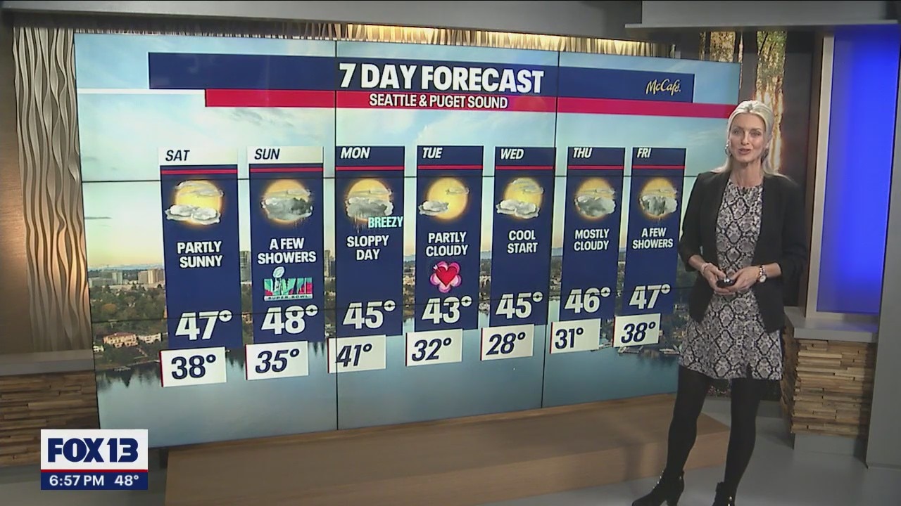
Saturday starts out with a few clouds and areas of patchy fog for some, mainly south. Highs cool into the upper 40s.


We have you covered for Super Bowl Sunday! We're forecasting mostly cloudy skies with just a few showers mid-morning to the north, otherwise, most of us will stay dry.

Highs Sunday land in the upper 40s. Clouds do increase throughout the day and chances for rain return after the dinner hour.


Unsettling weather is with us Monday. Rain chances increase along with breezy winds through Puget Sound. Highs cool into the mid 40s.
There is the threat of thunderstorms at the coast along with snow falling across the mountains.

Monday's system is fast-moving, and we'll flip back to a drier pattern for much of the work week.
Valentine's Day features partly sunny skies with much cooler temperatures, especially out of the gate. Wake-up temps are cold near freezing with highs only warming into the low 40s. Wednesday morning starts out even colder in the low 20s. Brr!
We should stay mostly dry through Thursday! Enjoy!
Have a great weekend all! ~Erin Mayovsky, FOX 13 Forecaster

*Coast Forecast

*Mountain Forecast

