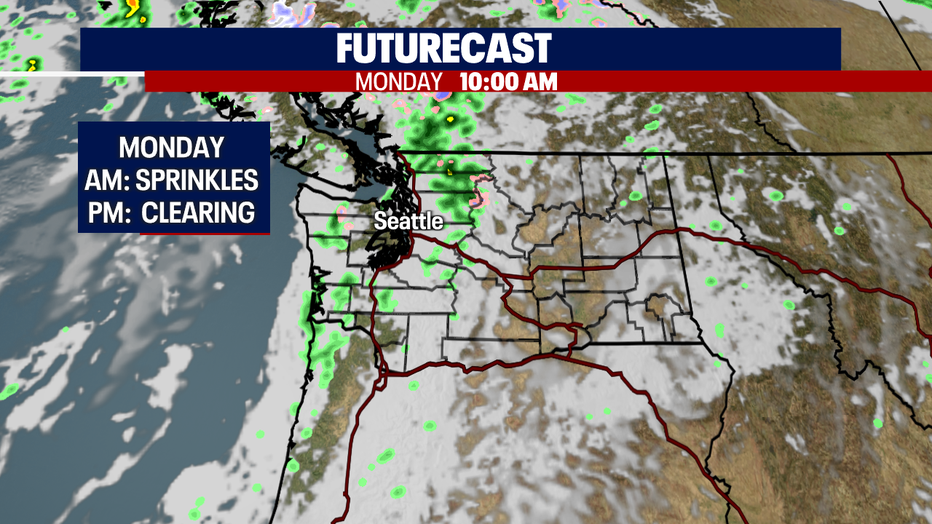
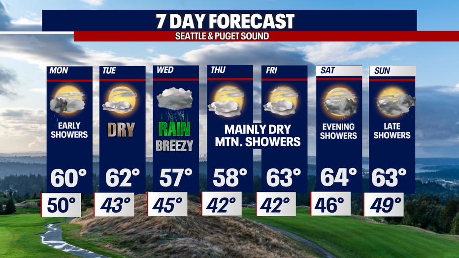
A few left over showers early Monday with a drier day Tuesday
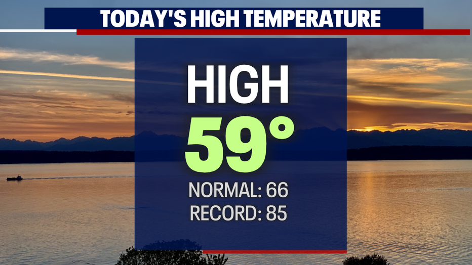
SEATTLE - We saw another round of cool and showery weather Sunday with highs only warming into the upper 50s to near 60.
We will see more changes this week as we ride the May rollercoaster. The start of the work week brings drier conditions with a strong system riding in midweek.
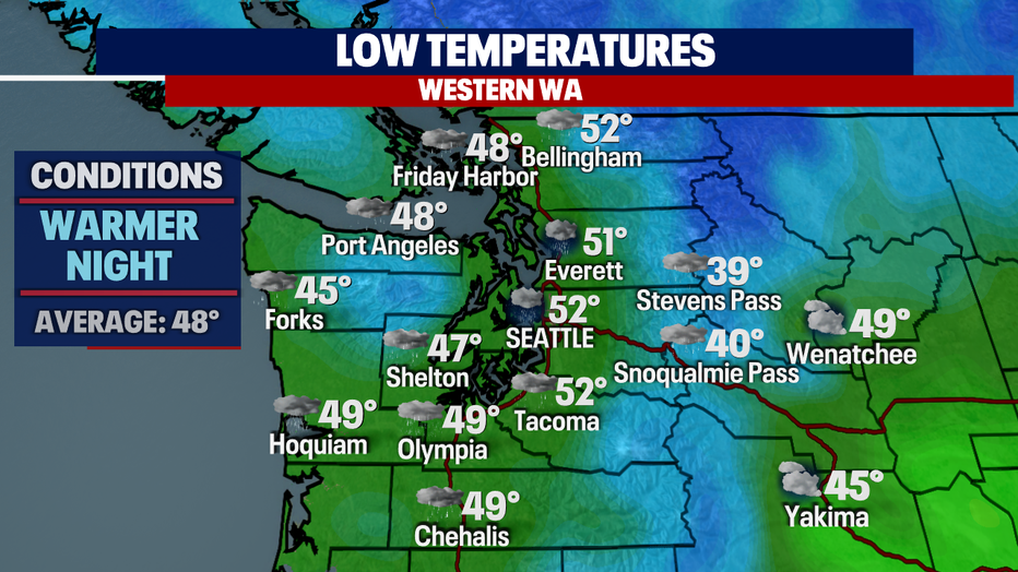
Overnight temps run warmer landing in the upper 40s to low 50s except for the NW WA Coast and Island Counties running slightly cooler in the mid 50s.
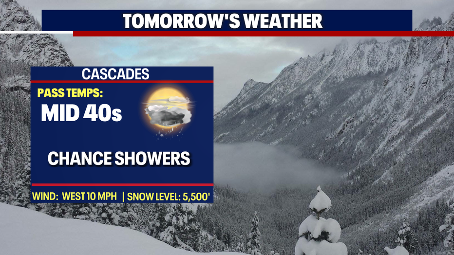
As low-level onshore flow persists with a slightly unstable air-mass Monday, skies will remain mostly cloudy with a few lingering showers as we start the morning commute.
By the afternoon most of us should dry out with temperatures around 60. Our new daily average shifts to 67 tomorrow so dress accordingly as we'll be 5-8 degrees cooler.
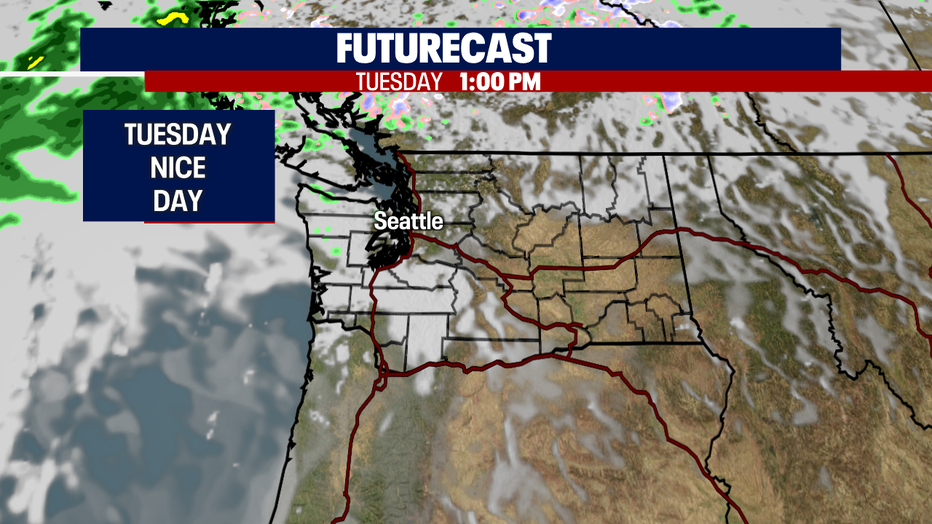
We should dry out completely by Tuesday as we see a brief break from our unsettled weather. Look for mostly to partly cloudy skies. Highs hang in the low 60s.
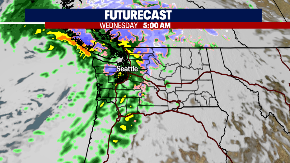
So, what follows a nice dry Spring day? A sloppy wet Wednesday! Yep, Mother Nature sending in another blustery day with rain, heavy at times, plus breezy winds too!
High temps will cool midweek into the upper 50s, but we do rebound back into the low 60s Thursday and Friday with mainly dry days. The weekend brings cloudier skies with late day/evening showers. Enjoy!
Have a great night all! ~Erin Mayovsky, FOX 13 Forecaster
*Beach Forecast
*Mountain Forecast
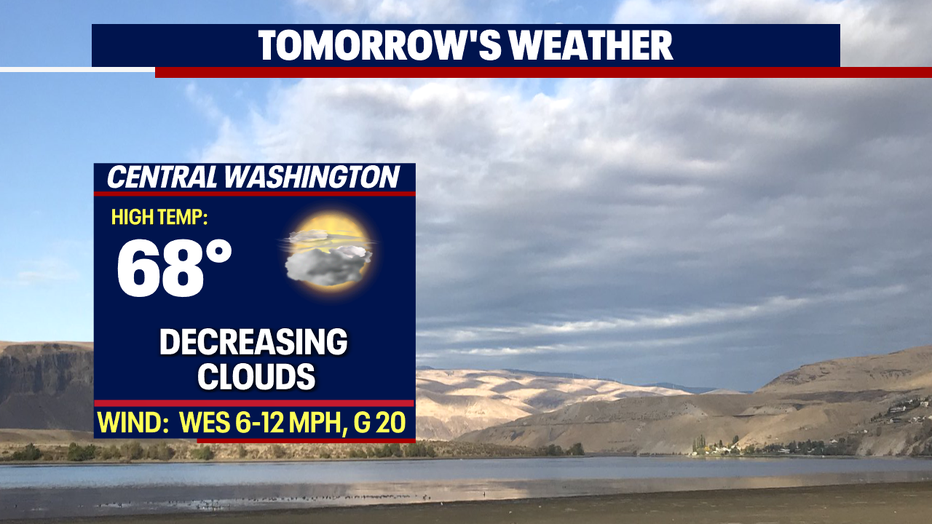
*Central WA Forecast