

A short break from the rain
A short break from the rain
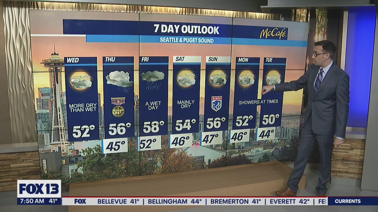
After a blustery day across the region, we will settle down Wednesday as we get a brief break before the next system hits.
Seattle - Western Washington is in for a much calmer day Wednesday, as the next very wet system waits in the wings for Thursday.
Tuesday was quite a doozy, wasn't it? We had strong wind, power outages, trees down, heavy rain and hail, and even a Tornado Warning issued by the National Weather Service. Thankfully, a tornado never touched down on the Kitsap Peninsula, but it did prompt alerts on people's cell phones and weather apps.
Today will be much calmer and quieter with partly cloudy skies and mainly dry conditions. High temps around the Puget Sound area will make it into the low 50s. On and off rain showers will arrive again tonight after dinnertime and continue through the early morning hours.

A very wet atmospheric river system is aimed at the Pacific Northwest for Thursday evening through Friday. The Olympics could see 4-6 inches of rain, the coast could see 2-4 inches, and the south metro is looking at 1.5-2.5" of possible accumulation. Areas in the rain shadow of the Olympics and parts of the north sound will likely see .50-1" of rain through Friday. This model shows the total accumulation through Friday evening.

One more issue from this event will be snow melt as snow levels rise dramatically in the Cascades. Heavy rain combined with that melting snow will cause rivers to rise. We could see some flooding issues, so stay tuned to the forecast.

Saturday should give us a brief break from the rain before showers pick up again early next week.

MORE FROM FOX 13 WEATHER:
DOWNLOAD: FOX 13 Weather and News Apps
WATCH: Forecast and Radar
READ: Closures and Delays
CHECK: Latest Weather Alerts and Live Traffic Map
INTERACT: Submit your Weather Photo
DAILY BRIEF: Sign Up For Our Newsletter
FOLLOW: Lisa Villegas, Erin Mayovsky, Brian MacMillan and Scott Sistek