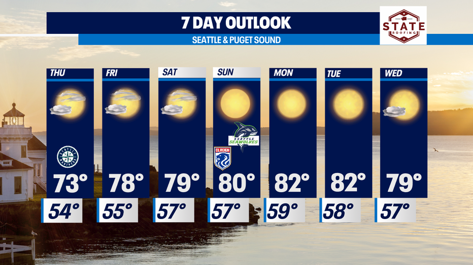
Another round of morning clouds and afternoon clearing with highs in the 70s around the region.

Temps hitting low 80s at the start of next week
Thursday and Friday will feel slightly cooler with cloud cover
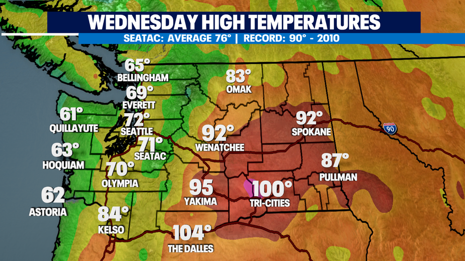
Seattle - Nice and comfortable conditions across Western WA today! Highs were cooler than average for most around the region with continued heat for Eastern WA.
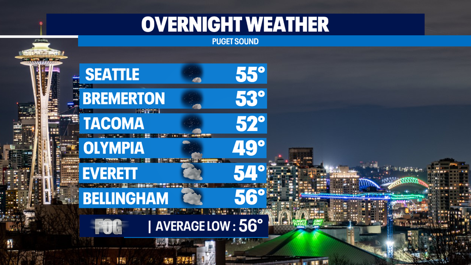
Tonight, temperatures will drop off into the upper 40s to mid 50s. Overnight clouds will increase with areas of patchy fog during the morning commute.
Skies will clear throughout the day Thursday for a partly sunny afternoon. Highs land in the mid 70s close to normal.
Friday high pressure builds in strong and will hang with us through the middle of next week.
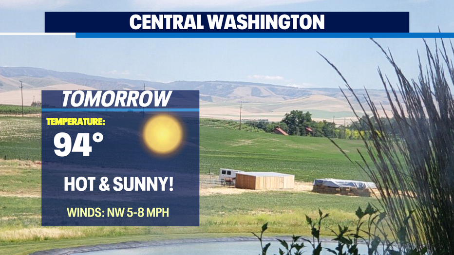
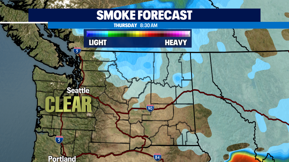
*Fire risk remains high for folks in Eastern WA. Thunderstorm potential falls off overnight. Temperatures for the next week will land in the 90s to near 100! And please remember any small spark can trigger the rapid spread of fire.
Have a great night all! ~Erin Mayovsky, Q13 Forecaster
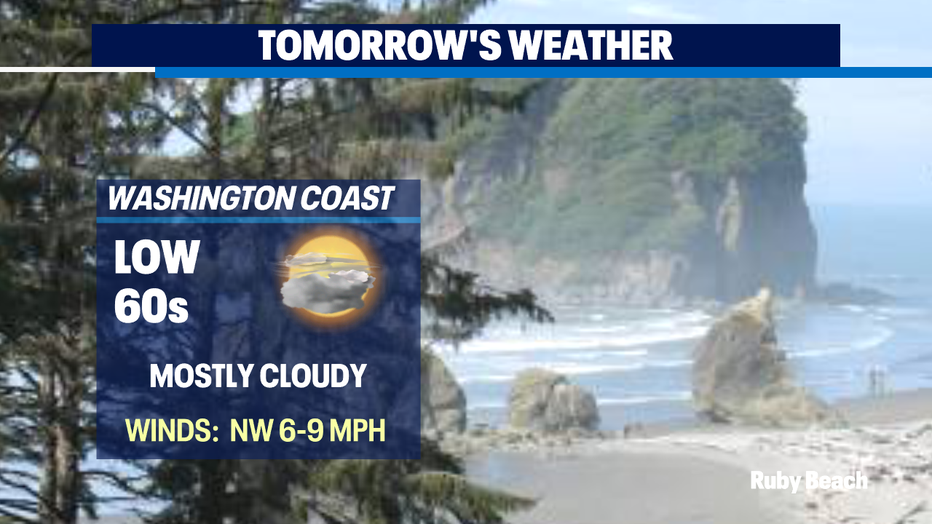
*Beach Forecast
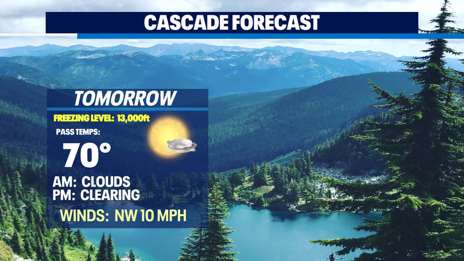
*Mountain Forecast
*Central WA Forecast & Smoke Outlook