

Arctic blast in Western Washington with powerful winds for some

Seattle weather: Frigid temperatures across Puget Sound
Seattle weather: Frigid temperatures across Puget Sound
We've called for yet another "Weather Alert Day" as frozen temperatures grip Western Washington. Powerful winds in the east Puget Sound lowlands (e.g. Monroe and North Bend) could lead to tree damage and power outages - not to mention bitter wind chills.
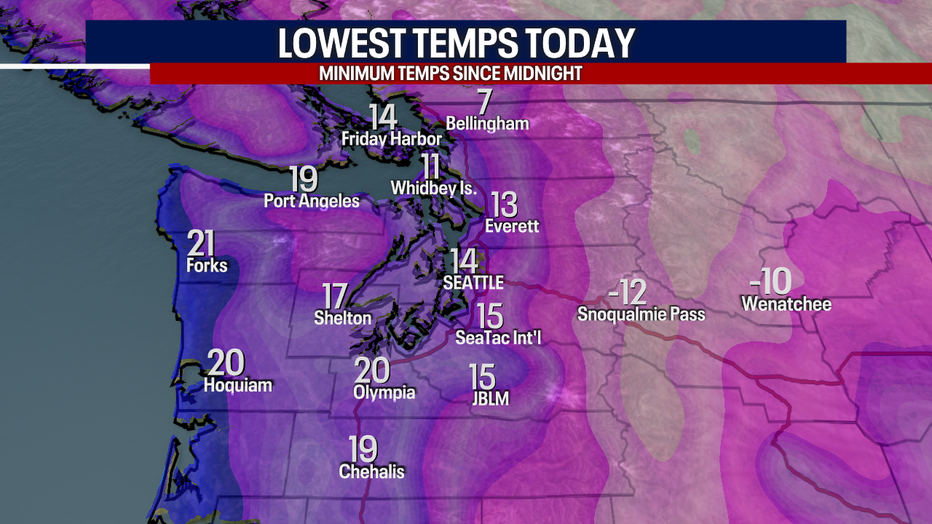
Take a look at our low temperatures earlier this morning! Bellingham and Hoquiam set new records for coldest lows, but SeaTac and Olympia fell shy of beating the records. Either way, it was brutally cold.
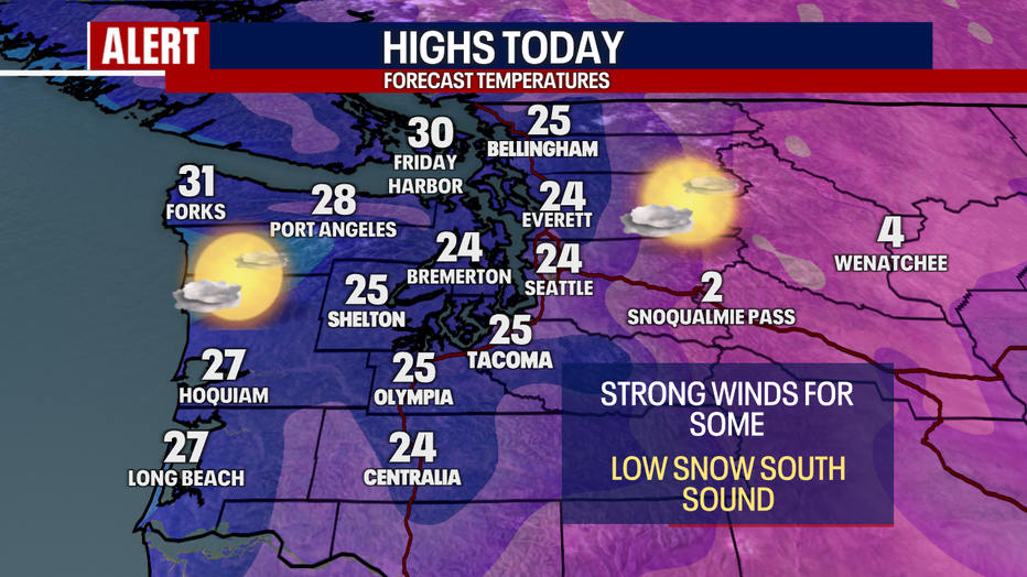
Highs today will only lift into the mid 20s for most. Unlike yesterday, today there's a lesser chance for records today - simply because the records for this date are extremely, exceptionally frigid. Take a look at how the records for coldest *high* temperatures compare to the forecast highs for this afternoon:

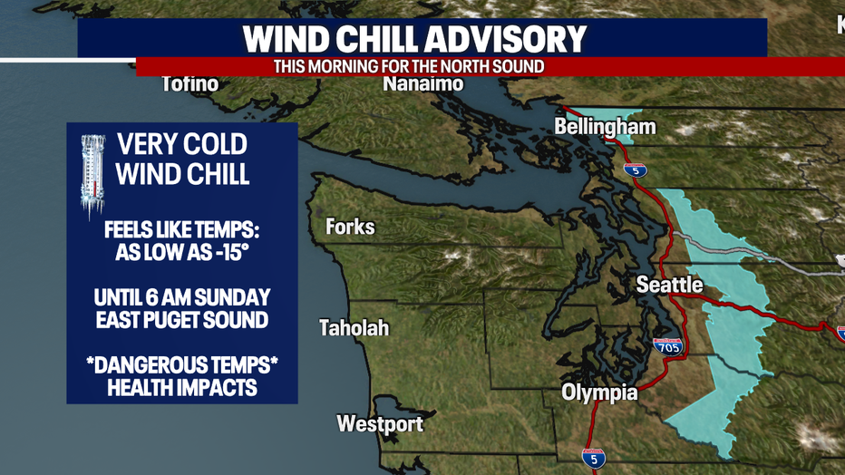
Wind chills (aka "feels-like" temps) were harsh once again this morning. At times, wind chills were as low as 26 below freezing along Snoqualmie Pass and just one degree in Everett. As of 10 a.m., Bellingham reported a wind chill of five below freezing.
A Wind Chill Advisory stays in place until noon for Western Whatcom County. The same alert also applies to the east Puget Sound lowlands (this includes places like Monroe, Woodinville, North Bend, Enumclaw, Eatonville and Bonney Lake) until 6 a.m. Sunday. Wind chills could reach as low as 15 below freezing for the east Puget Sound lowlands.
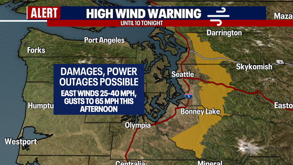
In the east Puget Sound lowlands as well, we're very concerned about forceful winds. Sustained east winds roaring through the Cascades could blow upwards of 25-40 mph with the gusts this afternoon reaching 50-65 mph. A High Wind Warning is in effect until 10 p.m. Power outages and tree damage are likely. Charge your phones and be ready to lose power. If you do, I'd recommend trying to head into a building that's heated (e.g. a shopping mall, movie theater, a friend's house or cold weather shelters. To learn more about the latter, click here)
Featured

Warming shelters open in Western Washington for winter weather
With the below-freezing temperatures and snow in western Washington, area warming centers are opening their doors for anyone who needs to get out of the cold.
There's also the chance for lower-elevation snow today. This will be primarily focused along and south of Olympia. While there could be flurries as far north as Tacoma, Seattle through the Canadian border should be dry today. Olympia could get a trace of snow. Between one and three inches (or more) could accumulate in the Centralia area. Closer to three to six inches (or more) could stack up near the Oregon state line for neighborhoods like Castle Rock and Kelso. Take a look at the winter alerts issued by the National Weather Service:
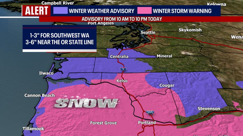
There will be a very distinct line of who sees snow and who doesn't today. Drier weather takes hold late tonight.
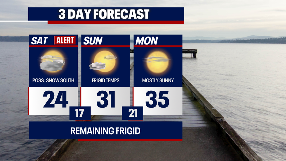
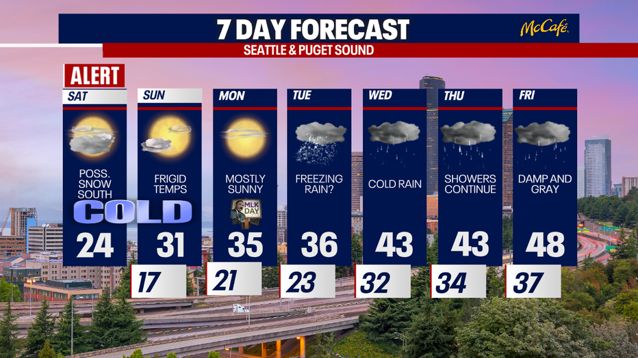
The dry weather continues Sunday and Monday (Dr. Martin Luther King Jr. Day). We'll enjoy beautiful sunshine, but temperatures will stay absolutely frigid. Unfortunately, it'll take several days for temperatures to warm closer to seasonal averages.
Tuesday could be an interesting weather day. Due to the chilly temps and incoming moisture, there could be a rain/snow mix in the lowlands or a little freezing drizzle or rain which could be treacherous if it materializes. There's still plenty of time for this forecast to flip-flop, so stay tuned!
Wednesday, chilly rain and mostly cloudy skies are in store. Thursday and Friday offer the chance for dangerous, significant freezing rain over the mountain passes. This could be due to two things: one, cold easterly winds keeping surface temperatures frozen and two, warmer, moister air pushing overhead. This is an evolving forecast, so stick with us for updates.
Check on your family and friends in the region to make sure they're doing OK in the cold. Take care and I hope you stay warm <3
Sincerely,
Meteorologist Abby Acone
Follow me on X @abbyacone, Instagram @abbyaconewx, TikTok @abbyaconetv and Facebook (Meteorologist Abby Acone)