

Astounding April warms significantly for the weekend

SEATTLE - Today will be our fourth dry in our streak of nice weather. So far in 2021 we've only been managed to get six of these in a row in March -- but this trend looks to beat that by at least 3 or 4.
This morning we're seeing seeing two weather tales, one where there’s no wind some morning chill / frosty areas like Shelton at 27. The other where a light north wind the air mixes up and it's significantly milder like Friday Harbor near 50.
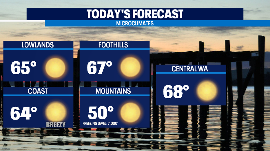
Regardless, we all will again see abundant sun and high temps will again end up in the mid 60s to upper 60s -- so likely a few degrees warmer than Tuesday. Mother Nature steers our chillier than normal spring back towards normal on Thursday. In a typical year, we usually hit 70 for the first time by April 15th and so we'll be spot on for Thursday.
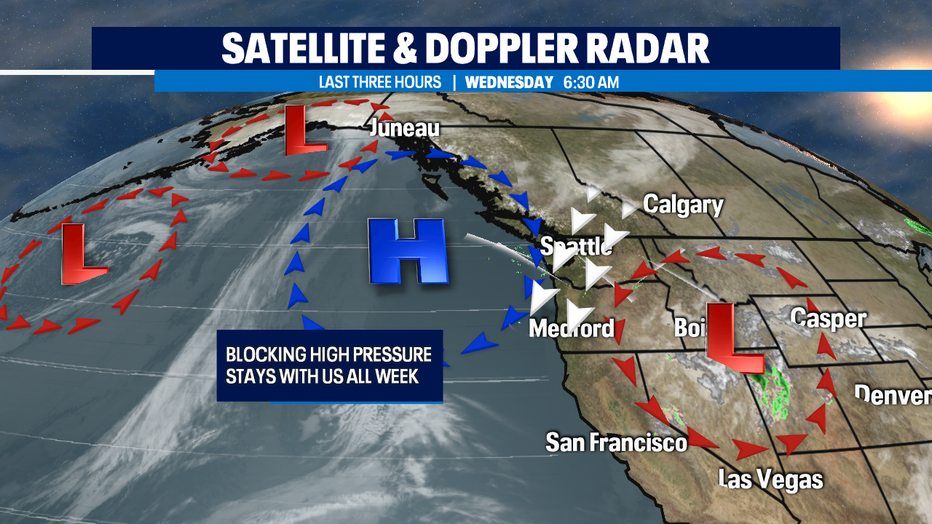
As the high pressure ridge over us gets squeezed up against the cut-off low over the four corners region -- we increase pressure gradients between the two weather features which increases the N/NE downslope Cascadia winds. That's a warming compression wind that will drive our temps into the 70s. We peak on Fri/Sat with highs in the mid to upper 70s. That's warm for April.
Record high temp for Saturday is 80 degrees at Sea-Tac Airport and we'll get close in some areas. But even at the forecasted 77 that's 17 degrees above the normal of 58.
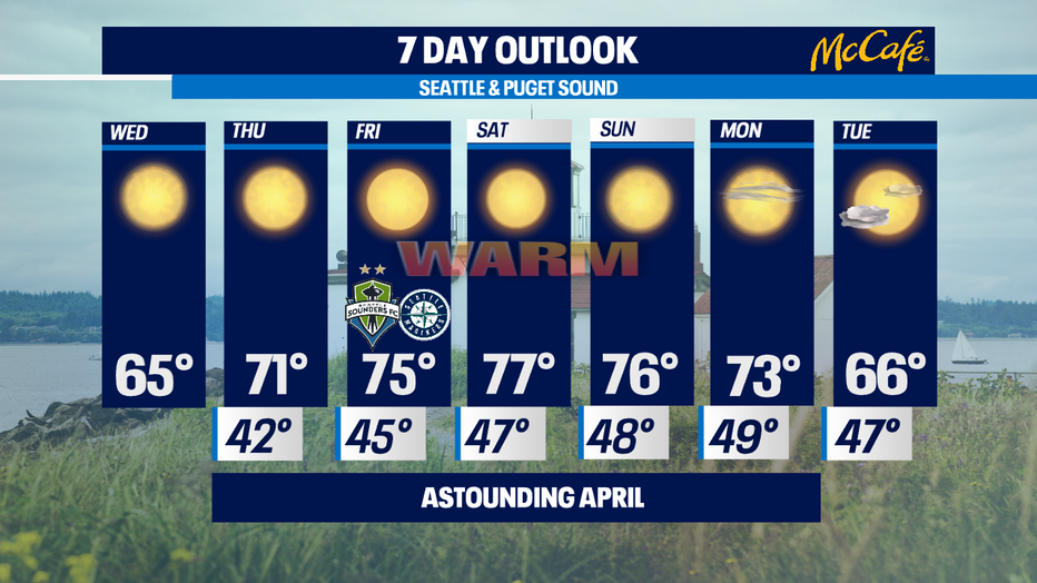
Long range, high pressure ridge breaks down starting Sunday. It doesn't look like a rapid pattern shift. We gradually cool down Sun/Mon back to the pleasant 60s and we'll see more marine influenced air which will mean more partly sunny until we get a front moving in perhaps second half of next week to deliver some spring showers, clouds, and back to the seasonal upper 50s.
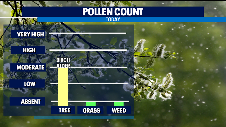
Raindrops will be needed to knock down pollen counts. We were at Moderate yesterday, and as we get warmer we've still got several days of potentially High or Very High stuffy head, sniffly, sneezy kind of days. April is typically when tree pollen wanes and grass/weed pollen ramps up.
Other April weather concerns will start to mount in our mountains in the backcountry areas with an unstable snowpack. As we get into the part of spring soon when warm melting temperatures in the afternoon and frozen conditions at night will accelerate with longer days and temps warm both day and night in the weeks ahead.
Avalanche control measures are common for our passes and most well-traveled areas. But in more remote out of bounds ski areas and for increasingly hikers that will venture into higher and higher terrain- check with the NW Avalanche Center for alerts and advisories before you head up to hikes in snowy areas. It's a very small population of recreators who would be at risk, but an encounter with an avalanche is often fatal.
-Tim Joyce
Q13 WEATHER RESOURCES:
DOWNLOAD: Q13 Weather and News Apps
WATCH: Forecast and Radar
READ: Closures and Delays
CHECK: Latest Weather Alerts and Live Traffic Map
INTERACT: Submit your Weather Photo
FOLLOW: Lisa Villegas, MJ McDermott, Tim Joyce, Erin Mayovsky and Grace Lim