

Seattle weather: Chilly, damp weekend ahead
If you are dreaming of warmer spring weather, don't get your hopes up: this week is looking damp with temperatures hovering well below average.

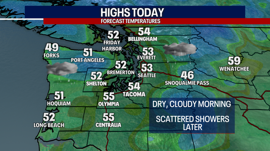
Highs today will only lift to the low to mid 50s. Grab a warm rain jacket if you're spending time outside! We are forecasting a dry, cloudy morning with isolated to scattered showers this afternoon and tonight.
Will the roof be open or closed for the Mariners tonight? It's tough to tell for sure because rain will be hit or miss today.
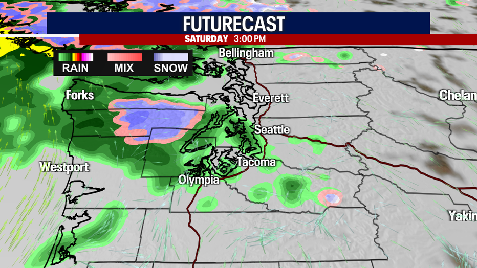
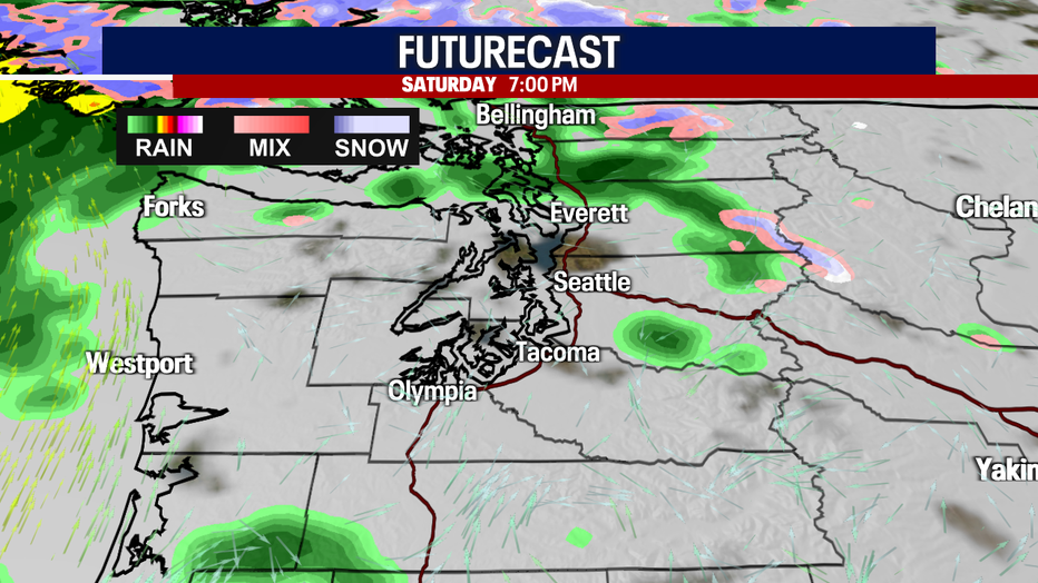
Tomorrow morning will be rather soggy, rainy and blustery. Gusts for most backyards could range between 20-30 mph with localized stronger winds for the typical suspects (e.g. the North Sound, coast and inland waters). Tomorrow afternoon, there might be enough instability to trigger weak thunderstorms and small hail.


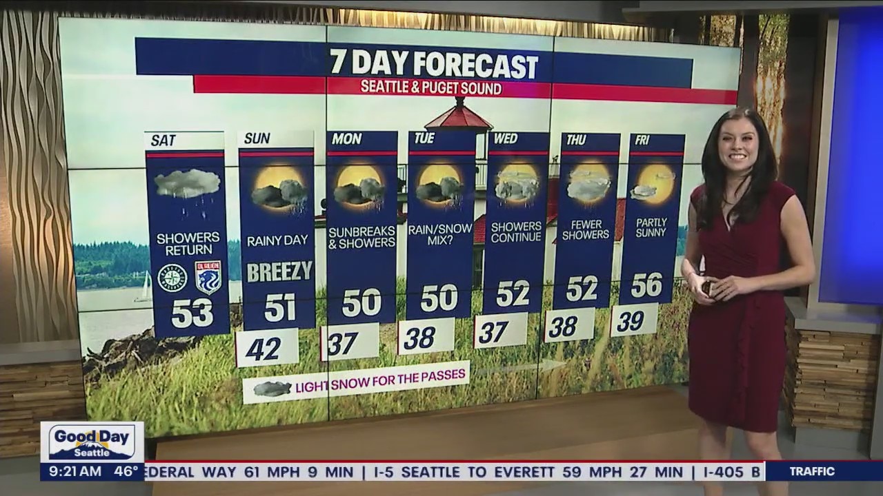
Sunbreaks, showers and thunderstorms linger into Monday. Tuesday morning may be cold enough where the foothills could see a brief, spotty and minor ran/snow mix. As temps warm up Tuesday afternoon, small hail and lightning are possible.
Another low pressure system in the upper levels of the atmosphere could spark showers Wednesday, but the day won't be a washout. As a more stable weather pattern takes hold Thursday, showers start to fall apart. While I can't entirely rule out light showers on Friday, the day will probably trend drier versus wetter with partly to mostly cloudy skies.
One positive aspect to our chilly and wet weather this spring: these kinds of conditions help protect our all-important snowpack over the mountains which plays a critical role in supporting the ecosystem and delaying the start to fire season.
By the end of April, long-range models are hinting at temperatures finally reaching the low 60s. For some perspective, the average temperature for Sea-Tac today is 59 degrees.

Take care and have a wonderful weekend!
Warmly,
Meteorologist Abby Acone
Follow me on Twitter @abbyacone, Instagram @abbyaconewx, TikTok @abbyaconetv and Facebook (Meteorologist Abby Acone)