

Cool and showery weekend, warmer next week

Widespread rain Saturday, tappering Sunday
Rain scattered throughout Puget Sound Saturday with temps in the low-50s, but wet conditions taper by Sunday. Q13s Grace Lim has the 7-day forecast.
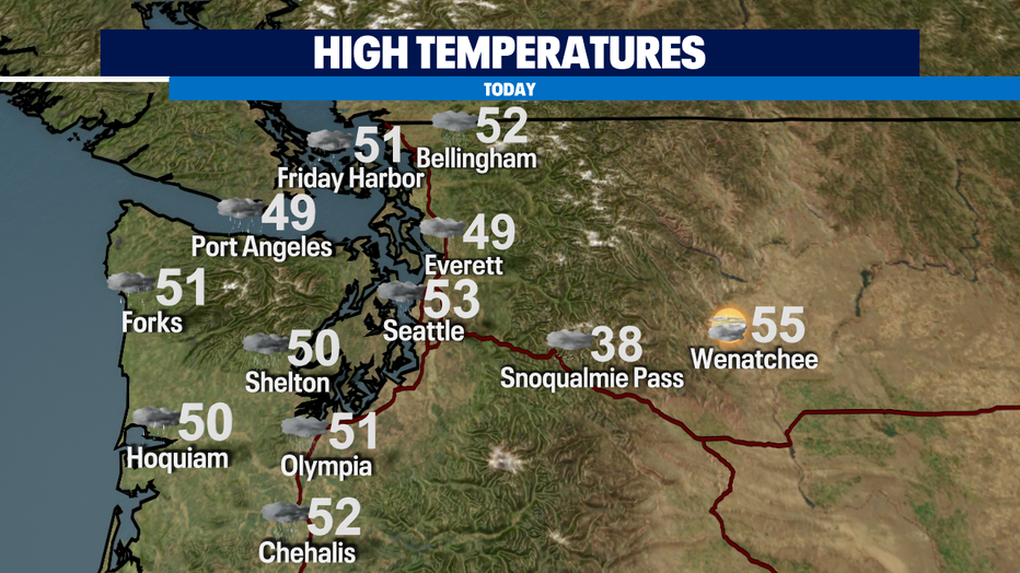
SEATTLE - Widespread and steady light rain will continue across Western Washington Saturday morning. By mid-afternoon, rain chances will become scattered and will be a cool day with highs in the upper 40s and lower 50s.
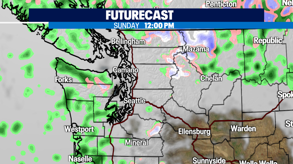
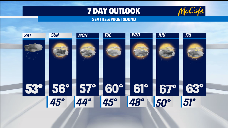
Upper level low will bring a few showers on Sunday and start tapering off Sunday evening. Highs will be in the mid to upper 50s. Expect a few showers on Monday and then a weak ridge will bring us a break in the rain Tuesday!
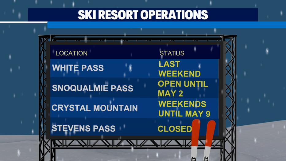
Our mountain passes can expect 1-3" of snow this weekend. Ski resort winter operations are below.
Models are in disagreement with our next rain potential on Wednesday and Thursday so stay tuned. GFS is a wetter solution and the Euro has the ridge amplifying leading to dry conditions. For now, I went with a slight chance for rain but both days could end up just cloudy! Highs will be in the 60s, close to 70 on Thursday. A front will bring rain Friday and into the first half of the weekend.
Have a great day!
Q13 WEATHER RESOURCES:
DOWNLOAD: Q13 Weather and News Apps
WATCH: Forecast and Radar
READ: Closures and Delays
CHECK: Latest Weather Alerts and Live Traffic Map
INTERACT: Submit your Weather Photo
FOLLOW: Lisa Villegas, MJ McDermott, Tim Joyce, Erin Mayovsky and Grace Lim