

Cool weather for Fourth of July
Cool weather for Fourth of July
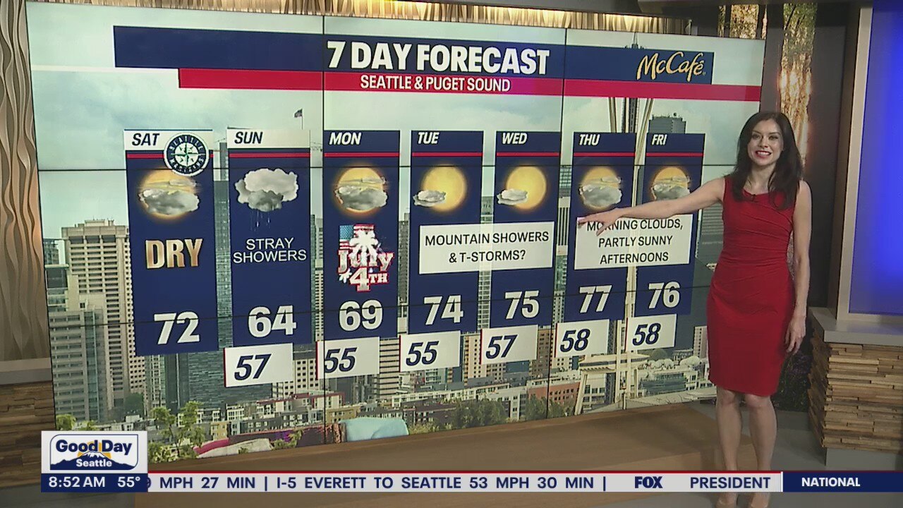
Dry and 72 for your Saturday, temperatures dip down into the 60s tomorrow and on the 4th.
Many were hoping for a warmer holiday weekend, but at least it won't be a washout. In fact, while most stay chilly on the Fourth, we only have a slight chance for isolated showers that day.

Today, we are forecasting mostly cloudy skies and highs in the 70s for many in Central and South Puget Sound. There is a slight chance for a thunderstorm over the Cascades late tonight, but there is a better possibility for that happening tomorrow.
Everyone in light green has the chance for some lightning and small hail today. In the far southeastern corner of the state, there is a low possibility for one to two "severe" storms where lightning, large hail and damaging gusts could be a problem.

Tomorrow, scattered showers and thunderstorms over the Cascades remain a possibility. Some rain could pop up over Puget Sound and elsewhere in Western Washington by the afternoon and evening. Highs Sunday will be super limited, only reaching the low to mid 60s!
Some showers are possible on the Fourth, but for the most part – light rain is most likely in the morning. Stick with us because the timing of the showers could change! By 10 p.m. when most of the firework showers are starting, many will be dry.
Here is how the showers could pan out via Futurecast:


Highs on Monday (Fourth of July) will be several degrees below average. Keep a rain jacket with you in case a shower drifts overhead.

The Cascades could see some showers and thunderstorms Tuesday and Wednesday. Both days, partly sunny skies and highs in the 70s are in the forecast for the lower elevations.
Thursday and Friday, cloudy mornings will give way to partly sunny afternoons. Enjoy the mild weather!

Thanks so much for choosing FOX 13. We're so grateful for your viewership. Hope you have a fun and safe Fourth!
Warmly,
Meteorologist Abby Acone
Follow me on Twitter @abbyacone, Instagram @abbyaconewx, TikTok @abbyaconetv and Facebook (Meteorologist Abby Acone)