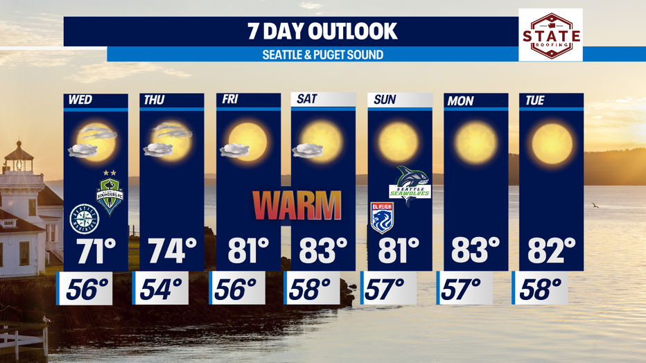
Cooling down Wednesday with warmer days into the 80s ahead!

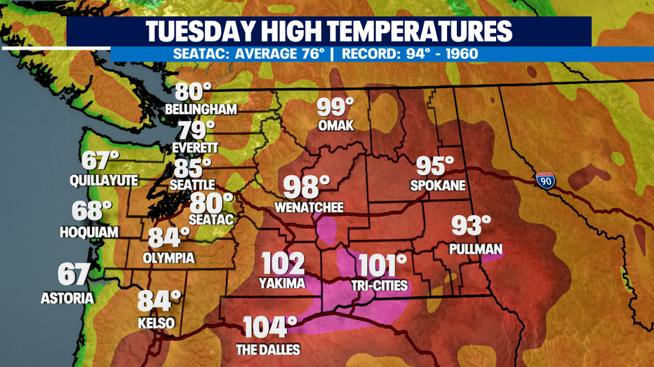
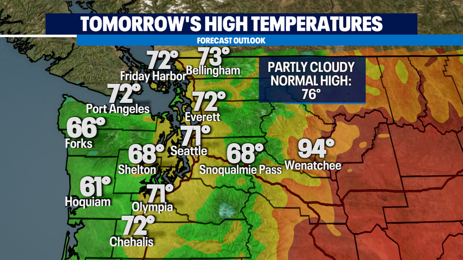
Seattle - What fantastic Tuesday! Highs for some climbing out of the 70s into the low to mid 80s. The coast staying nice and cool in the 60s, but folks in Eastern WA still dealing with upper 90s to 100+ degree days. Fire risk is elevated, especially east of the Cascades.
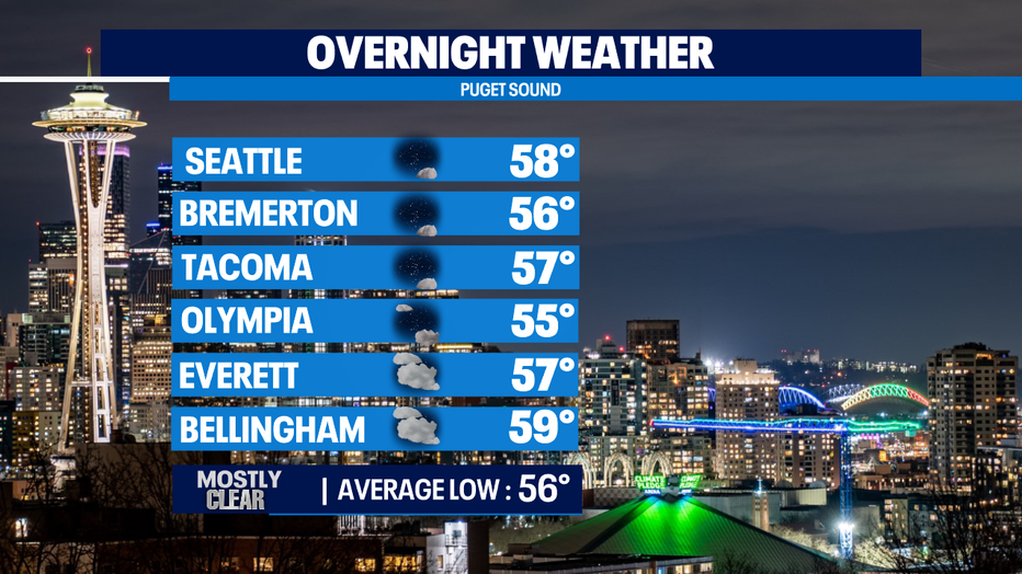
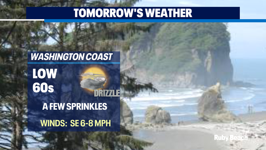
Overnight expect clouds to increase leaving us with another cloudy start for the morning commute. Lows will drop into the 50s to near 60.
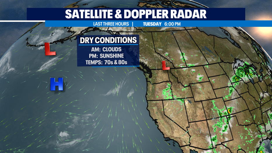
Our weather pattern will remain dry and warmer as we push into the end of the week into the weekend. Not much of any rain in sight besides maybe a few spits of moisture here and there at the coast and over the mountains with possible sprinkles briefly inland west of Puget Sound.
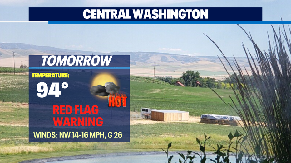
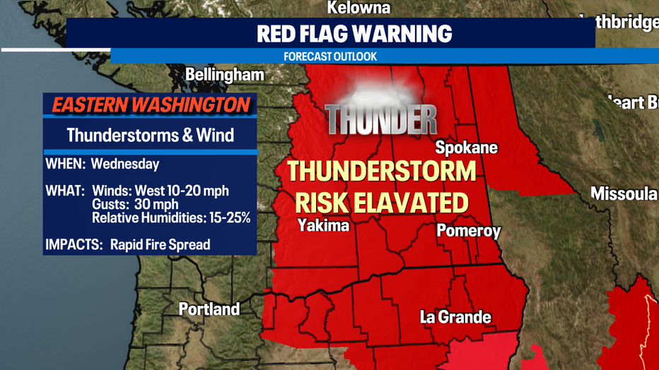
East of the Cascades the potential for fires increases with tinder dry grounds coupled with relative humidities between 15-25% and winds gusting at times up to 30mph. Add in a chance for thunderstorms and that could be a recipe for very dangerous conditions. Highs across the eastern portion of our state will hang in the 90s to 100+ at times over the next few days. Be aware of your surroundings as one small spark can torch our beautiful landscape.
High pressure will continue to dominant our forecast with temperatures landing 5-10 degrees above average for this time of year. (76) We're keeping an eye on models to see if any significant moisture will come our way, but as of now it looks like our strong ridge may win out keeping any rain at bay.
Have a great night! ~Erin Mayovsky, Q13 Forecaster
*Beach Forecast
*Mountain Forecast

*Central WA Forecast