

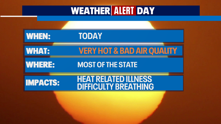
Double whammy - extreme heat and unhealthy air quality

Excessive heat warning, air quality alert for Western Washington
An excessive heat warning and an air quality alert are in effect through Saturday in Western Washington.
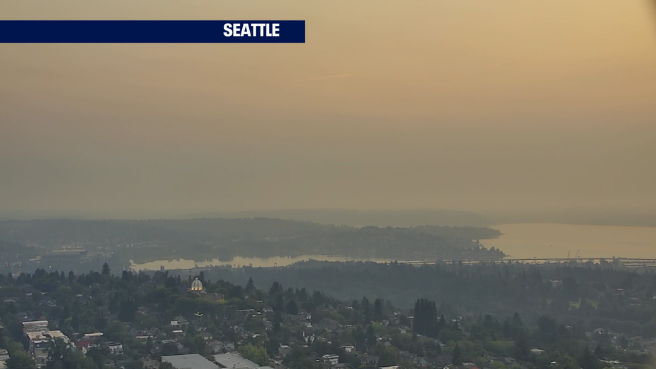
Seattle - Friday is a Weather Alert Day for two reasons - extreme, record-breaking heat and lousy air quality.
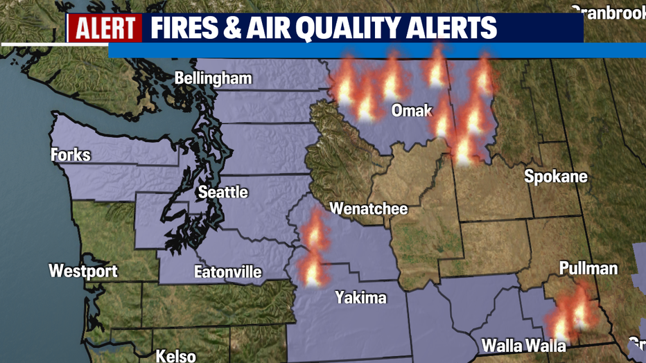
Wildfire smoke from fires in Eastern Washington and Southern British Columbia is wafting into Western Washington. We have an Excessive Heat Warning AND Air Quality Alert for most of the area through tomorrow at 7 p.m.
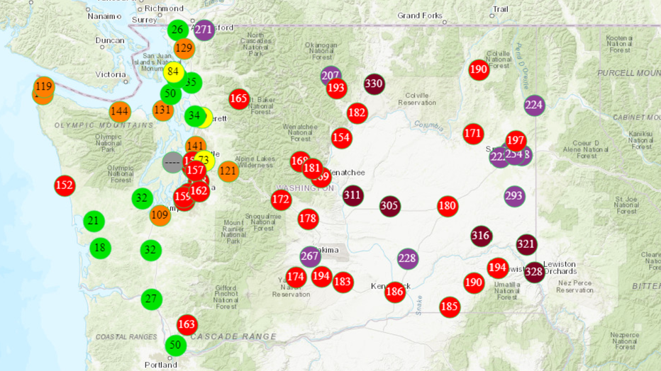
And here is the Air Quality Map from the Washington State Department of Ecology. The red dots over Seattle and Tacoma indicate "Unhealthy" air.
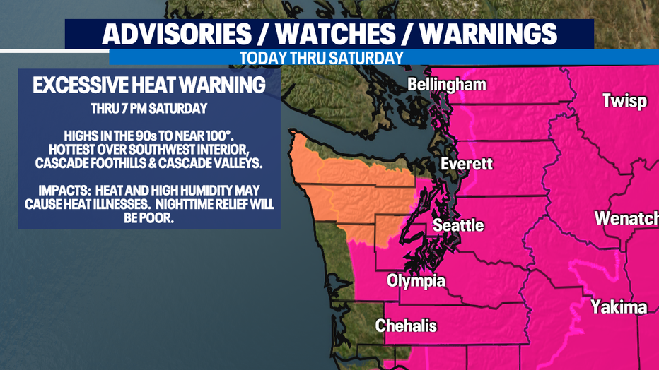
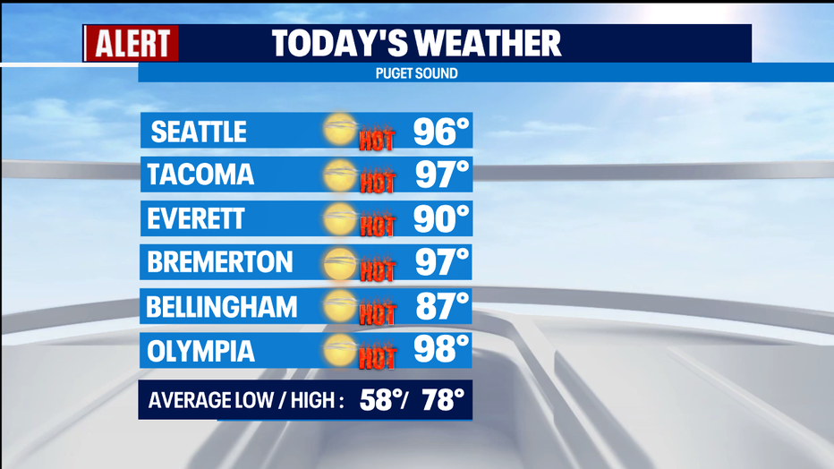
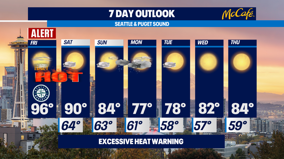
We'll have hazy sunshine today with the smoke, and with dangerous afternoon highs - 90s to near 100 for most of us. This will rival yesterday's temps. Here's the map of yesterday's highs. I can't believe Bellingham hit a record-breaking100 degrees! This is 15 degrees hotter than the previous record! Today will be a record-breaker too. The record for today at SeaTac is 92. We will break that with a forecast of 96.
Tomorrow will be cooler, but still hot with highs around 90.
Sunday, everything changes! An upper level trough moves in with onshore flow that will clear out the air and cool us down. AND there is a chance of a little rain overnight Sunday into Monday morning.
Monday will be mostly cloudy with a slight chance of showers and highs around normal - mid-upper 70s.
Tuesday will get sunny again and top out in the upper 70s.
Wednesday and Thursday, it's back to sunny skies with highs in the low/mid 80.
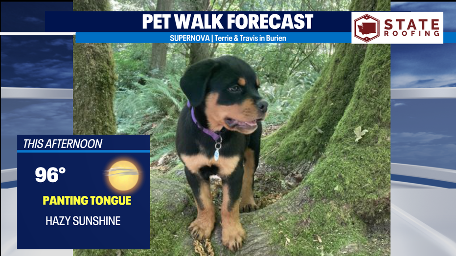
With hot temps and bad air, it's a Panting Tongue Day for the Pet Walk Forecast. But here's a cute puppy cooling off in the rain forest to make you smile!
-Meteorologist M.J. McDermott
Q13 FOX WEATHER RESOURCES:
DOWNLOAD: Q13 Weather and News Apps
WATCH: Forecast and Radar
READ: Closures and Delays
CHECK: Latest Weather Alerts and Live Traffic Map
INTERACT: Submit your Weather Photo
DAILY BRIEF: Sign Up For Our Newsletter
FOLLOW: Lisa Villegas, MJ McDermott, Erin Mayovsky, and Scott Sistek