Dry and cool week ahead for Western Washington
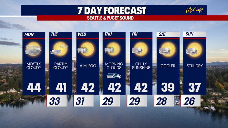
Seattle - Western Washington will be cool and dry this week as daytime highs plummet to the upper 30s by next weekend.
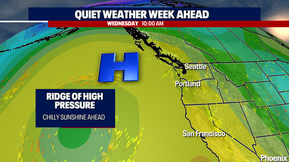
The Intermountain West will be seeing severe winter weather Monday, but in the Pacific Northwest, a ridge of high pressure will begin to settle in keeping the region dry and cool the next seven days.
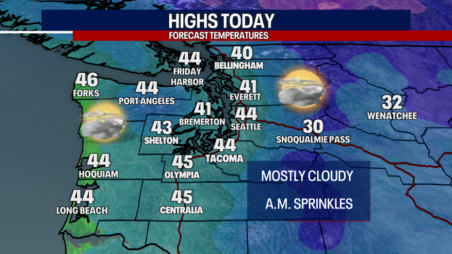
Monday morning brought a few light showers, but the rest of day looks mostly cloudy with a few sunbreaks. Afternoon high temperatures will be in the 40s.
A ridge of high pressure just offshore will keep storm systems away from the Pacific Northwest over the next several days. Fraser Valley outflow winds will be gusty at times in western Whatcom County and the San Juans. This quiet weather will also feature some morning fog and lots of afternoon sunshine the next several days.
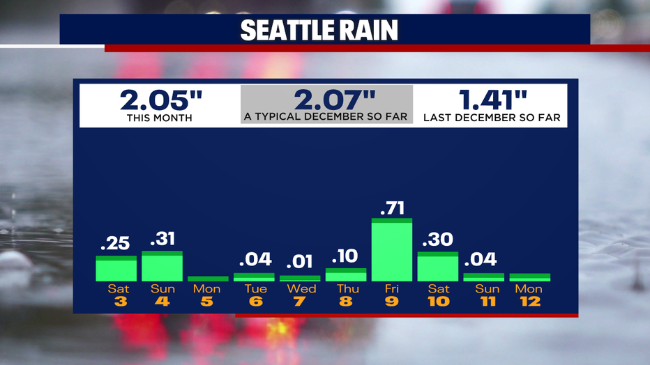
The first half of the month has been wet almost every day so far. Sea-Tac is right on track for a typical December on the rain gauge so far, however it is going to be mainly dry over the next seven days.
The blocking ridge of high pressure off the coastline will stay put for the next week keeping wet weather systems away, but temps will be cooler by next weekend with highs in the mid to upper 30s and overnight lows well into the 20s.