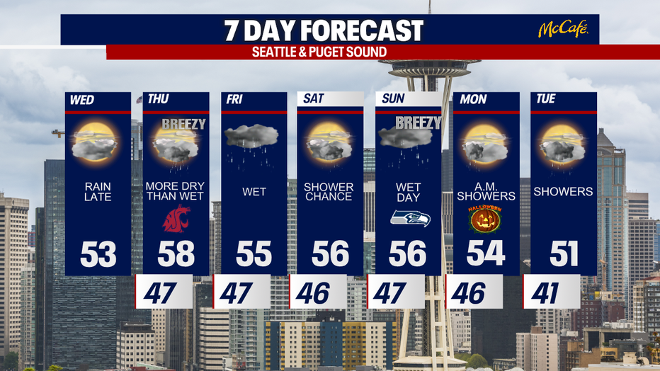
Dry day Wednesday, but showers loom tonight
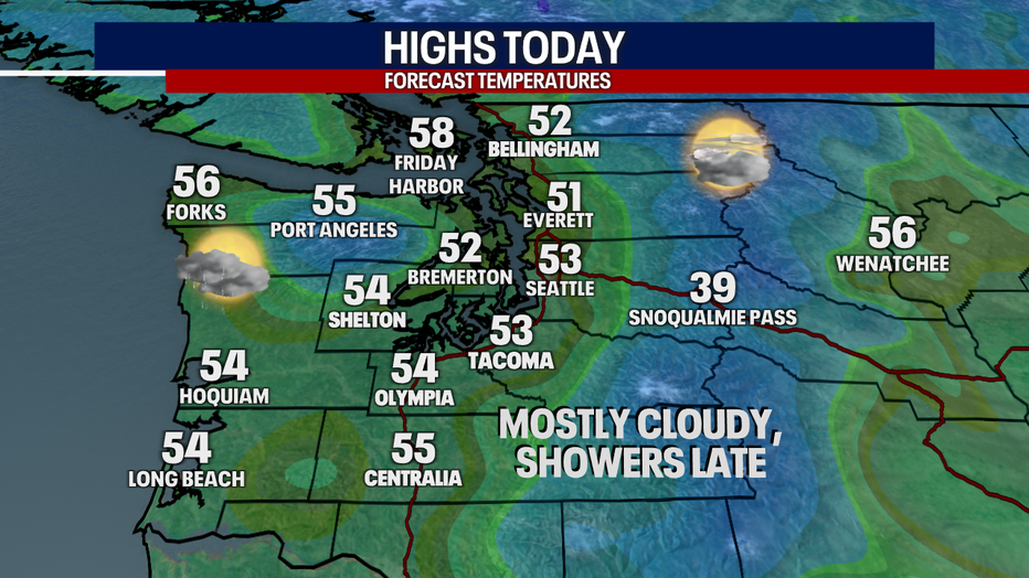
Seattle - Wednesday will be partly to mostly cloudy and mainly dry for the daylight hours around the Puget Sound area.
The next wet system arrives tonight after sunset, but will only bring light showers to the area. Afternoon high temps will remain cooler than average, as they have the past four days.
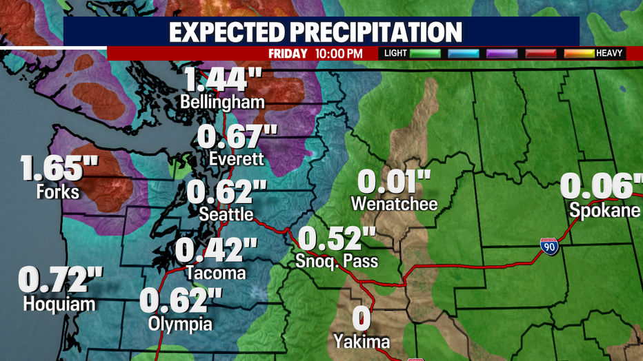
Thursday, a few more showers will pop up with breezy wind at times, but it looks more dry than wet. Early Friday, a very wet system will dip into the area from the north. This will bring heavy precipitation to Whatcom County and a decent amount to the central and south sound as well.
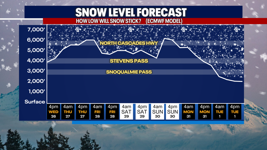
Snow levels will bounce between 4,000-6,000 feet through the end of the month, with November starting off with a chance for some pass level snow again.
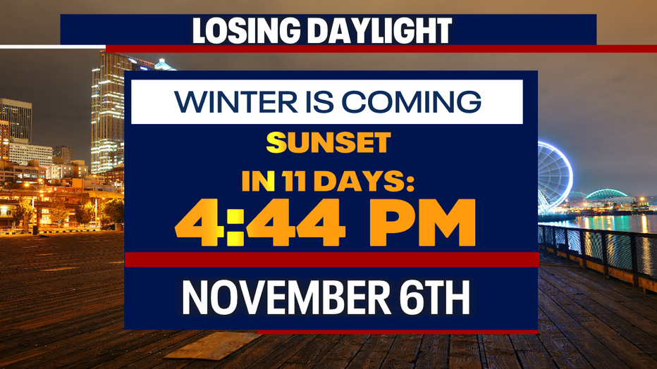
We are losing more than three minutes of daylight every day this time of year. Wednesday is the last day until March that the Seattle area will have a sunset after 6:00 PM. In a couple of weeks when we adjust clocks back an hour, we'll begin an 81-day stretch of the sun setting before 5:00 PM.
Saturday looks like the better day this weekend, with a potentially potent storm system arriving on Sunday. That storm could bring a lot of rain and breezy wind. If you're heading to the Seahawks game Sunday and don't have a covered seat, find those rain pants now.