Excessive heat invades Western WA
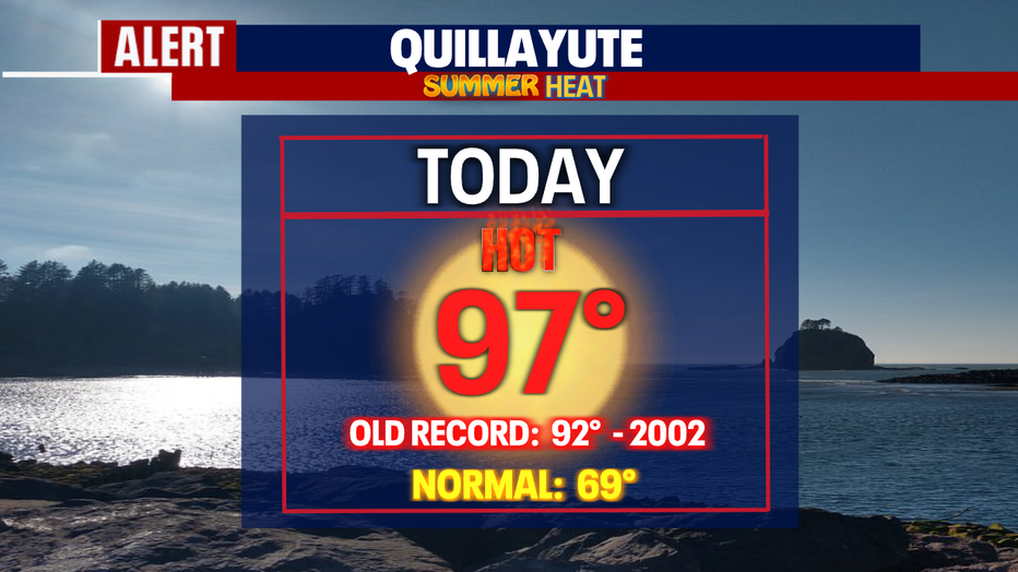
Seattle - The heat is already on folks! Sunday the northwest WA Coast hit 97 at Quillayute smashing the old record of 92 set back in 2002. This is a sign of what's to come heading into the workweek.
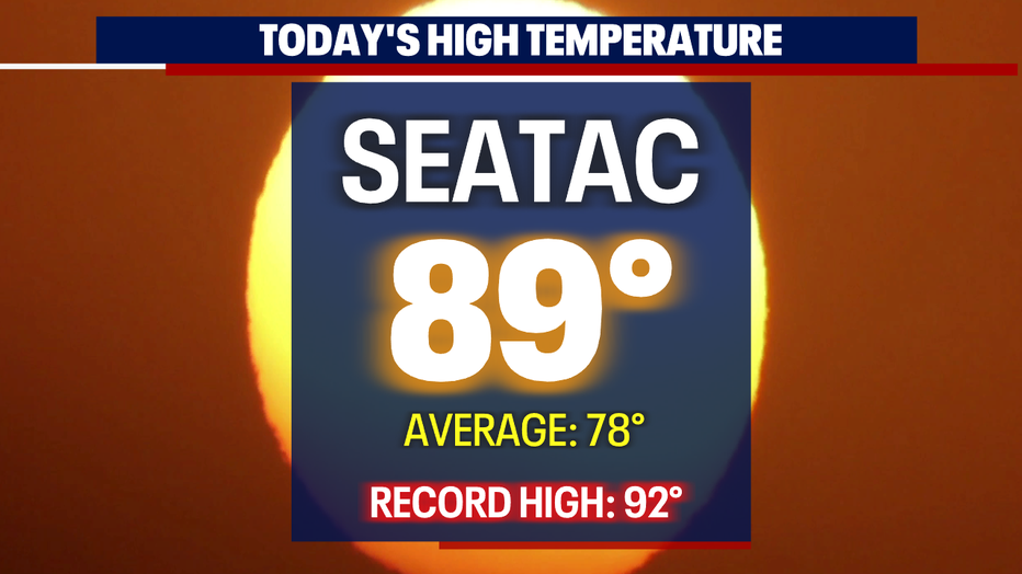
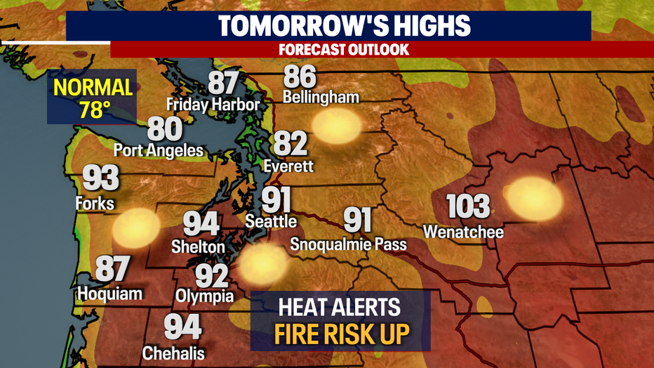
No records broke for the Seattle area today, but highs did soar past average. SeaTac hit 89 at the airport with even warmer highs for places like Shelton at 96.
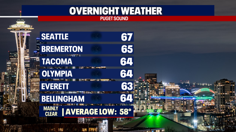
Overnight skies stay clear with lows only cooling into the mid to upper 60s thanks to northeasterly winds keeping us warmer than average. The normal seasonal low for this time of year is 58.
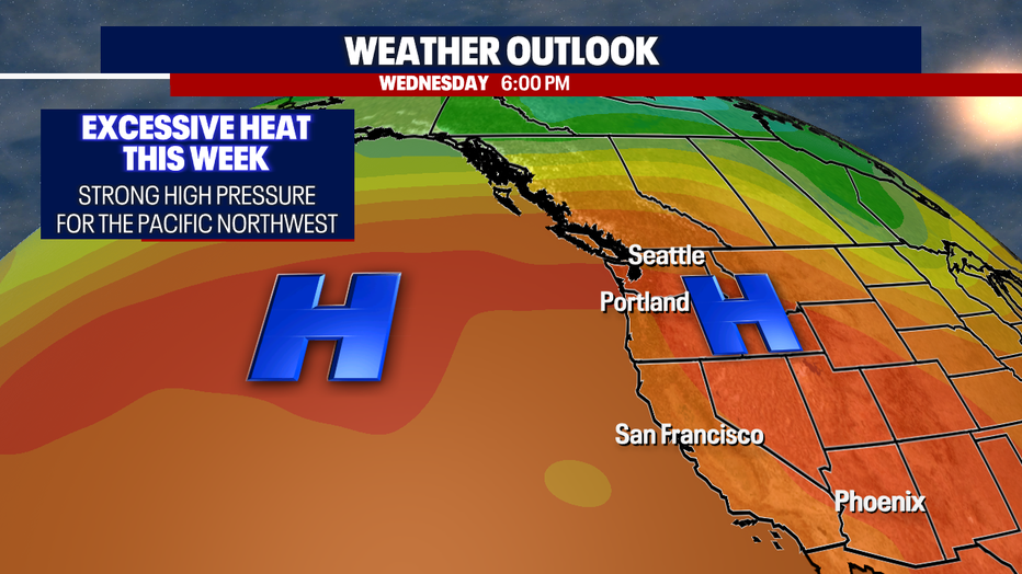
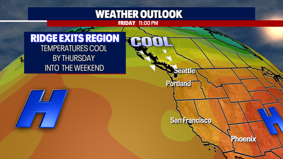
As strong high pressure takes over the region temperatures will continue to push well above average close to record territory this week.
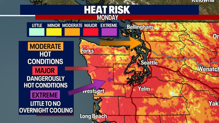
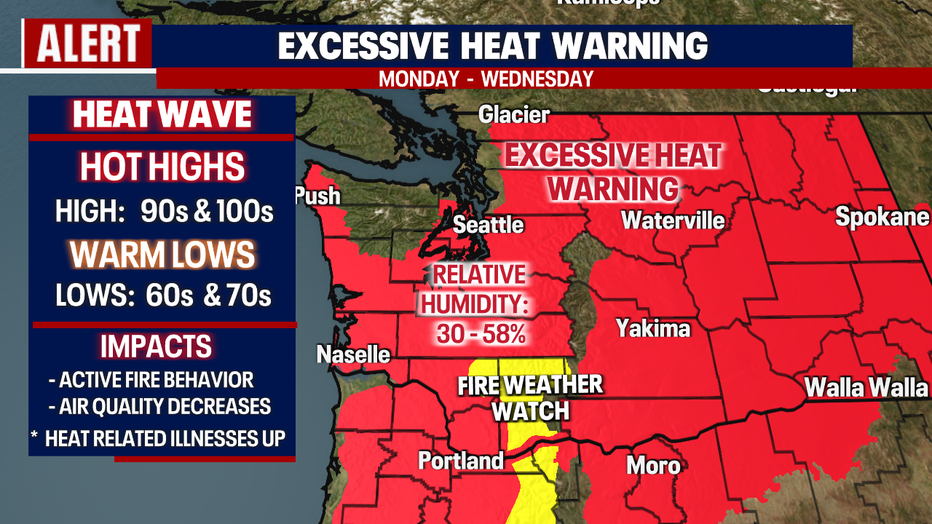
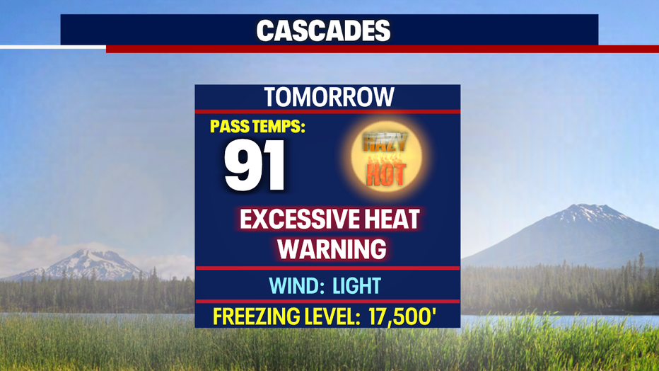
As temperatures rise the Heat Risk will elevate and move into the Major & Extreme zones. This is especially concerning for those who suffer from heat related illnesses along with fire danger becoming extremely high during this time. These conditions have triggered many heat alerts across the state. Most will expire as we move into Wednesday.
Make sure to stay out of the sun, drink plenty of fluids, stay in an air-conditioned environment, and don't forget to check in on relatives and neighbors during this time.
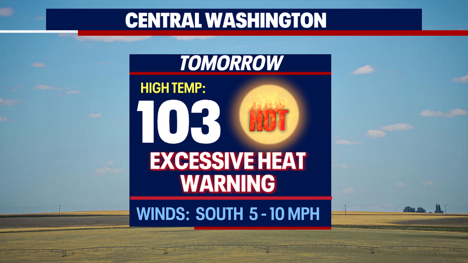
Most of us west of the Cascades will stay below triple digits, but some spots like North Bend could land at 100. And to the east highs climb even more with 103 for Wenatchee.
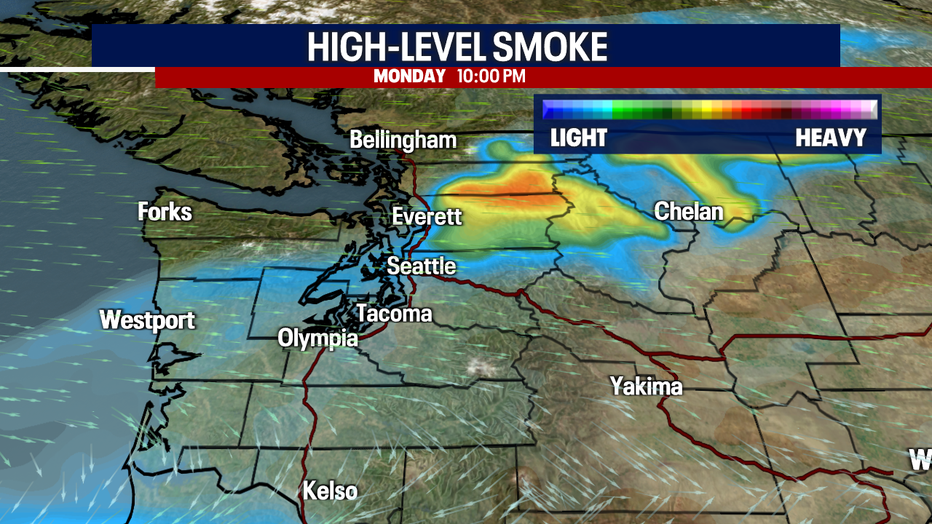
As winds flow out of the northwest some of us will start to see and smell smoke in the upper atmosphere by Monday night. We're keeping an eye on Snohomish, Skagit, and Whatcom Counties as those areas will see the most haze. We should see a little improvement later in the week.
After a long week of heat relief arrives just in time for the weekend. Our ridge will move on and that will allow cooler air to flow into Western WA from the north. Temperatures finally drop down to normal, near 79.
Stay cool all and make sure to stay hydrated!
Have a great week! ~Erin Mayovsky, FOX 13 Forecaster

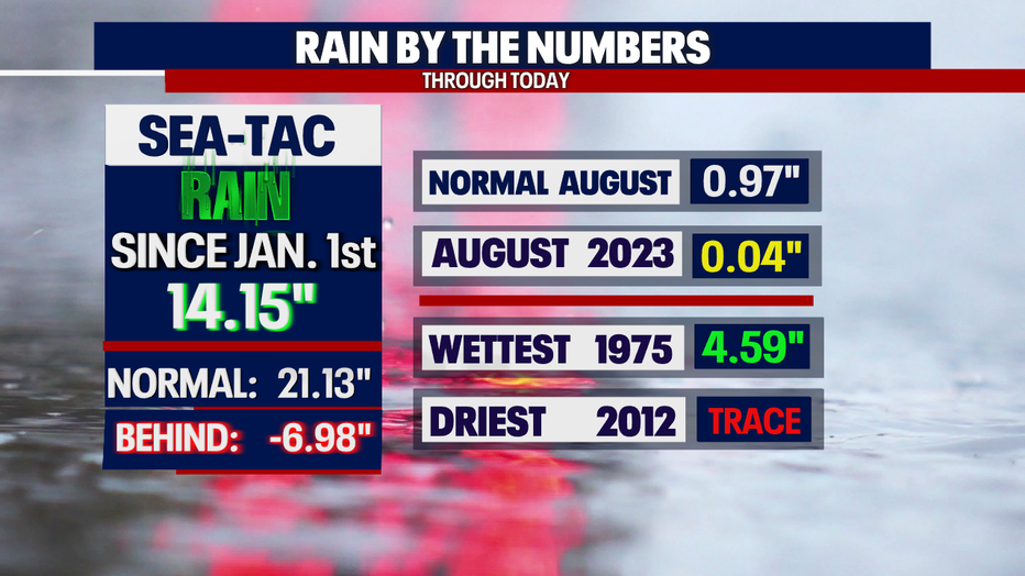
*SeaTac Rain Almanac
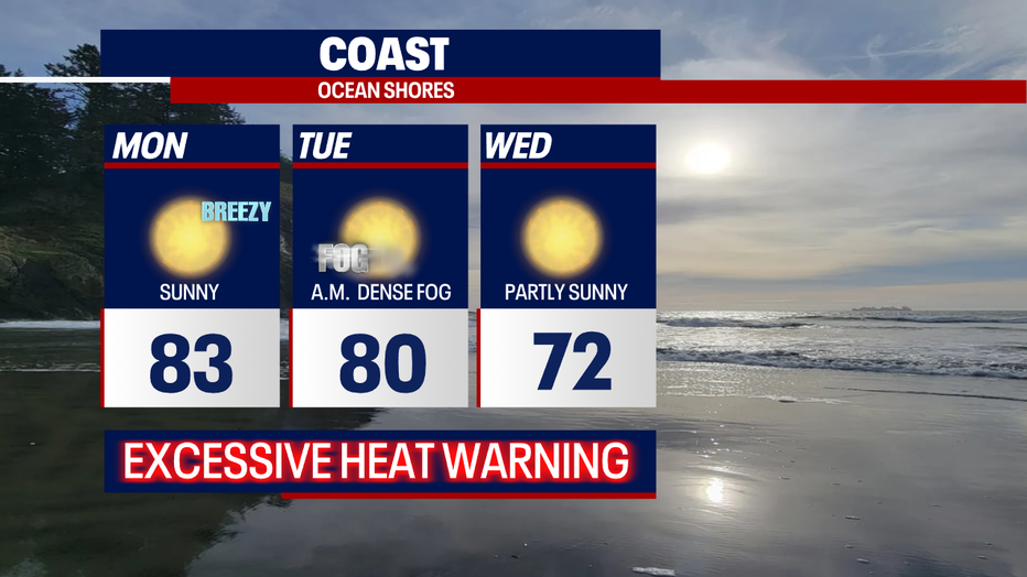
*Coast Forecast
*Mountain Forecast
*Central WA Forecast