

Seattle weather: Flooding threat through Wednesday

Lots of rain through the weekend, flood threat tapers off
FOX 13 Meteorologist Abby Acone is tracking more and more rain this week. The threats of flooding we've seen the last few days look to slowly dwindle past Tuesday.
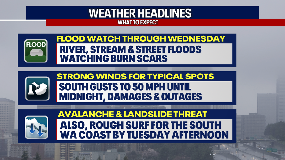
SEATTLE - An atmospheric river weather pattern is blasting heavy, excessive rain across Western Washington. This will elevate the threat for flooding of many kinds, particularly for local rivers, as well as raising the risk for landslides and strong winds.
A Flood Watch is in effect until late Wednesday night for all the spots in dark green.
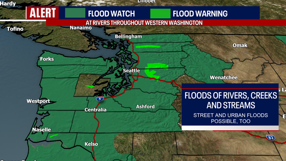
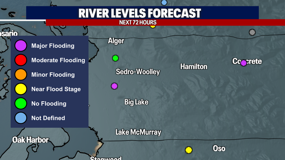
In the lime green in the map above, Flood Warnings are posted. This is to account for major flooding in the forecast for the Skagit River near Concrete (cresting tomorrow afternoon) and the Snoqualmie River near Carnation (cresting late Tuesday evening) and moderate flooding in the forecast for the Tolt River above Carnation (cresting tomorrow morning), the Skykomish River near Gold Bar (cresting Tuesday afternoon), Snoqualmie River near Snoqualmie Falls (cresting Tuesday afternoon) and the Skokomish River near Potlatch (levels rising and lowering in the coming days).
If you live in these flood-prone communities, be prepared for road closures and street and pasture flooding. For more details, head to the National Weather Service website or their Advanced Hydrologic Prediction Service.
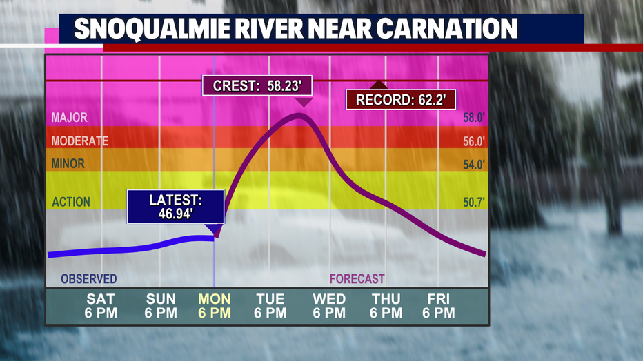
Here's one hydrograph of the Snoqualmie River near Carnation:
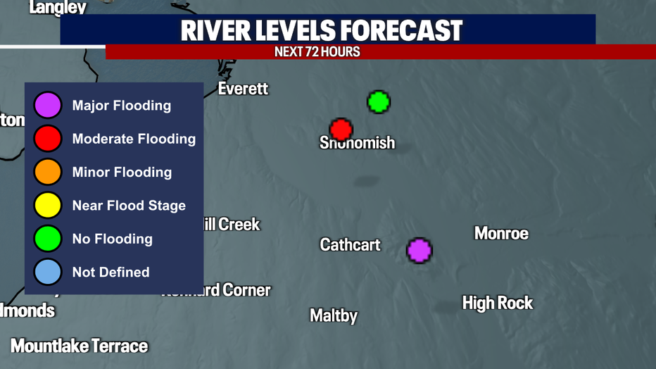
There may be major flooding as well along the Snohomish River near Monroe and the Skagit River near Mount Vernon. Stay tuned because these forecasts are highly subject to change.

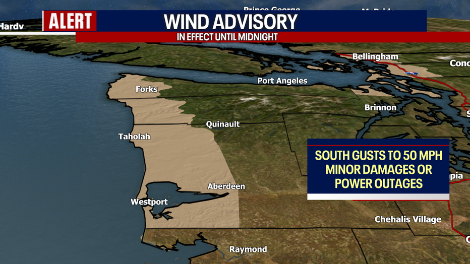
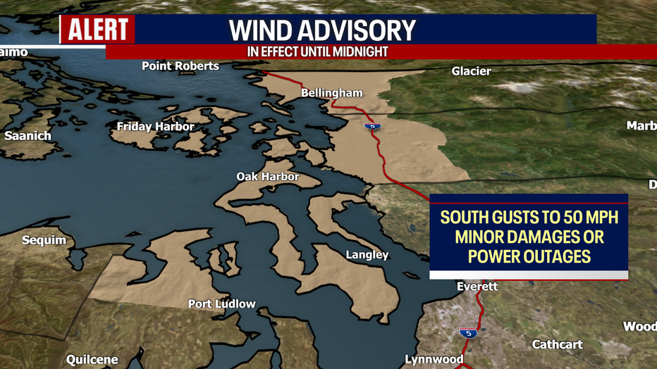
Winds will be gusty tonight. Until midnight, a Wind Advisory remains in place for the Central and North Coast, inland waters, Salish Sea, Bellingham and Mount Vernon. South gusts to 50 mph could cause tree damage and trigger power outages. Elsewhere, winds could blow between 30-40 mph.
Rain will be almost nonstop overnight and tomorrow. Driving will be extremely slick and slippery. Highs will be reached before 7 a.m. tomorrow, reaching the mid 50s for most. Temperatures will gradually cool to the low 50s Tuesday afternoon.
By the time everything is said and done from this system, between 8-10 inches of rain could fall by Wednesday evening for the Olympics, 4-6" or more for the Cascades, 3-4" for the coast and 1.5-3" for the Puget Sound lowlands.
We also need to monitor local burn scars for debris flows, landslides and flooding - particularly the Sourdough and Bolt Creek burn scars overnight. Localized urban flooding could happen as well.
Rough surf is possible by tomorrow afternoon for the South Washington Coast.
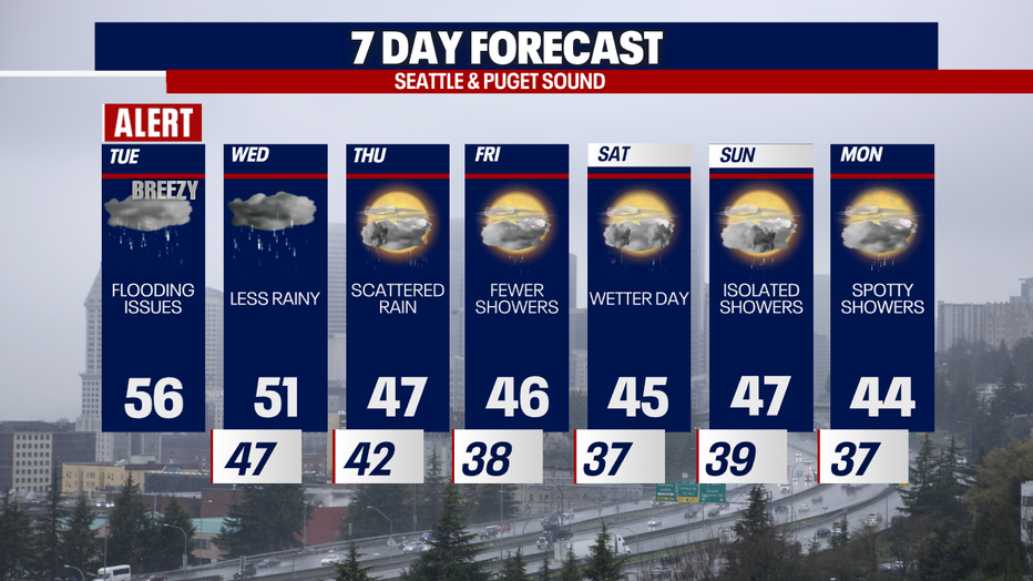
Here's a look at the seven-day forecast. Overall, river levels will gradully recede late Wednesday and into Thursday (the exact timing may vary by neighborhood). Saturday could be a bit active with lowland rain and mountain snow.
Take care,
Meteorologist Abby Acone
Follow me on X @abbyacone, Instagram @abbyaconewx, TikTok @abbyaconetv and Facebook (Meteorologist Abby Acone)