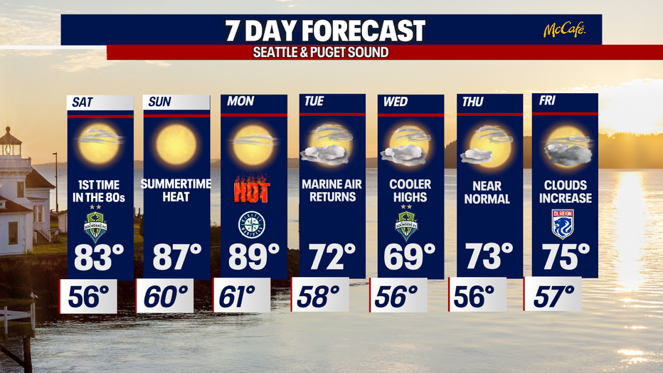
Seattle weather: Get ready for our first summer heat wave as temps soar into the 80s & 90s

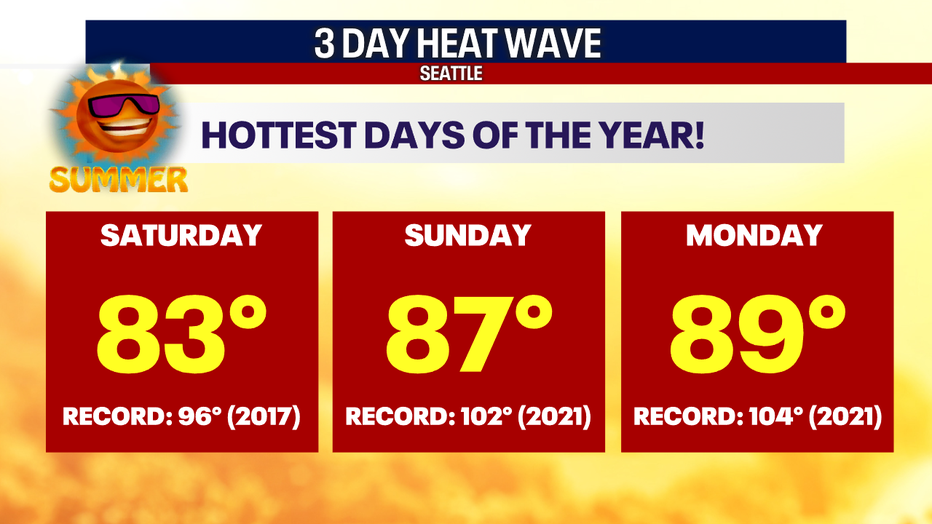
Temperatures closer to 90 on Sunday and Monday
Things will start cooling off on Tuesday with temperatures in the low 70s.
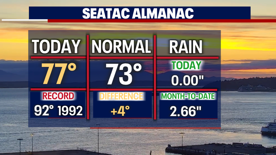
SEATTLE - Another day in the 70s in the books for Seattle! Friday's high hit 77 at the airport, making it the 10th time to warm into the 70s this year. Normally by this point, we should have seen over double that amount.
Get ready for the 80s and 90s as a mini-heatwave gets going Saturday, Sunday, and Monday.
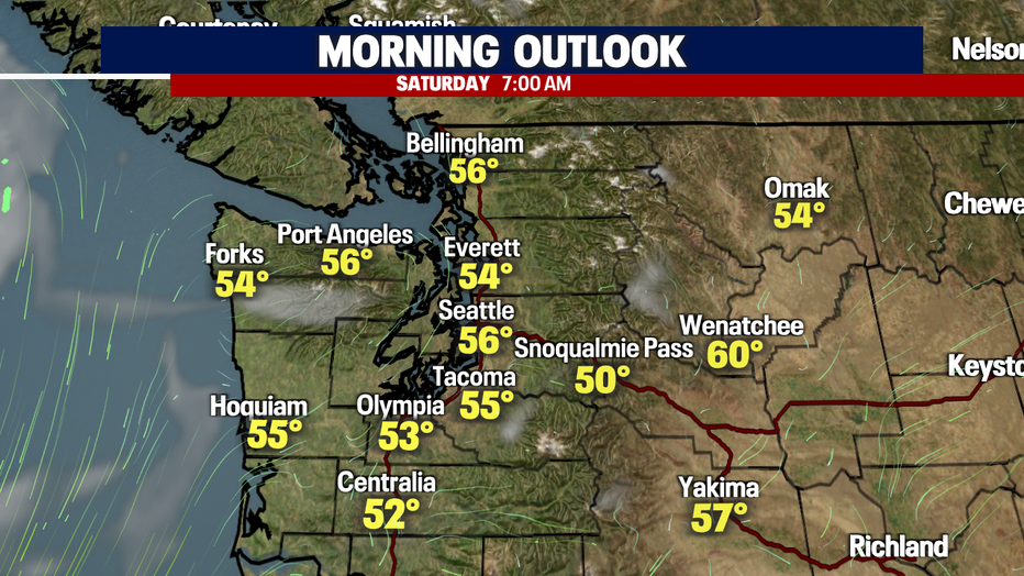
Overnight, temperatures cool into the low to mid-50s around the region. We'll see plenty of sunshine out of the gate Saturday morning.
With high pressure strengthening our pattern, we'll stay dry and hot. This combination triggers our first "Heat Advisory" for Western WA, and it does extend all the way south through portions of Northern California.
The advisory goes into effect late Saturday night lasting through Monday when temperatures peak in the upper 80s to low 90s.
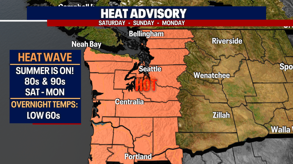
The next three days won't be record-breakers, but still very hot! We have not seen this type of heat since last summer. Make sure you're prepared if hanging outdoors for long periods of time. Stay hydrated, use sunscreen, and limit time in direct sunlight… find shade to help cool down.
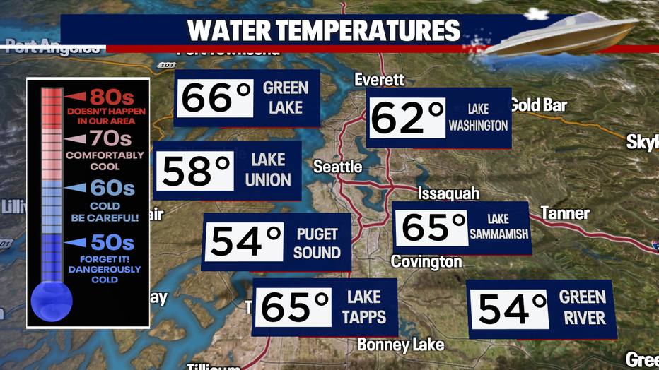
If your plans take you to area waters, please know that our rivers, lakes, and oceans are extremely cool right now. With water temperatures in the 40s, 50s, and 60s, that can be a dangerous shot to your body. Make sure to stay with your partner and wear a life jacket. Be safe!
Mother Nature will send in marine air to cool us down starting Tuesday. Highs drop into the upper 60s to mid-70s under mainly dry conditions. Enjoy!
Have a great weekend all! ~Erin Mayovsky, FOX 13 Forecaster