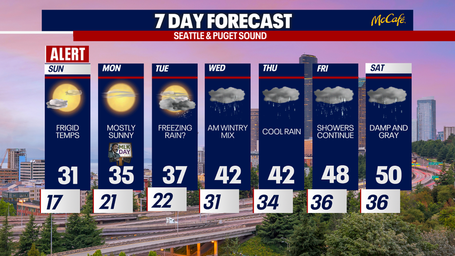
Seattle weather: Gradual warming trend into next week
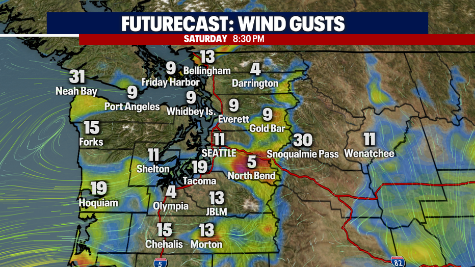
Seattle - In the wake of the arctic blast, conditions are slowly improving around Wester Washington. It will still remain breezy and cold overnight, but the High Wind Warning and the Wind Chill Advisory have both been allowed to expire. A few locations may see gusts near 35mph.
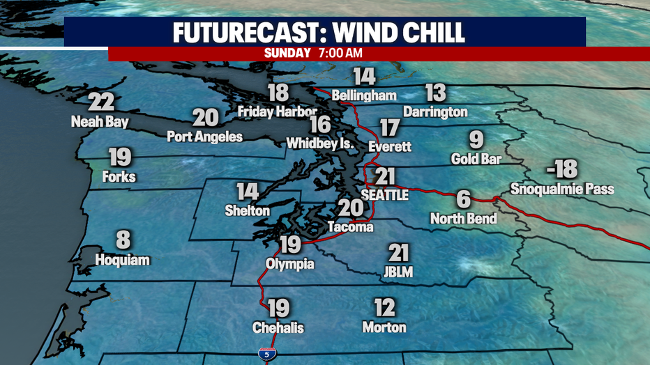
By early Sunday morning, wind chill readings in the foothills , including North Bend and Gold Bar, will be in the single digits. We won't see too many more locations with sub-freezing readings, except for the mountain passes.
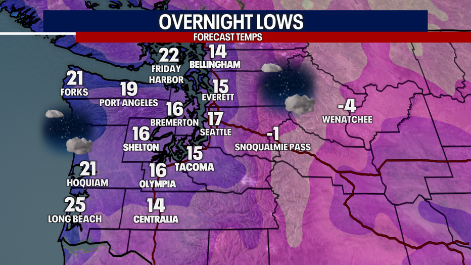
Overnight lows are forecast to be below freezing again area-wide with many locations in the teens. Along the coast, lows will dip into the 20's.
The gradual warming trend will continue over the rest of the weekend and on into next week. By tomorrow afternoon, the highs will warm to above freezing along the coast along with the Southwest Interior.
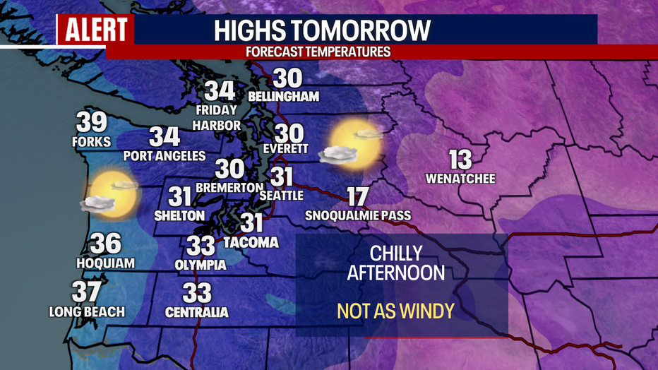
By Monday, Seattle and many surrounding areas will be above freezing for the first time in 3 days. We are tracking another storm system which has to potential of bringing another round of winter mix on Tuesday night and Wednesday morning. While the temperatures in the lowlands will begin to moderate and the wintry mix turns to rain, the passes will need to be monitored for the potential threat of freezing rain. By next weekend, mild temperatures in the upper 40's and low 50's return.