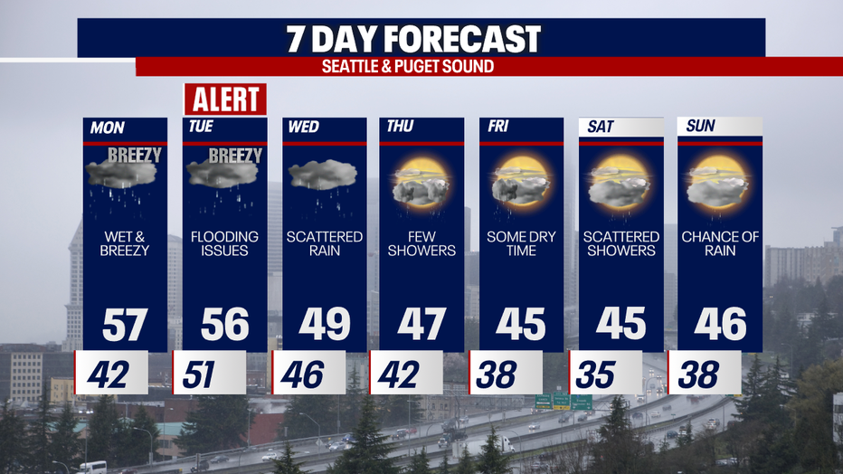
Heavy rain & mild temperatures Monday
Heavy rain came down this morning, and we saw a few lingering showers this afternoon, but once again we have calmer conditions tonight.
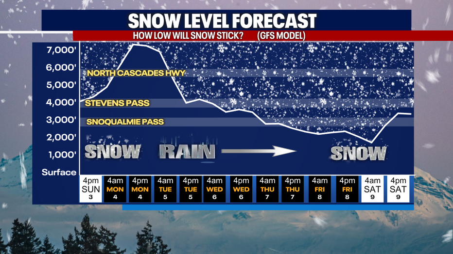
Snow levels will rapidly rise tonight into Monday morning as an atmospheric river moves into the Pacific Northwest. Expect to see snow levels well above the passes on Monday--7500-9000'.
Heavy rain will fall throughout the day Monday, and we won't see a real let up of the rain until Wednesday.

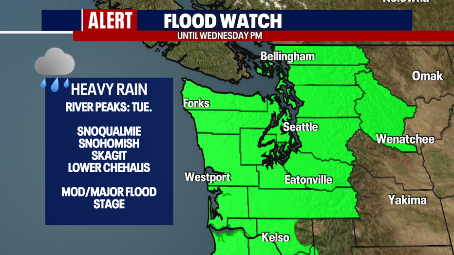
A Flood Watch is in effect for Western Washington through late Wednesday evening. This rain event has the potential for several rivers-- including the Snoqualmie, Snohomish, Skagit, and low Chehalis-- to reach moderate to major flood stage.
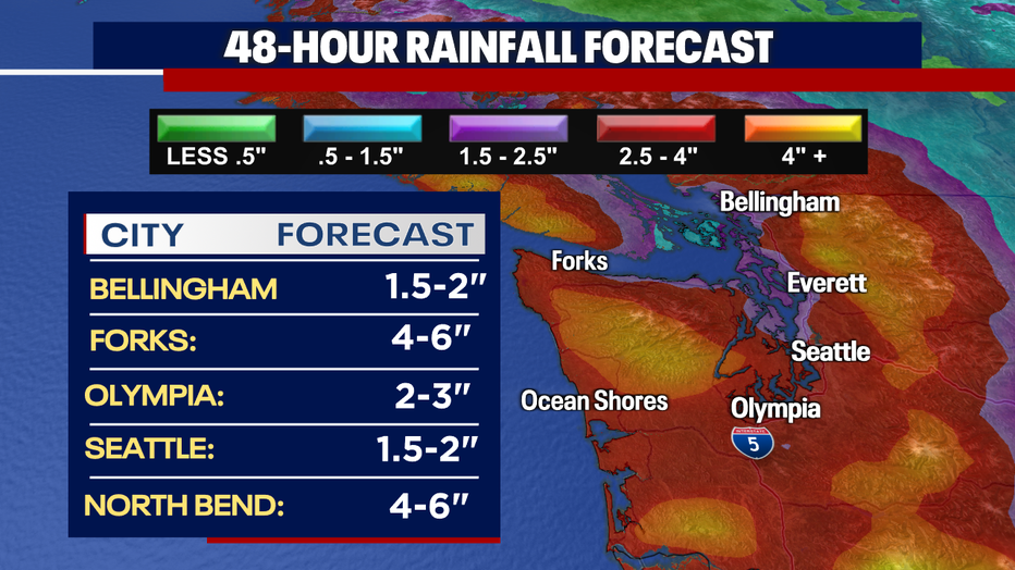
Rain totals over the next 48-hours look to be heaviest along the coast and in the Cascades.
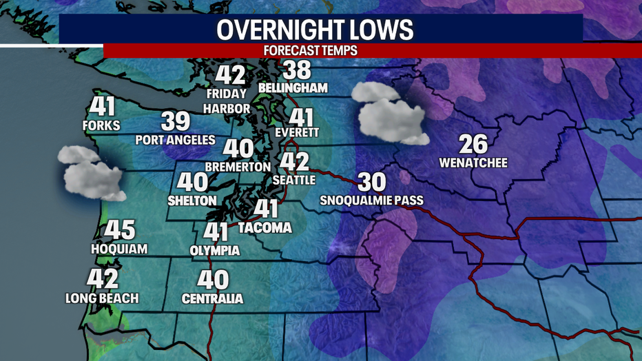
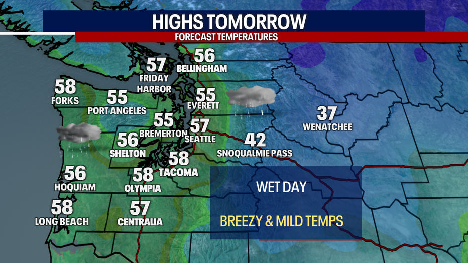
Temperatures will be very mild and well above average for Monday and Tuesday as the atmospheric river will bring in warmer conditions from the south.
Scattered showers will continue through the work week. Next chance of rain breaks return for Friday afternoon.