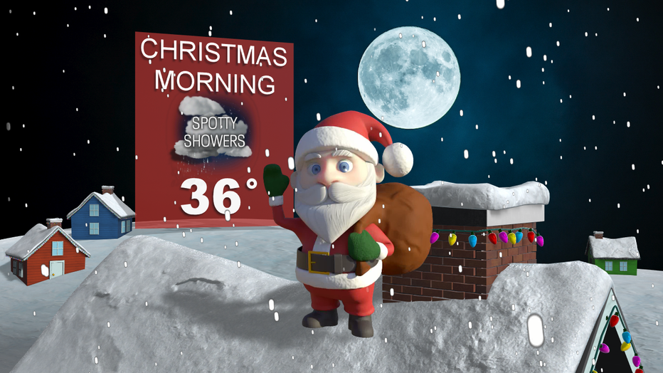
Here is your Christmas forecast!
seattle - It was beautiful today! We were off to a cold start, but sun returned and I know a lot of us took full advantage. The clouds will gradually thicken up this evening. This is ahead of rain tracking our way.
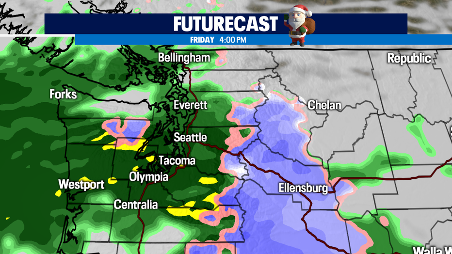
An upper level low pressure system will allow for rain chances to return. Rain chances will roll in after midnight along the coast. The winds will increase and gusty will range between 20-25 mph.
Rain will slowly work its way E and N though the morning. By the afternoon, all of us will be dealing with the rain. The winds will be increase slightly. Expect winds sustained between 5-15 mph.
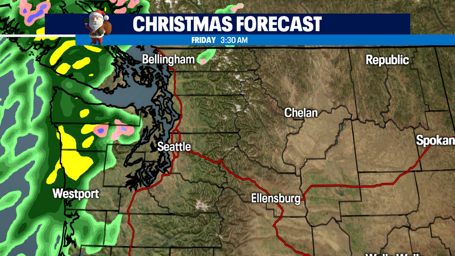
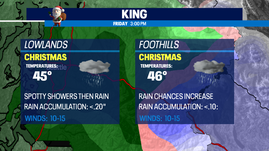
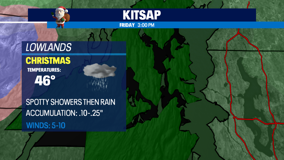
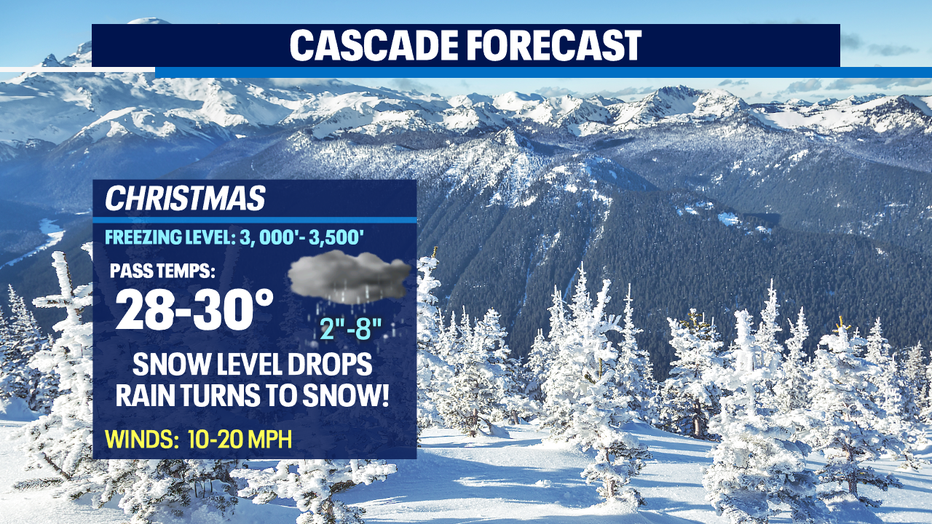
Here is a look at your Christmas county forecast:

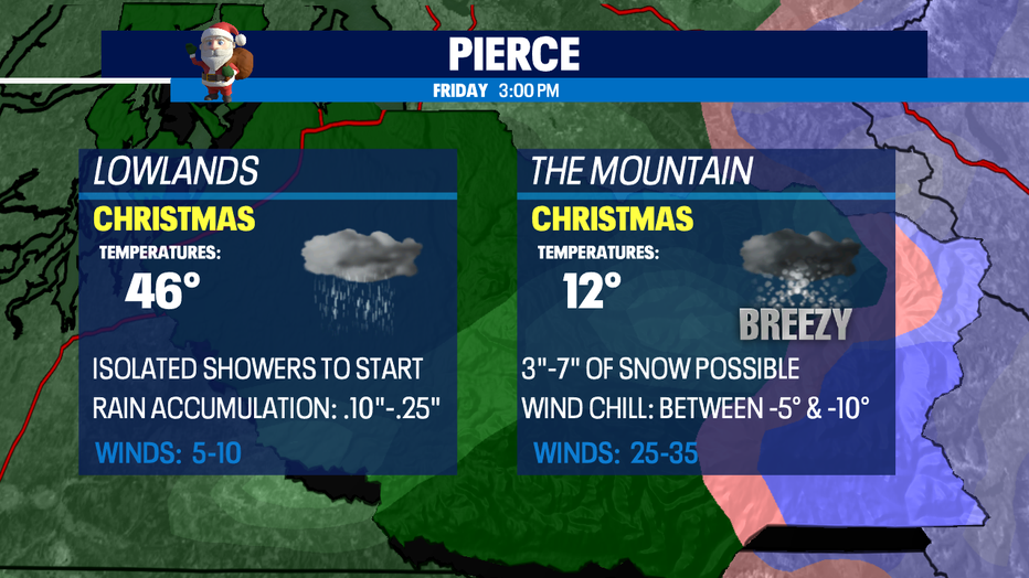
Our BEST shot for Christmas snow will take place in the mountains. The snow level falls to around 3,000'. A mix of rain and snow will hit first and then transition into snow by the afternoon and evening.
If you're hitting the roadways, please take it easy out there. Stay safe and I hope you are enjoying the holiday.