

Seattle weather: Mainly dry weather ahead for the first weekend in February
Friday to start with scattered showers
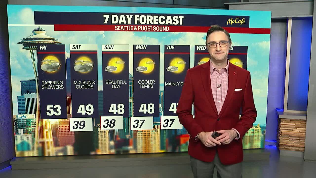
Scattered light showers will continue overnight into Friday morning. Lows in the upper 40s.
SEATTLE - Drier and cooler weather arrives this weekend for the lowlands, while mountain snow pack continues to recede with no significant snow in sight.
Showers have mainly ended midday Friday around the Puget Sound area. This afternoon is looking drier and mild, with sunbreaks mixed in.

A low pressure system off the coast will sag south heading into the weekend, bringing in drier conditions Saturday and Sunday. Other than a few isolated sprinkles, Saturday will be dry with partly to mostly cloudy skies.

The last two weeks have been tough on mountain snowpack as warm rain and high snow levels moved into the area. Many spots along the Cascades are at 50 to 60 percent of normal snowpack, with the Olympic Basin only at 32 percent of normal. The next week will be mainly dry in the mountains, so I expect these numbers to go down even more over the next seven days.

The extended forecast looks mainly dry over the next seven days, with a slight chance of showers on Wednesday. Temperatures will be at or slightly below average starting on Sunday with a mix of clouds and sunshine next week.
