

Monday Forecast: Spotty showers and sunbreaks

Cloudy, muggy start to Monday
Expect a cloudy, mild and muggy start to the day. Temperatures will only fall into the mid-lower 60s for most locations. A stray shower will be possible on your morning commute as well.
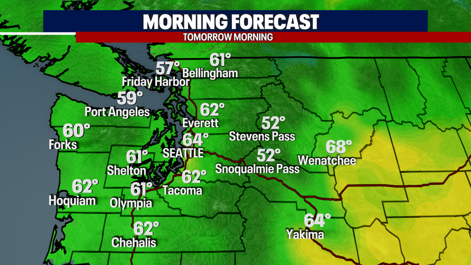
Seattle - Expect a cloudy, mild and muggy start to the day. Temperatures will only fall into the mid-lower 60s for most locations. A stray shower will be possible on your morning commute as well. Here is a look at your morning temps:
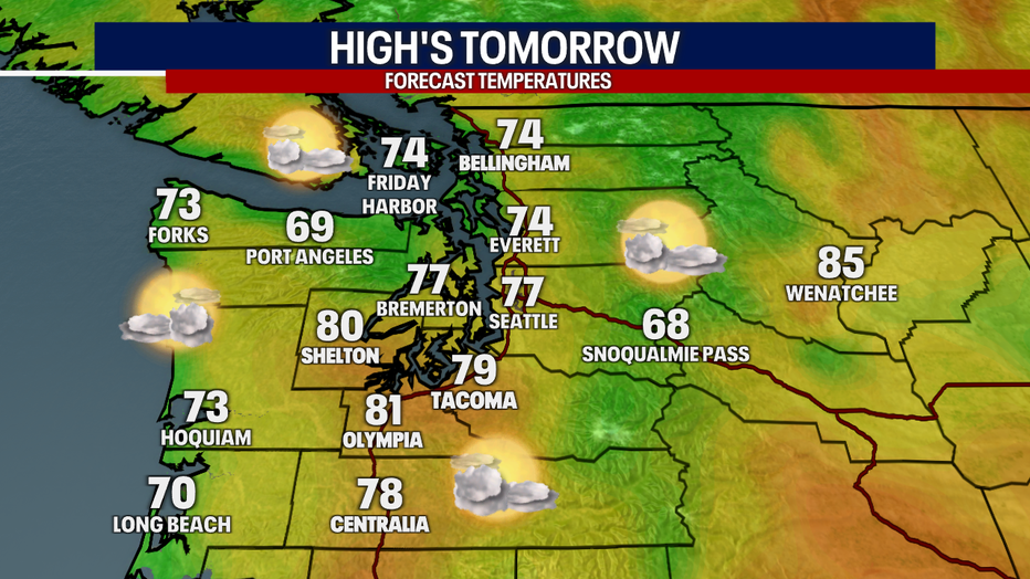
Temperatures will rise into the 70s once again tomorrow afternoon. Here is a look at your high temps:
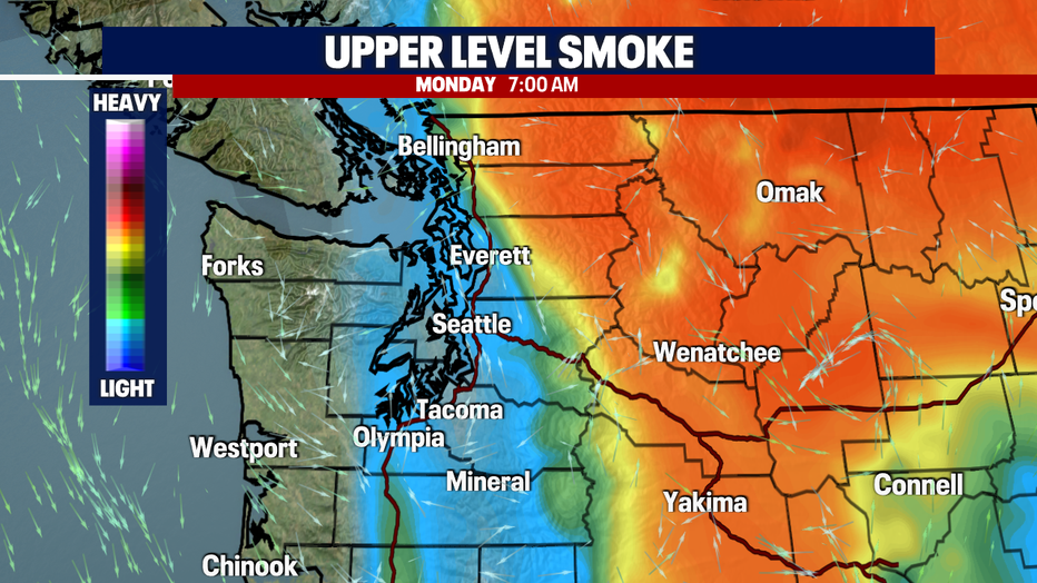
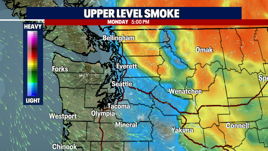
The upper-level haze/smoke that we've been seeing this weekend will begin to significantly clear out tomorrow. It'll linger for some, but the process will continue through Tuesday.
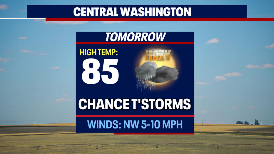
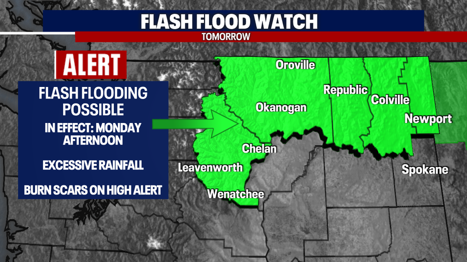
Thunderstorms will return for those across central and eastern Washington tomorrow. These storms could produce heavy rain, gusty winds, pea-size hail, and lightning. Be on high alert for those around burn scars. A Flash Flood Watch will go into effect tomorrow afternoon and will remain in effect until tomorrow night. This is where the biggest threat for flash flooding could occur. Here is a look at the forecast:
Rain chances will be a bit more promising for us (Western Washington) Tuesday evening to Wednesday morning. Another frontal system will head our way and increase showers. This will keep temperatures in the 70s as well.

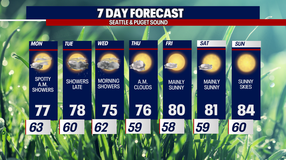
I'll leave you with a look at your 7-day forecast:
Have a good one!