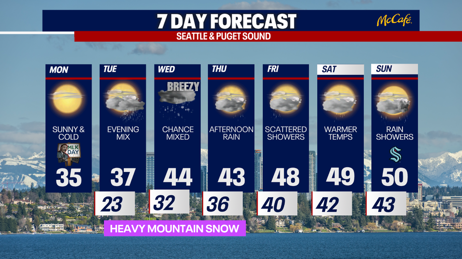
Mostly sunny and cold Monday, travel impacts possible Tuesday

Seattle weather: Freezing rain possible Tuesday in Western Washington
FOX 13 Meteorologist Brian MacMillan has your Pacific Northwest weather forecast.
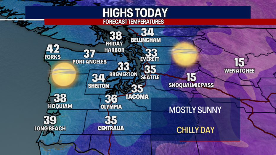
SEATTLE - Western Washington is feeling the chill Monday morning, as temps start out in the teens and low 20s for most spots.
Expect mostly sunny skies today with high temperatures in the mid 30s. This will be our coolest and sunniest day of the next week. Easterly winds will continue to push through the Cascade gaps, bringing gusty winds to the areas usually impacted in the Cascade foothills. Spots like North Bend could see 35 to 40 mph gusts.
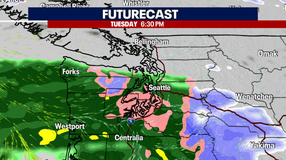
Tuesday will bring gradually warmer temperatures with dry conditions through most of the daylight hours. If you have the ability to do so, you might want to leave work a little early on Tuesday. An approaching system will bring a chance of freezing rain or light snow to the I-5 corridor south of Everett during the evening commute. It will quickly switch over to regular rain later in the evening, but for a brief time, it could impact the roads.
Stay tuned to the forecast Tuesday morning for the latest on this approaching system.
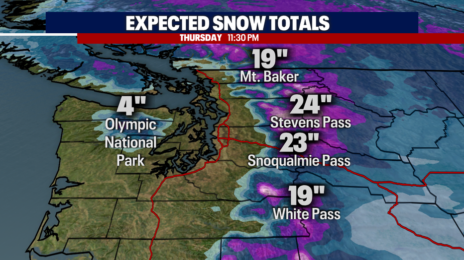
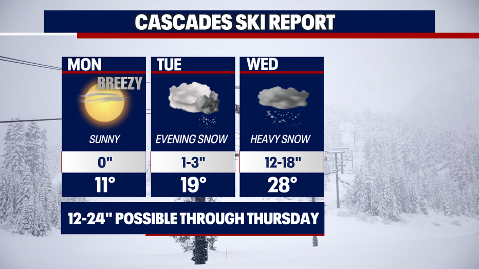
This next round of wet weather in the lowlands will produce impressive snow totals in the mountains. One to two feet is expected at the ski resorts and over the passes Tuesday through Thursday.
The gradual warmup will continue every day this week, with temps back close to 50 degrees by the weekend. It seems after a slow start, the Cascades and mountain resorts are having a great January!