

Perfectly persistent August weather
SEATTLE - When we see the same conditions over and over again, we call that persistence in the weather world. And this time of year we often see these picture-perfect days with temps in the comfortable 70s repeatedly around Western Washington. Today, nearly identical to yesterday with some brief AM clouds and fog and gorgeous blue skies in the afternoon.
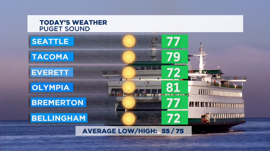
I think we'll get a tad toasty in areas in the South Sound and Cascade foothills where temps will top out in the low 80s today. Winds will pick up a bit this afternoon with possible gusts 20-25 mph, which will take an edge off of any heat. Upper 80s are likely in Central Washington again. Areas near active wildfires could end up seeing poor air quality this afternoon. Coastal folks will enjoy temps near 70.
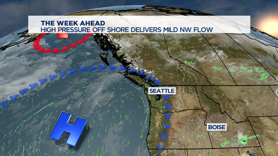
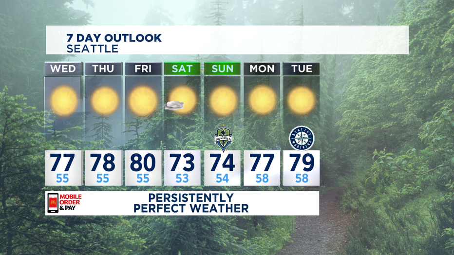
Our weather pattern isn't going to change all that much. We've got high pressure off our shores, that will drive in a NW flow in the atmosphere. Some mornings that will mean some morning clouds in some spots but even the cloudiest areas will see blue skies by the afternoon. I think at least one day this week we'll end up hitting 80 for a couple hours. The most likely day for that looks like Friday. A bit cooler for the weekend as a we see a marine push of cooler air to bring us back to the low to mid 70s.
Hurricane Laura is barreling towards the coast of Louisiana and eastern Texas. Landfall likely around 11pm Pacific Daylight Time tonight. Laura could make landfall as a strong category 3 or weak category 4 storm. This would mean catastrophic damage from sustained winds near 130 mph for several hours, a storm surge that could be up to 20 feet where the storm makes landfall, and up to a foot of rain.
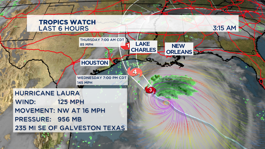
The storm will quickly move inland which could cause flooding rains in Arkansas and Tennessee as it tracks inland back towards the east coast. -Tim Joyce