

Persistently pleasant with a few afternoon showers

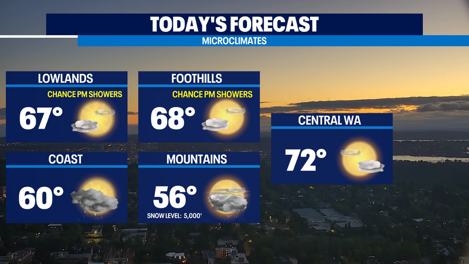
SEATTLE - We’re still under the influence of a dip in the jet stream called a trough. It’s delivering pretty benign weather with pleasant mornings and enough afternoon atmospheric lift to bring a few showers later in the day—but even those will hang mostly in the mountains/foothills and along the coast.
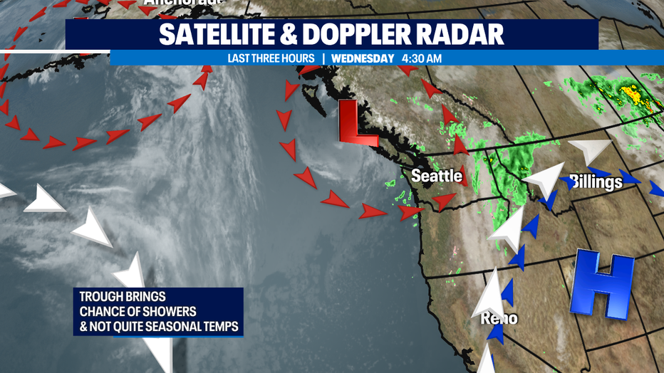
We're in this (relatively) cool and showery pattern through today and tomorrow. This will also mean some temps that will be just below the seasonal norm of 70 the next few days.
We still look to be dry for most of the day on Thursday before the weak weather system offshore finally moves inland keeping us a tad wetter on Friday morning than we've seen recently. I'm optimistic we'll be back to a generally dry-ish weather pattern with scattered rain showers by Friday evening that dry-ish weather pattern looks to hold through the weekend. It does look soggier for the coastal areas and the Olympic Peninsula.
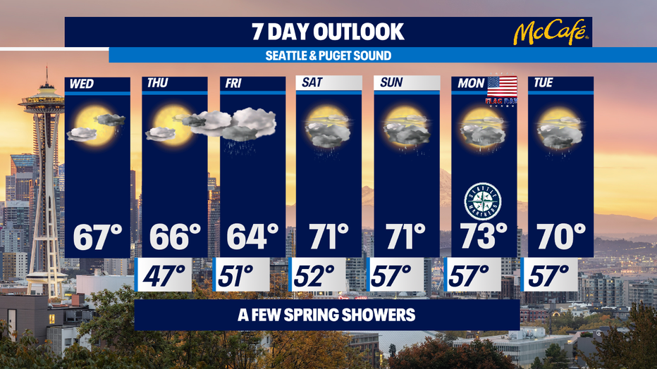
At this point, it seems we'll have more clouds on Saturday than Sunday, but both days have warmer temps and a chance of showers. At this point it looks like the wettest day of the next 7 is next Tuesday. A bit too soon to tell for sure since it's so far out. -Tim Joyce
Q13 WEATHER RESOURCES:
DOWNLOAD: Q13 Weather and News Apps
WATCH: Forecast and Radar
READ: Closures and Delays
CHECK: Latest Weather Alerts and Live Traffic Map
INTERACT: Submit your Weather Photo
FOLLOW: Lisa Villegas, MJ McDermott, Tim Joyce, Erin Mayovsky, Grace Lim and Scott Sistek