

Seattle weather: More potential snow Saturday morning
Seattle weather: Potential snow Saturday morning
FOX 13 Seattle weather anchor Stephen Kilbreath is tracking more snow possible on Saturday morning for another Weather Alert Day.
Rain has started along the coast and as it moves inland the temperatures are cooling, and it is turning into a rain/snow mix. There is a chance of small amounts of accumulation in the South Puget Sound early Saturday.

This is a weak system, but temperatures are cool enough, and there will be moisture in the air. Saturday morning is a WEATHER ALERT DAY, especially in the morning because of potentially dangerous driving conditions.
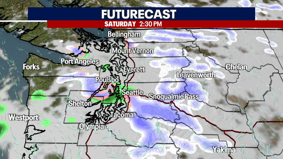
Futurecast has been paused at 2:30 p.m. This is the most precipitation we will see on Saturday as the system continues to weaken. A lot of it will be a rain/snow mix, as you can see in the graphic.

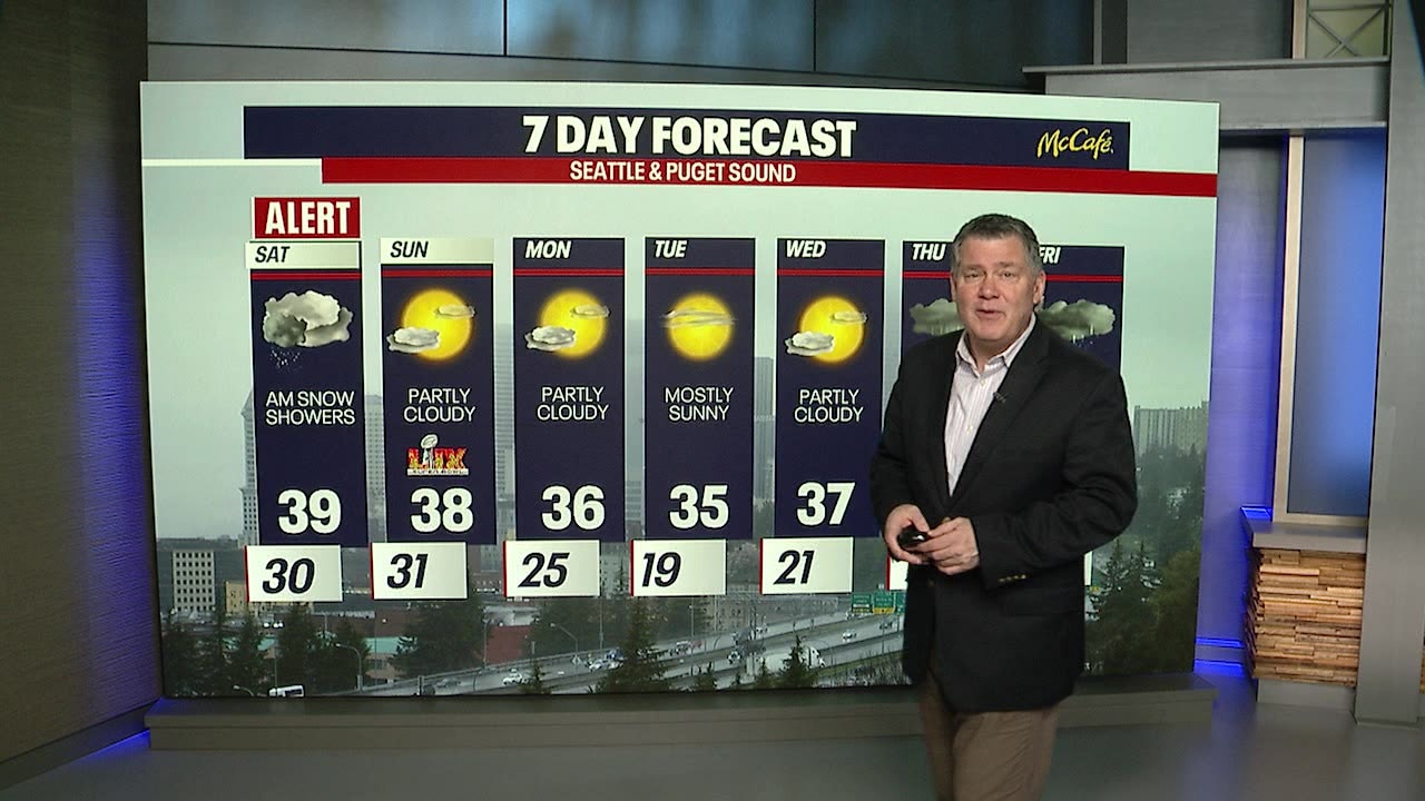
After some brief snow showers tomorrow morning, the high temps will be in the mid to upper 30s. The next couple of days will be nice but COLD. Look at Monday into Tuesday…only 19 degrees overnight! Brrr…
Rain and snow mix is expected again on Thursday and on Valentine's Day. That turns into rain as we head into the President's Day holiday weekend as temperatures warm up into the 40s.
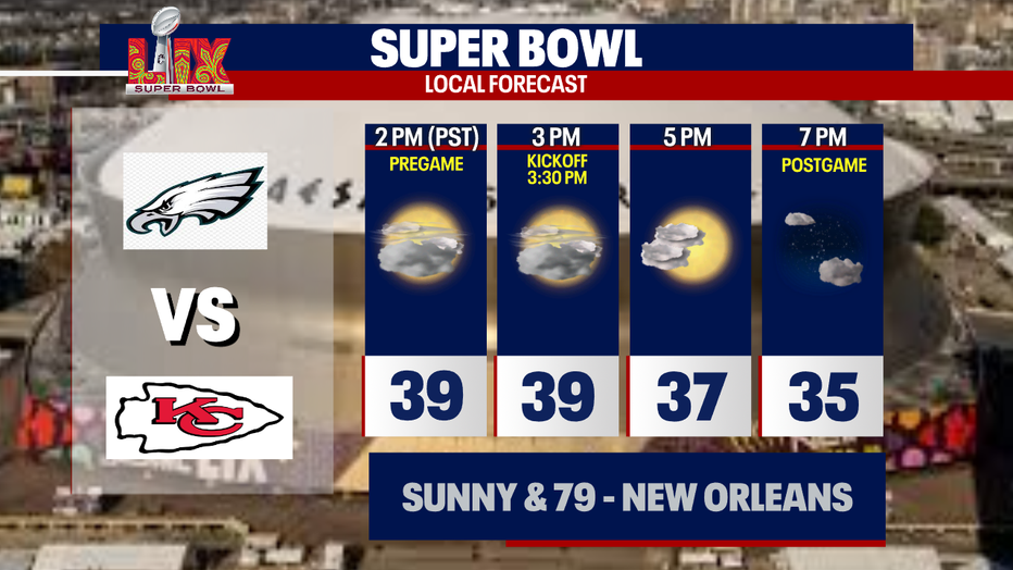
And we wrap it up with your local Super Bowl forecast!
Enjoy your day!
Stephen
MORE TOP STORIES FROM FOX 13
Washington Senate passes changes to parental rights in education
Japan Airlines plane clips tail of Delta plane at Sea-Tac Airport
Judge blocks DOGE access to sensitive Treasury Department payment system records
Man sentenced to 20 years for grooming, taking WA girl to Michigan home
To get the best local news, weather and sports in Seattle for free, sign up for the daily Fox Seattle Newsletter.
Download the free FOX LOCAL app for mobile in the Apple App Store or Google Play Store for live Seattle news, top stories, weather updates and more local and national coverage, plus 24/7 streaming coverage from across the nation.