

Rain returns for the penultimate day of winter

Soggy weather to welcome spring
We're heading into the first weekend of spring with a rainy forecast.
Seattle - After a fantastic Wednesday, changes are ahead.
Clouds continue to move in. Rain will develop before the day is over. Mostly dry this morning and a little bit of light steady rain this afternoon. The evening commute looks pretty soggy.
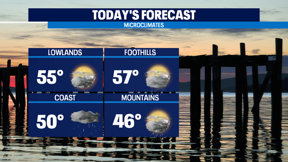
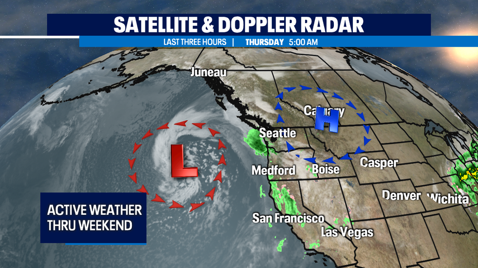
Winds will pick up late this afternoon as the front approaches out of the south and southeast. While it will be breezy at times today & tomorrow, the winds will remain below wind advisory criteria.
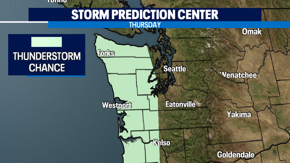
There is a slight chance of pop-up thunderstorms later today along the coast with the unstable air mass that will move across the region with the low moving slowly onshore tomorrow. Most of the thunderstorm activity, if it occurs at all, will be mostly in offshore waters and along the coast. But there is a slight chance of thunderstorms around Puget Sound in the afternoon — slightly better shot for these Friday.
High temperatures will be cooler than the upper 50s and low 60s we attained yesterday. Normal is 54 for this part of March, and we will be a little bit below that for Thursday. This unsettled weather pattern with rain at times will continue through the weekend and even into Monday. Saturday the showers might only be for the coast and mountains, so Sunday looks like the soggier day of the weekend.
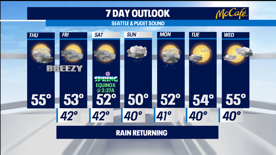
Tomorrow is the last full day of winter. Spring officially begins at 2:37 AM in the Pacific Time Zone on Saturday. It looks like drier weather builds back into the forecast for next Tuesday and Wednesday. -Tim Joyce
Q13 WEATHER RESOURCES:
DOWNLOAD: Q13 Weather and News Apps
WATCH: Forecast and Radar
READ: Closures and Delays
CHECK: Latest Weather Alerts and Live Traffic Map
INTERACT: Submit your Weather Photo
FOLLOW: Lisa Villegas, MJ McDermott, Tim Joyce, Erin Mayovsky and Grace Lim