

Seattle heat wave: Temperatures stay in the 90s through Friday in Western Washington

Weather Alert Day: Temperatures in the mid-90s through Friday
Weather Alert Day: Temperatures in the mid-90s through Friday
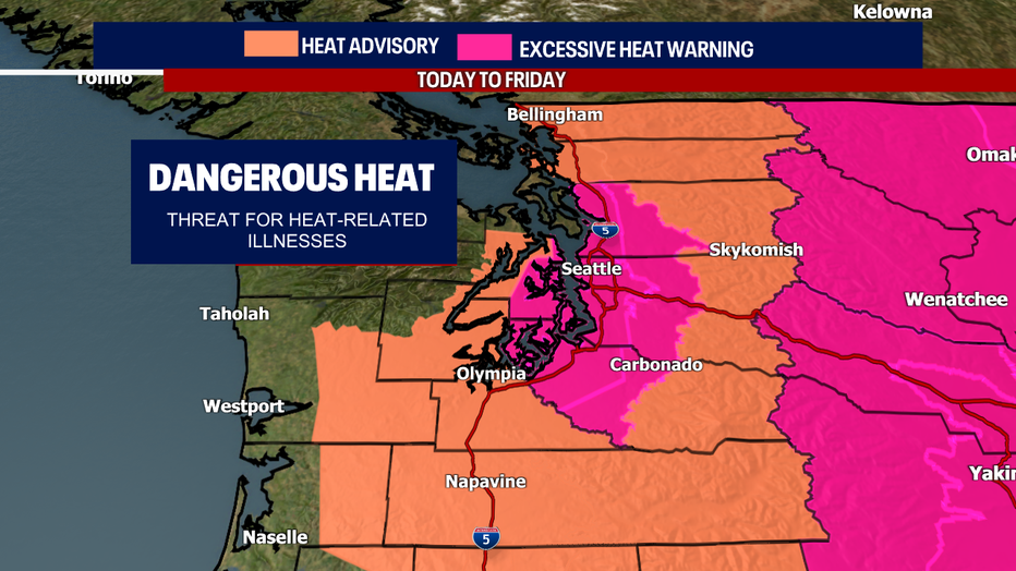
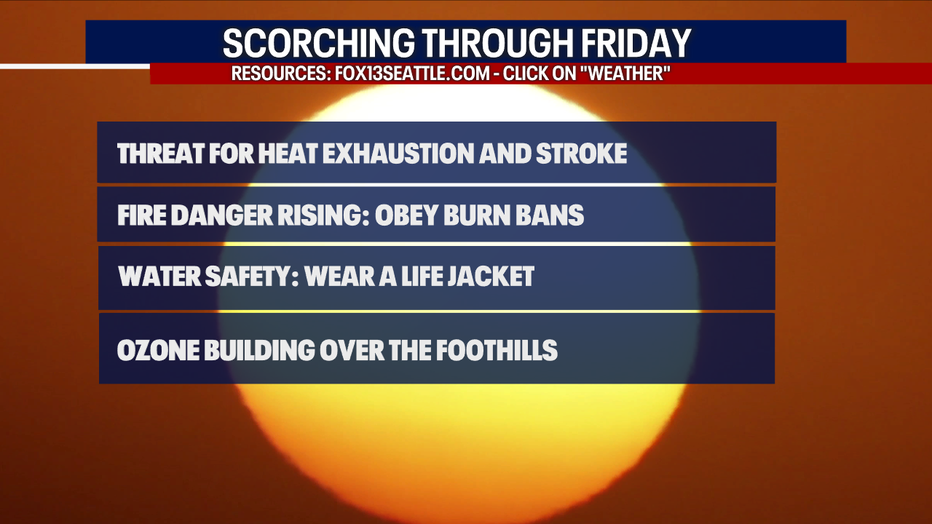
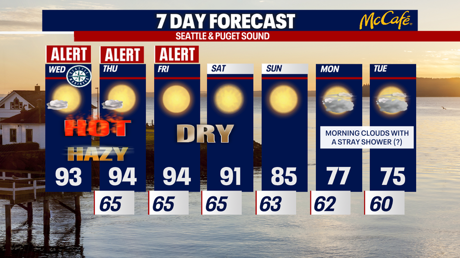
SEATTLE - We are tracking more scorching heat across Western Washington – the mid 90s stick around through Friday. Highs drop to 91 on Saturday. There's still a medium to high threat for heat exhaustion and stroke. Take extra care of the kiddos, seniors and pets in your life!
There are still Excessive Heat Warnings and a Heat Advisory in effect until Friday.
Make sure you stay hydrated. Seek shade and wear sunscreen. To find cooling centers around the region, click here.
RELATED: Staying cool during Seattle's hottest days of the year: Tips, cooling centers & pet safety
Also, wear a life jacket if you are cooling off in a lake, river or Puget Sound. Remember that fire danger is elevated. Heed any burn bans in your area!
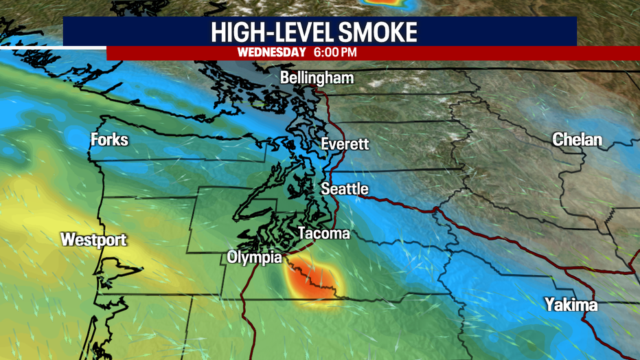
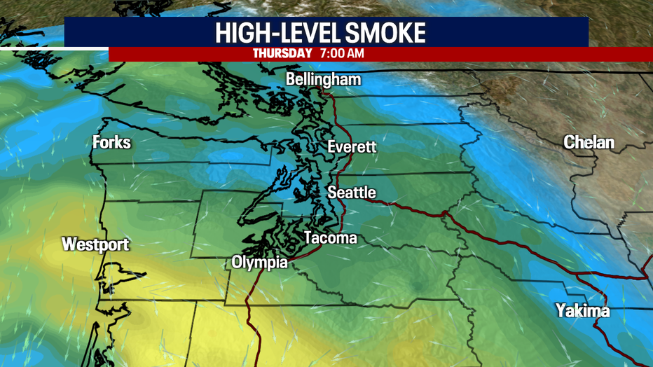
Highs today will be similar to yesterday if not a degree or two cooler than Tuesday: this is because some mid to high-level clouds could push through the region. Along with the clouds could be some thin, high-level smoke from fires burning in California. Not very much wildfire haze will make it to the surface, so we are not expecting a drop to air quality to the ground from the smoke. However, air quality is dropping in some areas due to ozone (this is according to Puget Sound Clean Air Agency and National Weather Service). For more, click here.
Here is what the National Weather Service is saying about the air quality:
"Along with high temperatures this week, we are expecting high levels of ozone pollution (smog) for the Cascade foothills of King and Pierce counties from Issaquah to the east. North Bend and Enumclaw will particularly be affected. Ozone levels are expected to reach UNHEALTHY FOR SENSITIVE GROUPS in the afternoon, on Wednesday through Friday (July 27-29).
Ozone can trigger a variety of health problems including chest pain, coughing, throat irritation and congestion. It can also worsen bronchitis, emphysema, and asthma.
Ozone concentrations are expected to be the highest in the afternoon and evening. We expect the ground-level ozone pollution levels to come back down to healthy levels as temperatures decline."
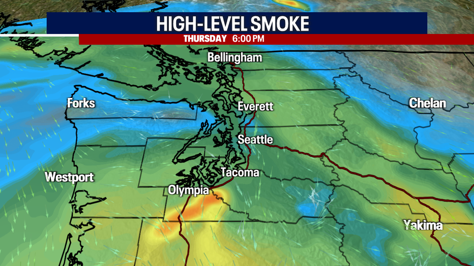
Check out the mid to high-level smoke we could see today and tomorrow (like everything, forecasting wildfire haze is challenging and very fluid):
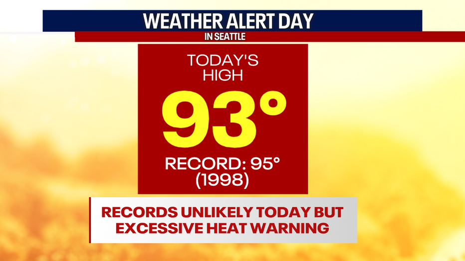
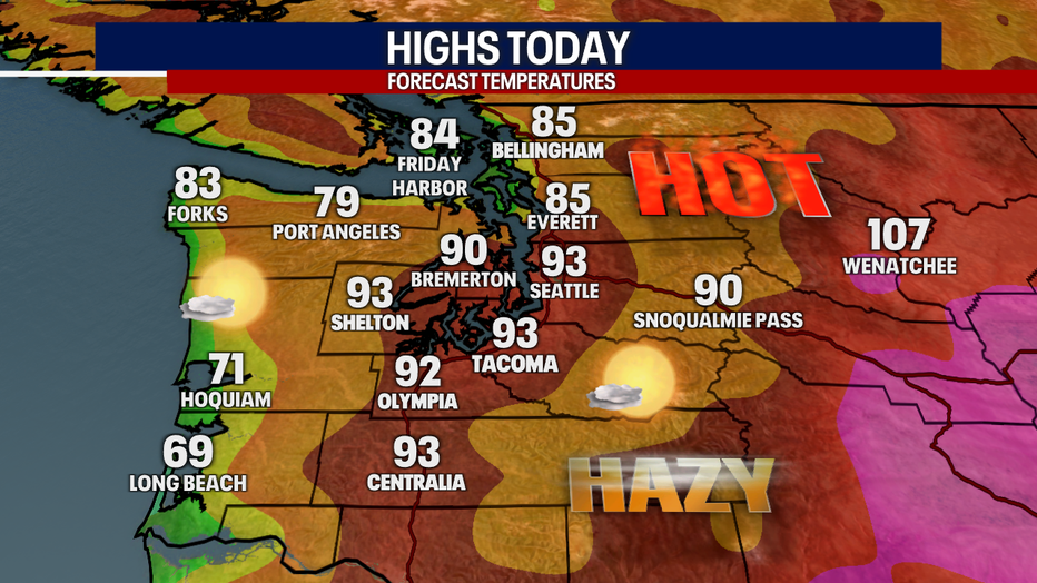
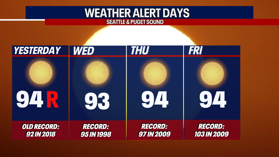
Sea-Tac Airport will come close, but will likely fall shy of the record for today (which stands at 95 for today). We are also not expecting records elsewhere, including at Bellingham, Olympia and Hoquiam. Here is a check of the comparison of forecast highs today and the records:

We stay in the low 90s into Saturday. By Sunday, highs drop to the mid 80s.
More dramatic relief from the heat arrives Monday and Tuesday, along with our familiar onshore push. Highs will comfortably reach the mid 70s. The mornings will be cool and cloudy. Sunbreaks are possible in the afternoon. Some data suggest a few showers could pop up Monday and Tuesday. That would do wonders for scouring any haze in our skies!
Take good care today!
Warmly,
Meteorologist Abby Acone
Follow me on Twitter @abbyacone, Instagram @abbyaconewx, TikTok @abbyaconetv and Facebook (Meteorologist Abby Acone)