Seattle weather: Storms increase wildfire risk

Seattle weather: Warm, hazy and sunny Saturday
FOX 13 Seattle Meteorologist Ilona McCauley has your latest western Washington weather forecast!
SEATTLE - An active Friday in our Cascade passes as thunderstorms fired up during the afternoon and into the evening. Storms contained a lot of lighting with isolated spots also seeing some heavy rain. Fire risk will remain high due to some more storms possible again on Saturday afternoon.
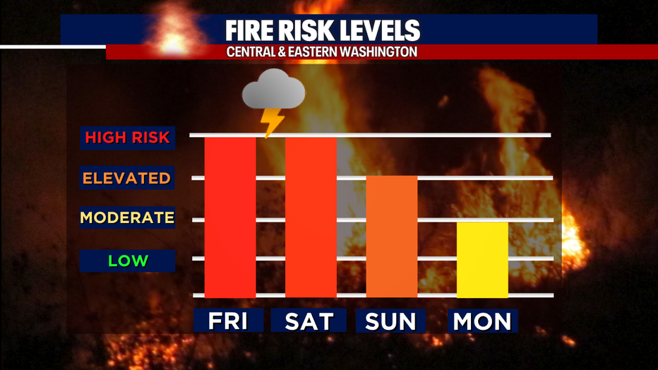
High fire danger on Friday and Saturday with a chance for storms in the mountains.
The warm, unstable air will linger into Saturday, adding to the possibility of storms in the Cascade crest and eastward. Storms may produce dry lightning, so the fire danger will need to be monitored again through the afternoon and evening.
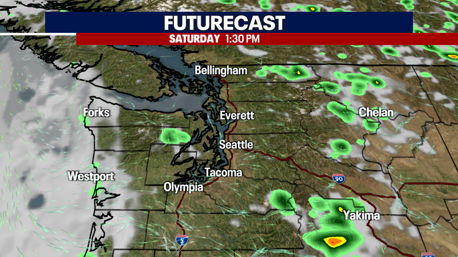
Another round of mountain thunderstorms will be possible Saturday afternoon.
Saturday is forecast to be another warm and hazy day around Puget Sound, impacting our air quality. Onshore flow will increase beginning Sunday, helping to blow the smoke back out east and improve air quality once again.
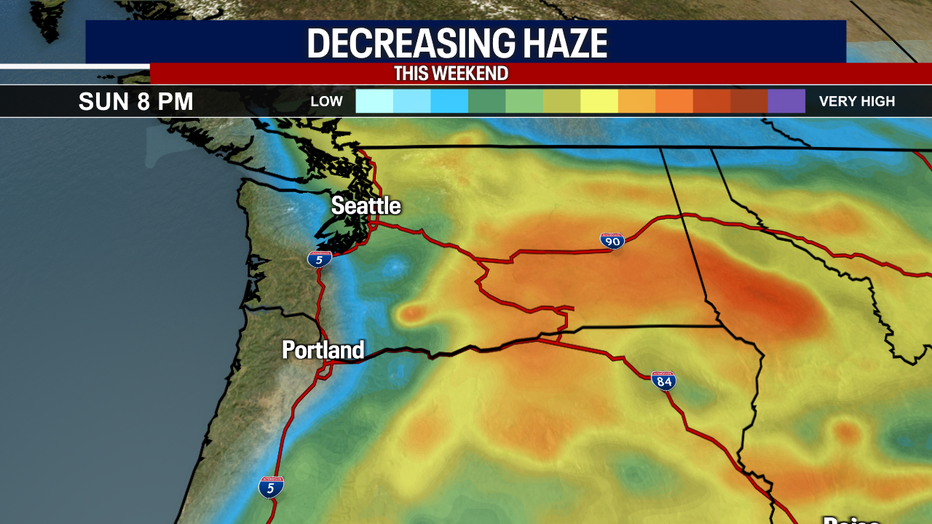
Wildfire smoke will continue to keep skies hazy into the weekend. Some slight improvement by late Sunday.
We will see moderate air quality on Saturday. By Sunday, areas to the east of Seattle will see some improvement with smoke continuing to clear out during the evening. Skies will be noticeably clearer by early in the week as onshore flow increases.
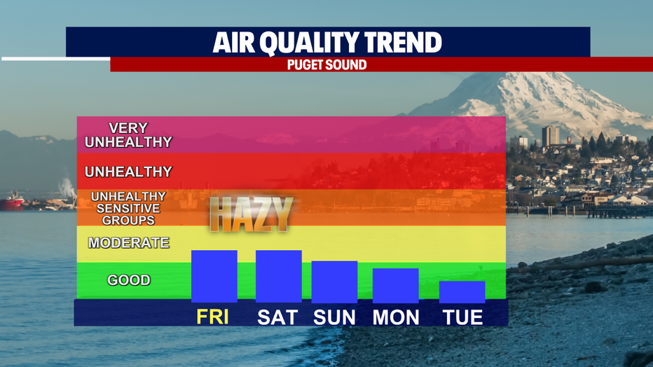
Smoke from nearby wildfires will keep air quality in the moderate range with some fresh air by Monday.
Not only will the shift in the winds allow smoke to clear out, but we are also looking at a cool down by Monday with some light drizzle possible Wednesday through Friday.
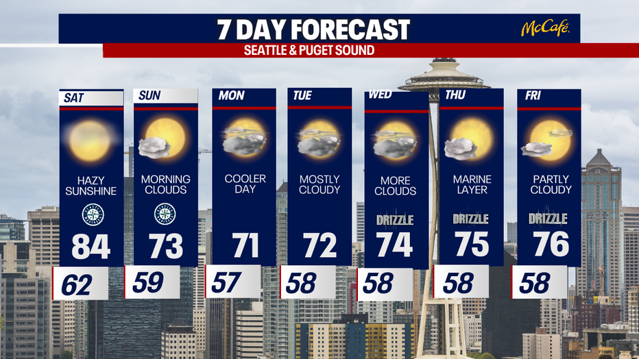
A warm and hazy Saturday, but stronger onshore flow will blow out the smoke and also bring down temperatures throughout the week. (FOX13 SEATTLE)

