

Seattle weather: Another chilly week ahead for Western Washington
Mix of clouds and sunshine
As we continue with below normal temperatures, we'll be close to freezing early Monday morning.
SEATTLE - If you were hoping for a big warm-up in Western Washington, this new forecast will be super disappointing. Temperatures stay chilly throughout the workweek before rising to the low 50s this weekend.
The last time we had a day of 50 degrees or warmer was February 12. The last 21 days, temperatures have ranged seven degrees below average.

The average first 60 degree plus day in the Seattle area is February 22, so Mother Nature is lagging behind this year. The average last freeze every season is March 9.

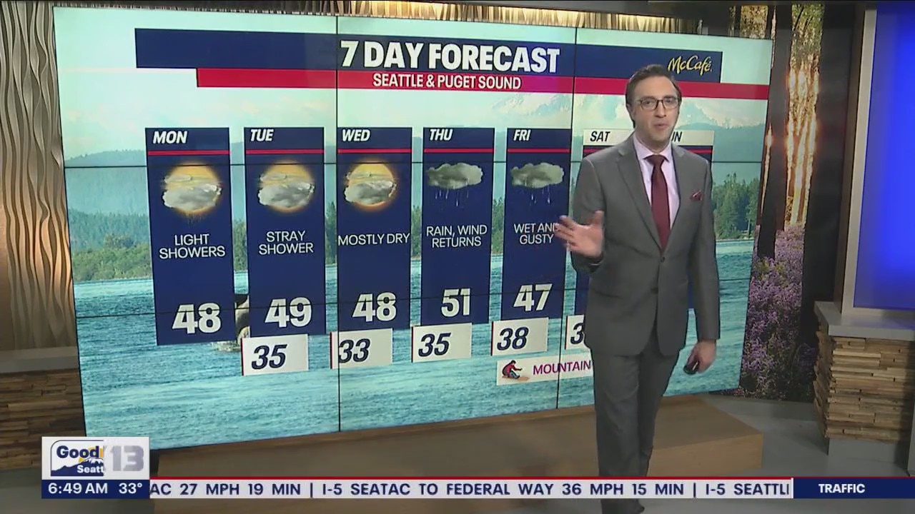
After an icy morning, we're forecasting highs to reach the mid to upper 40s for most. You can plan on a mixture of sunshine and clouds. Only isolated showers are expected today.


Tuesday and Wednesday will likely wind up dry with only sparse showers and sunbreaks.

Wet and breezy weather returns by late Thursday. Friday stays active with blustery conditions, heavy mountain snow and lowland rain.
Saturday could be less windy, but scattered rain is ongoing. Showers stick around Sunday.

Hope you have a wonderful week! Thanks so much for choosing FOX 13 :)
Warmly,
Meteorologist Abby Acone
Follow me on Twitter @abbyacone, Instagram @abbyaconewx, TikTok @abbyaconetv and Facebook (Meteorologist Abby Acone)