

Seattle weather: Calmer overnight, more rain and mountain snow ahead

Calmer overnight, a few more inches of snow for the mountains
Seattle weather: Calmer overnight, a few more inches of snow for the mountains
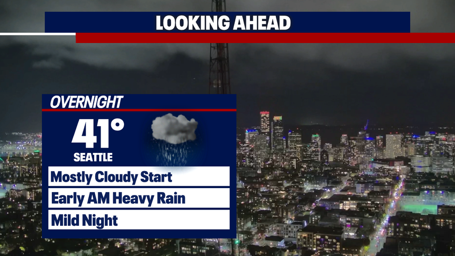
SEATTLE - After a wet & gusty morning paired with heavy mountain snow, conditions have calmed down this evening. Scattered showers and a few more inches of snow are possible overnight.
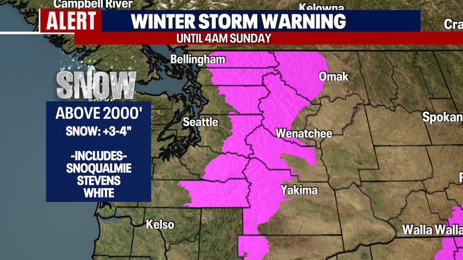
The Winter Storm Warning remains in effect through 4am Sunday morning. Up to four more inches of snow is possible tonight.
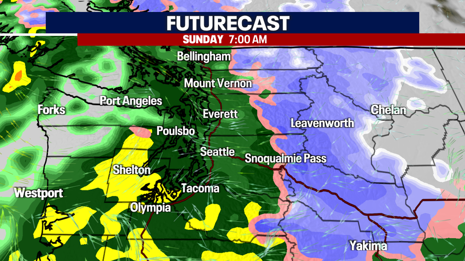
It will be a wet start to our Sunday as the first of two atmospheric river systems move in. Showers will be scattered into the afternoon along with breezy winds; gusts up to 25 mph.
Snow levels will jump quickly up to 6000-7000', changing the mountain snow to rain. Avalanche danger will also increase as the rain will fall on top of the recent heavy snow accumulation.
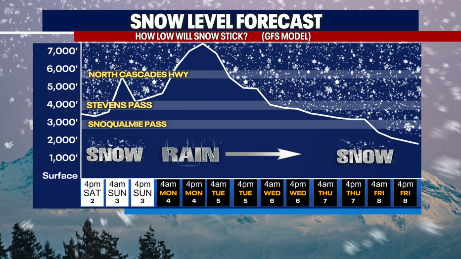
A stronger and wetter atmospheric river will move in Monday through Tuesday; this will also bring in much milder temperatures.
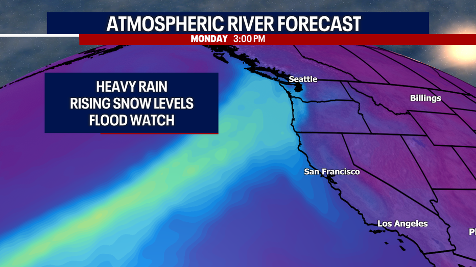
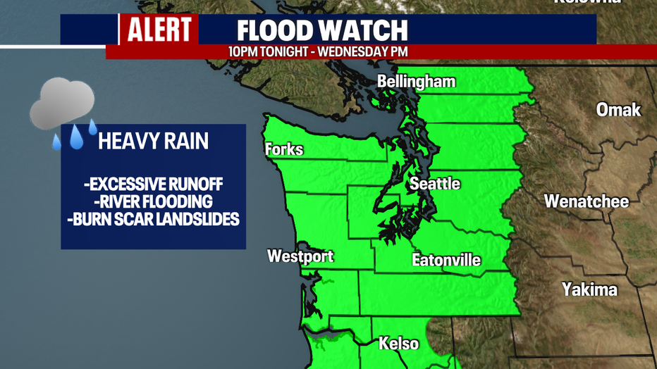
With the excessive rain in the forecast, a Flood Watch will go into effect tonight through Wednesday night for Western Washington. We will be watching for potential river flooding and burn scar landslides.
Mild temperatures and wet conditions continue through the end of the week. The forecast is currently dropping snow levels at the end of the week, bringing more snow to the passes.
