

Seattle Weather: A Cooler End to Labor Day Weekend
Seattle - A new season of college football begins tonight! It will be a perfect night at Husky Stadium for their home opener. Skies will be clear with temperatures in the mid 70s.
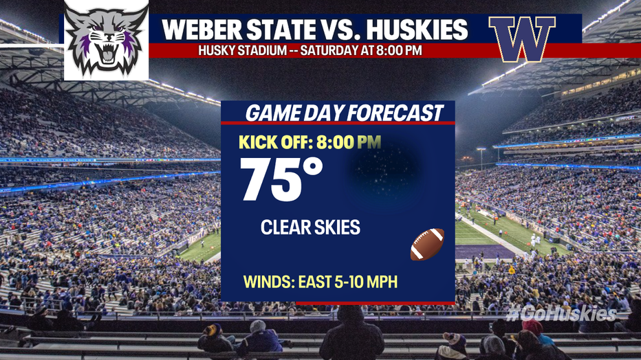
A new season of college football begins tonight! Skies will be clear with temperatures in the mid 70s.
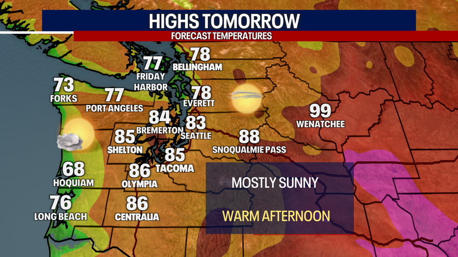
Another warm day with highs easily climbing into the 80s once again. With foggy skies tomorrow morning and mostly cloudy skies along the coast, temperatures there will be noticeably cooler.
Sunny skies and warm temperatures will continue into Sunday. A few clouds will increase in the afternoon.
Unseasonably warm temperatures and breezy winds on Sunday will lead to a higher fire risk in the Central Cascades. Relative humidity levels will also be quite low, only 15-20%. Use caution if you are out camping as embers may spread fire quickly.
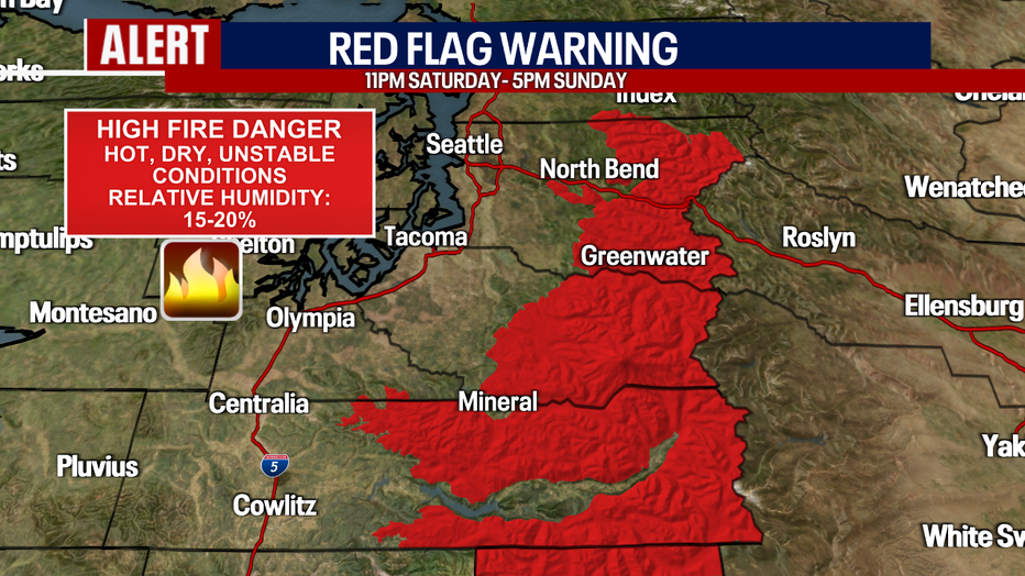
Unseasonably warm temperatures and breezy winds on Sunday will lead to a higher fire risk in the Central Cascades.
The ridge of high pressure will weaken some by tomorrow afternoon, increasing clouds around Western Washington. No rain is expected tomorrow. There is a slight chance for the mountains on Monday night.
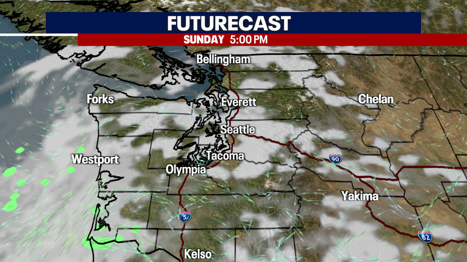
The ridge of high pressure weakens during Sunday afternoon, allowing an increase in clouds.
One more warm day before we cool off to end the Labor Day Holiday Weekend. But, the cool temperatures and clouds won't stick around for long, sunnier skies and highs back in the 80s by Thursday.
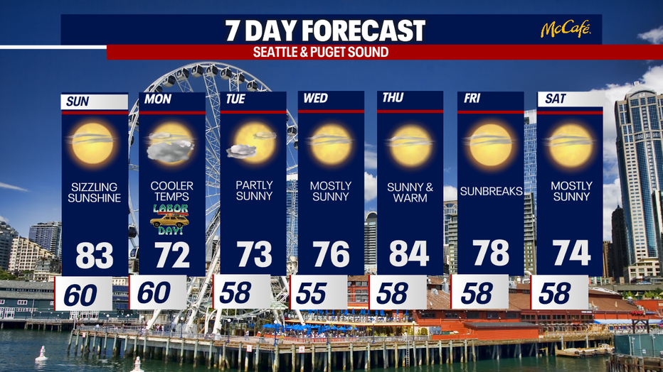
One more warm day before we cool off to end the Labor Day Holiday Weekend. (FOX13 Seattle)