

Seattle Weather: First Spring storm arrives on Tuesday
Seattle weather: cloudier skies ahead as rain returns
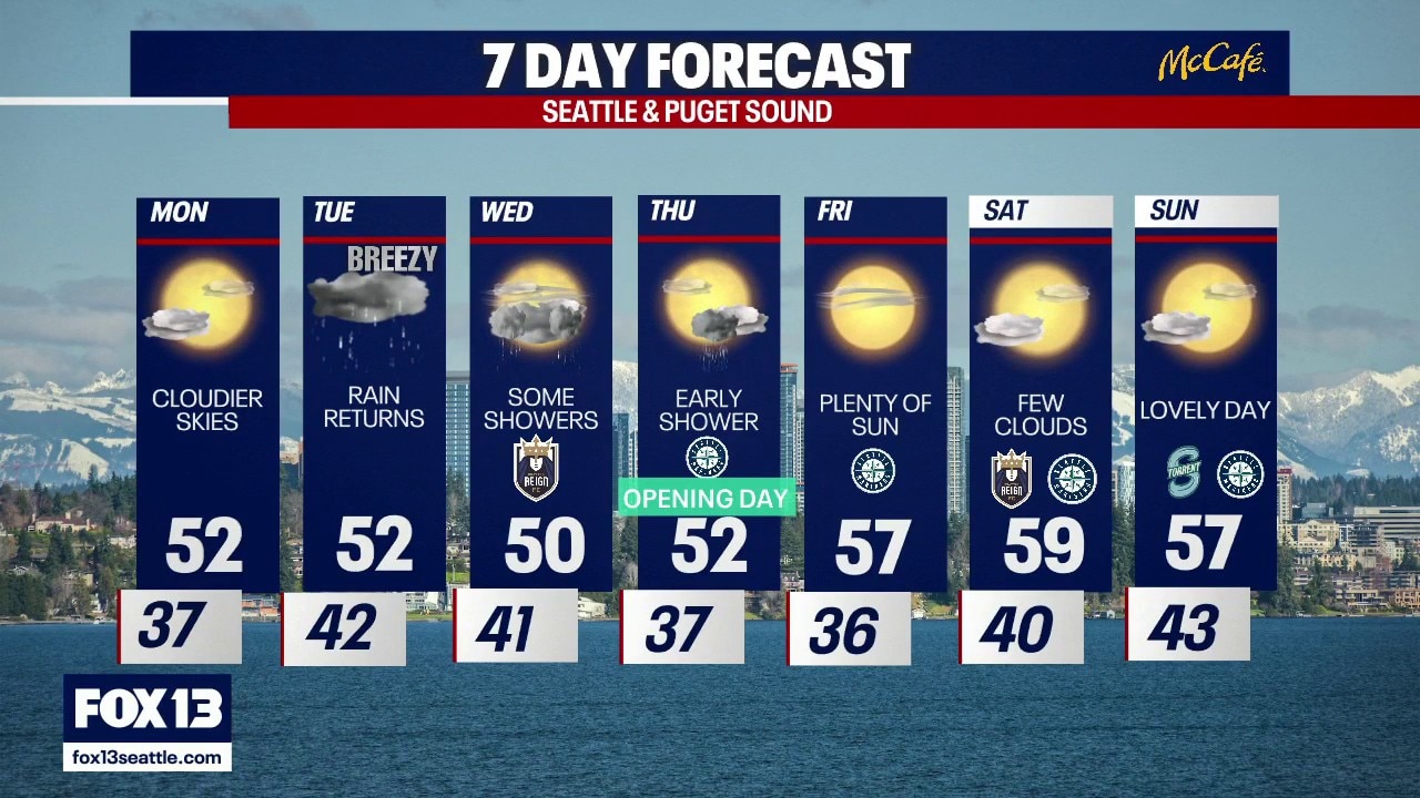
FOX 13 meteorologist Ilona McCauley has your seven-day forecast.
Seattle - The weekend brought a much-needed break from the rainy atmospheric river. We enjoyed a mainly sunny and dry sky. Monday will see a few more clouds around the area ahead of our next rainmaker, which is forecast to arrive on Tuesday.

After enjoying a dry an mainly sunny weekend, more clouds will move inland throughout the day Monday.
Grab an extra layer on Monday morning as morning lows will be chilly, near freezing in some spots. Partly cloudy and slightly cooler in the afternoon with highs near 50.

Afternoon highs remain cool to start the week.
After the latest atmospheric river sent snow levels up near 8000 and 9000 feet, much of the beneficial snow we picked up was melted. This next round of will lower snow levels back down, where a light dusting of snow is forecast to fall.

Cooler air will force snow levels to lower beginning on Tuesday with a light dusting of snow.
Winds will be gusty next week when the next system arrives on Tuesday. Some spots may see gusts nearing 45 mph.

Gusty winds picking up on Tuesday with speeds nearing 45 mph.
Hard to believe, but the new season of Mariners baseball starts this Thursday. The home open is looking good so far with an even nicer weekend ahead.

Lowland rain and mountain snow early in the week with a dry weekend ahead.