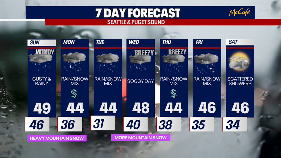
Seattle weather: Gusty and rainy with mountain snow

Seattle weather: Cascades could get several feet of snow
Fox 13 Seattle Meteorologist Ilona McCauley has your weather and mountain snow forecast for western Washington!
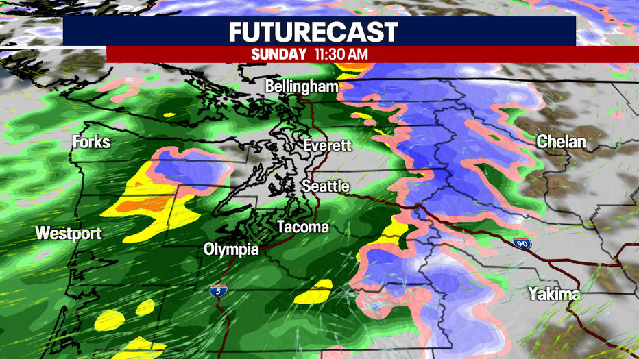
Seattle - The much advertised storm which is set to bring heavy mountain snow, lowland rain and gusty winds arrives tonight. By Sunday, the main center and cold front will move in from the north. The westerly winds will create a rain shadow over the Central Puget Sound by the Olympics. The westerly winds will also create up-sloping along the Cascades, increasing the snowfall in the mountains.
Snowfall amounts will be hefty, totaling anywhere between 1-3 feet between Sunday and Monday. Please monitor the road conditions as this snow will impact travel on all our passes the next few days.
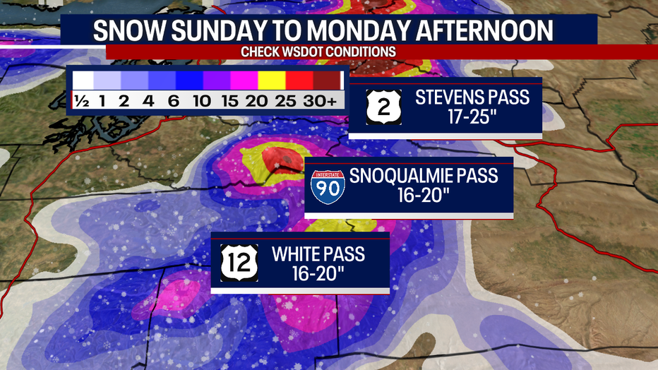
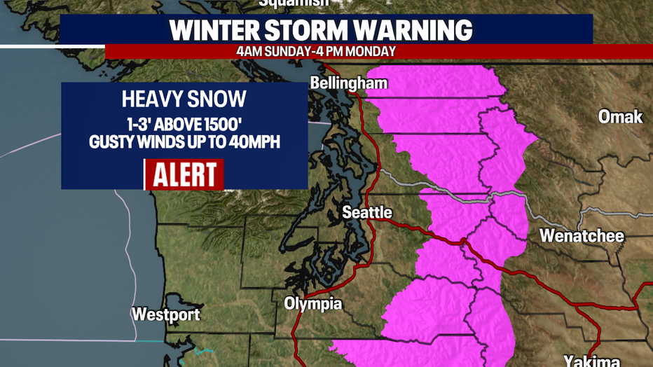
The National Weather Service has issued a Winter Storm Warning for the entire Cascade mountain range beginning Sunday morning till Monday afternoon. Pass travel will be extremely difficult with heavy snow and gusty winds.
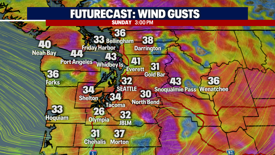
Winds will also be picking up in the lowlands. Wind gusts may near 45 mph at times, especially through the Strait.
With cloudy skies and widespread rain, afternoon highs will be a bit cooler than average, in the upper 40's to lower 50's.

A wintry mix is looking possible for early Monday morning, especially along the convergence zone which is forecast to set up in Snohomish County. Areas in our foothills may also see the mix on Monday morning. The remainder of the week is expected to be quite cool and damp with more mountain snow possible on Wednesday and Thursday.