Seattle Weather: Heavy mountain snow this weekend

Chance for showers, light mountain snow this weekend
Fox 13 Meteorologist Ilona McCauley has your weekend weather outlook for the greater Puget Sound area!
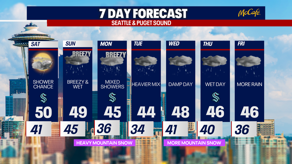
SEATTLE - We closed out the week with beautiful sunny skies and spring-like weather on Friday. Moving into the weekend, it will be weather whiplash as we are tracking cooler temperatures, windy conditions, rain and lots of snow!
The changes will begin as early as Saturday with afternoon temperatures cooling just a bit. Clouds will increase with a few on-and-off showers possible, mainly north.

Snow in the mountains will pick up beginning Saturday in the North Cascades, and then by early Sunday, we will see heavy snow throughout the entire Cascade range. It will be important to watch both the weather forecast and road conditions when traveling over the passes anytime in the coming days.
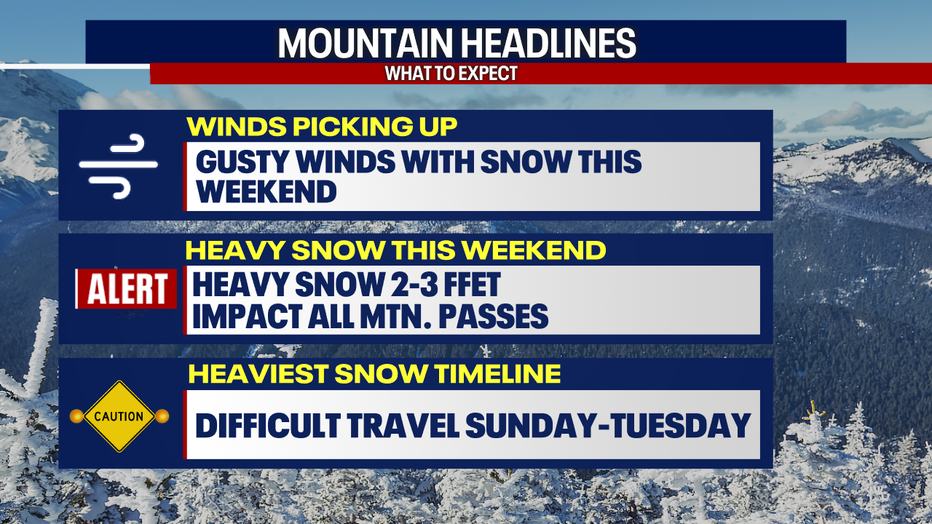
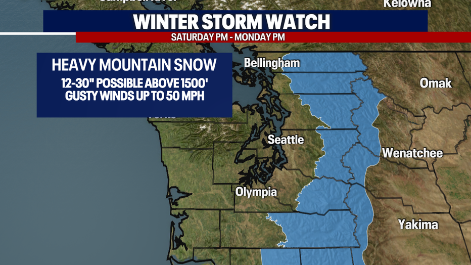
With snowfall forecast to total 2-3 feet over the next few days and winds gusting up to 50 mph through the mountains, A Winter Storm Watch is in effect Saturday through Tuesday.
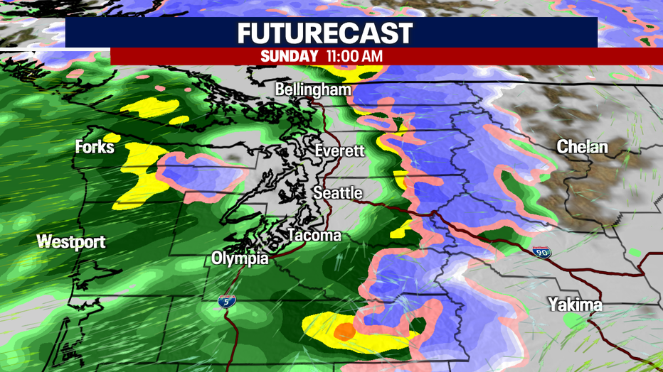
While heavy snow is forecast in the mountains, the lowlands will be seeing a lot of rain on Sunday. It may be heavy at times along with breezy winds. Rainfall amounts on Sunday will range between .25" to 1". With more rain expected for much of the week.
With cold air filtering in on Monday morning and Tuesday morning, there is still a potential we may see a wintry mix on those days. Accumulations would be light and likely on grassy areas. The upcoming week looks very wet with rain in the area till at least Friday.