

Beyond the rainbow: Here's when, where we could reach 70 degrees in Washington

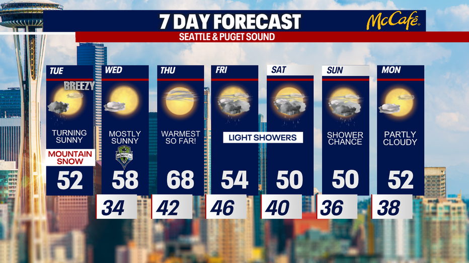
Tuesday expected to be breezy, but warmer weather on the way
It may still be breezy on Tuesday, but winds shouldn't be damaging.
SEATTLE - Western Washington is looking at a transition day Tuesday with scattered showers and breezy winds to start and more sunshine and calmer weather to finish.
The Puget Sound Convergence Zone could cause showers to linger longer in areas between Seattle and Everett today, but everywhere else will be drying out and bringing back some sunshine. Highs will be a bit warmer, in the low 50s.
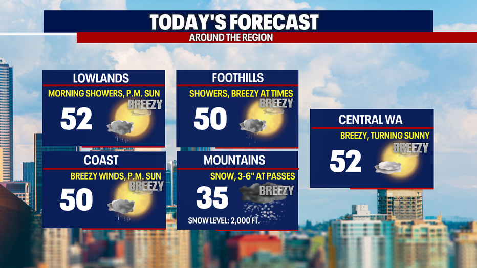
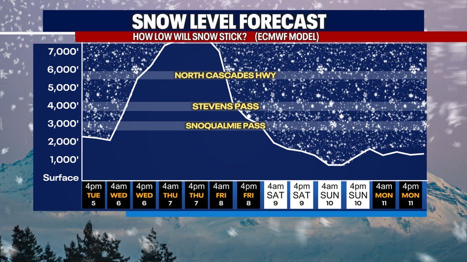
The Cascades will see another three to six inches of snow by the end of the day. Looking ahead, freezing levels will soar as high pressure takes over Wednesday and Thursday. However, by the weekend snow levels will drop again, bringing more light snow showers to the passes.
In the lowlands, a ridge of high pressure will quickly warm temperatures back to average by Wednesday. Thursday, high clouds are in the forecast with temperatures close to 70 degrees. That will likely be Seattle's warmest day so far this year. The warm weather won't last long. Much cooler temps hit on Friday through the weekend with a chance for showers.
MORE FROM FOX 13 WEATHER:
DOWNLOAD: FOX 13 Weather and News Apps
WATCH: Forecast and Radar
READ: Closures and Delays
CHECK: Latest Weather Alerts and Live Traffic Map
INTERACT: Submit your Weather Photo
DAILY BRIEF: Sign Up For Our Newsletter
FOLLOW: Lisa Villegas, Erin Mayovsky, Brian MacMillan, Abby Acone and Scott Sistek