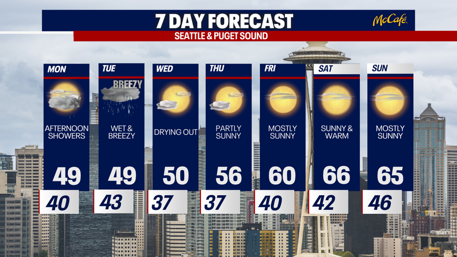
Seattle Weather: Lowland rain and mountain snow Monday
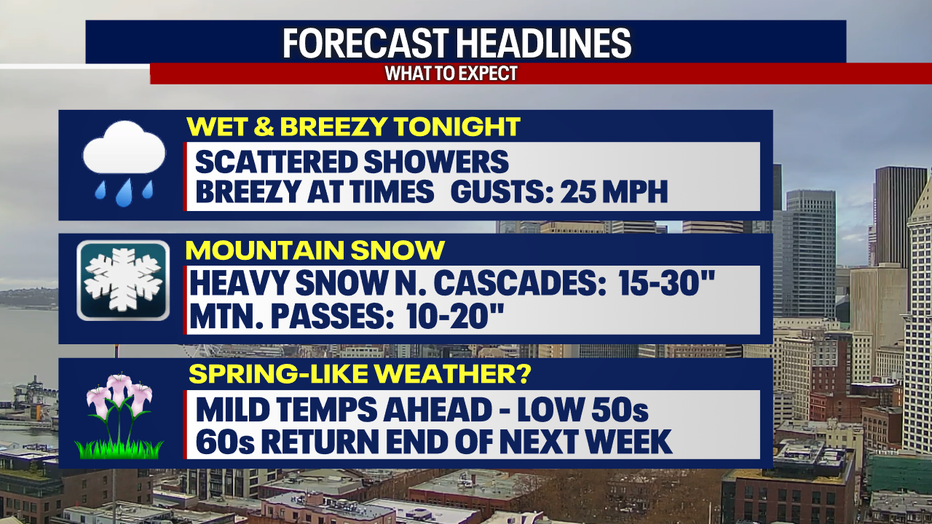
Scattered showers and mountain snow continues tonight into the work week. Winds will be breezy at times, with gusts up to 30 mph.
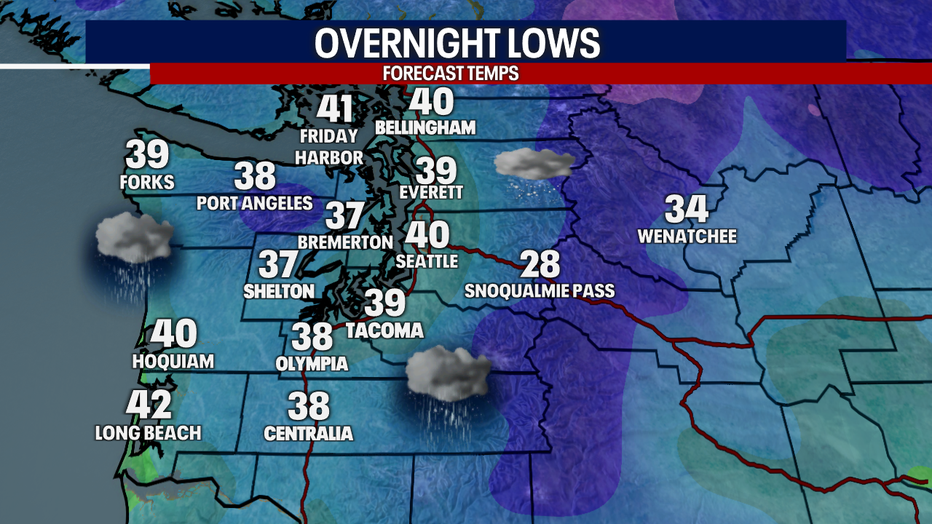
Overnight temperatures will be relatively mild, only in the upper 30s to low 40s.
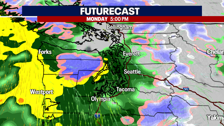
A brief lull in the showers early Monday with only a few isolated rain pockets. Rain will increase after noon.
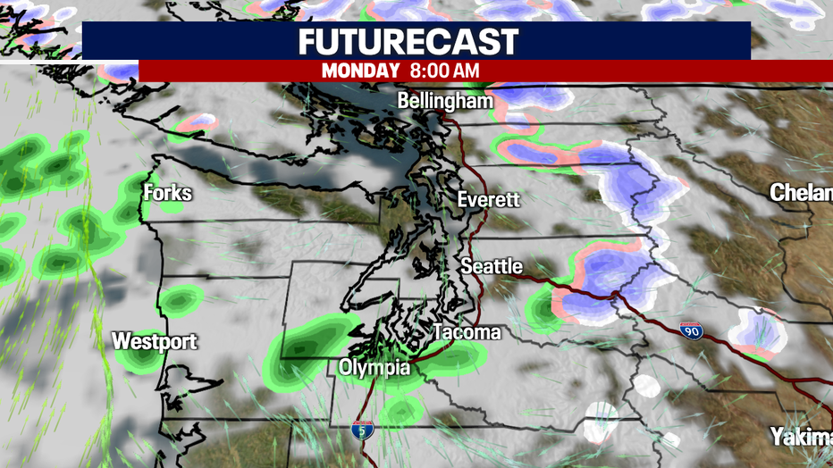
Rain will increase for the second half of the day, with more widespread showers, breezy winds and more mountain snow.
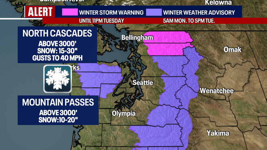
Mountain snow will continue tonight into early Wednesday. The heaviest snow will be in the north cascades, especially Skagit and Whatcom counties. Several feet of new snow will fall on the Cascades and even 10-20" of new snow for the passes.
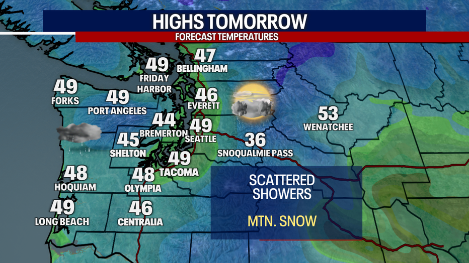
High temperatures on Monday will be the coolest of next week. We will see temperatures in the mid to upper 40s, which is slightly below average.
Skies will dry out by the end of Wednesday with temperatures slowly warming. Highs by the end of the week and into the weekend will top out above average, mid 60s!