

Seattle Weather: A Return to Dripping Skies and More Normal Highs
Seattle weather: cooler, wetter weather returns on Sunday
Fox 13 Seattle Meteorologist Ilona McCauley has your weather outlook for the week ahead!
Seattle - After enjoying a few days of spring-like weather with sunnier, drier skies, a slight chance of showers returns to Western Washington beginning tomorrow. Showers will generally be very light with amounts only totaling about .01-.15" over the next two days.

Spotty light showers will be possible around Western Washington on Sunday. Amounts will be very light.
The coast and the foothills have the best chance at seeing on and off showers during the day on Sunday. The main disturbance will be far south of us, so only a few wrap-around showers will make it into our area. Snow levels will begin to lower back to around 3500'. Light snow showers near the passes and on ski slopes will total about 1".

After spring-like weather the last few days, light rain returns to our area. (FOX13 Seattle)
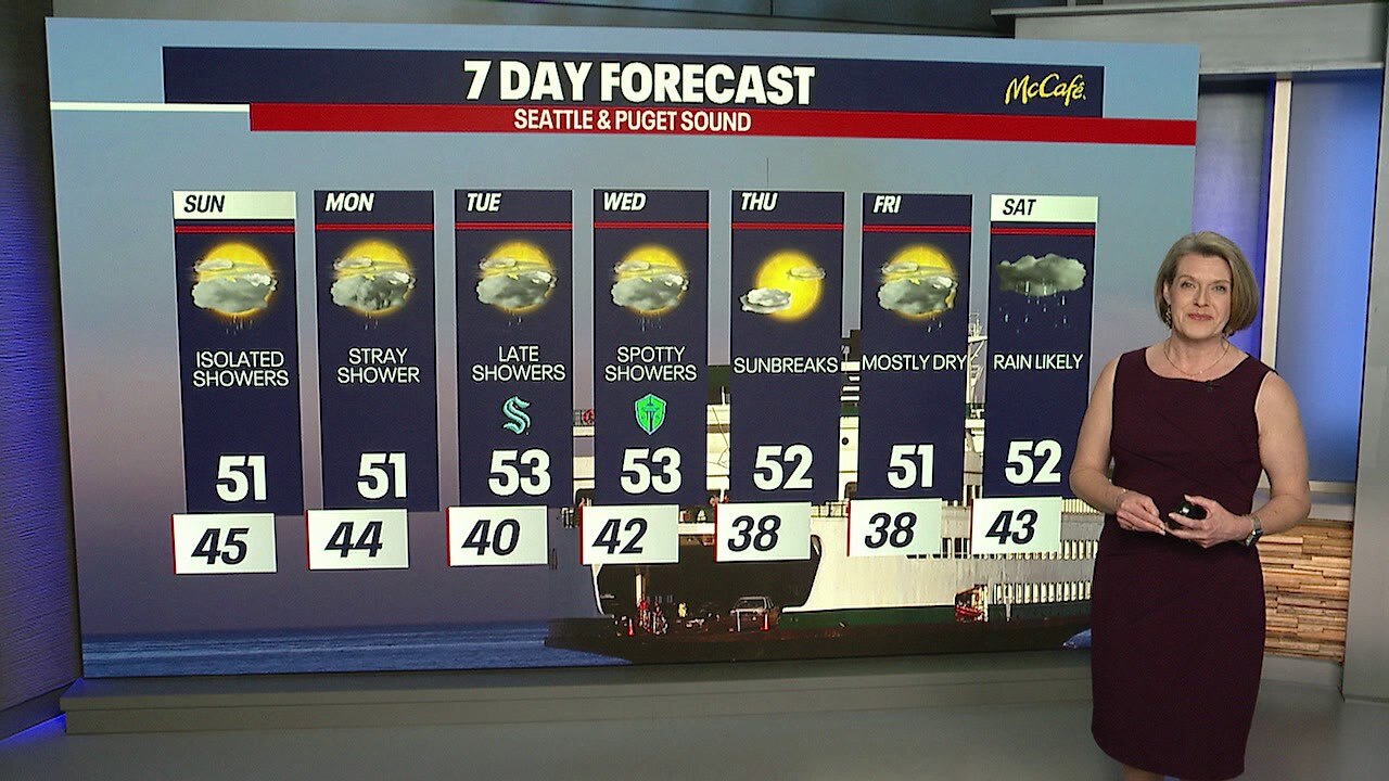
After 4 straight days of highs of 60 degrees or warmer, we will cool back down to near-normal afternoon highs in the low 50s.

Afternoon highs will return to normal beginning Sunday.
An unsettled week ahead with slight chances for showers through Wednesday. We will enjoy sunnier skies on Thursday before more widespread rain moves in by next weekend.

A return to scattered showers and temperatures near normal for the upcoming week. (FOX13 Seattle)