Seattle Weather: Mixed rain & snow showers to start Friday

Rain-snow mix hits Puget Sound this weekend
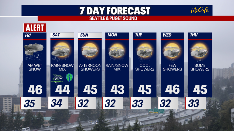
It's going to be wet all week long, but FOX 13 Meteorologist Ilona McCauley is also tracking snow in the area, starting this weekend.
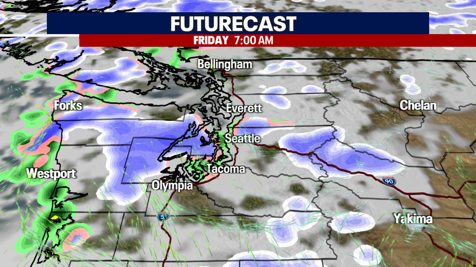
Tracking overnight snowflakes and rain showers this evening as cold air has moved in, and snow levels have dropped. Can't rule out snowflakes this evening around Western Washington. Looking at mainly light accumulation, but can't rule out a few inches by Friday morning.
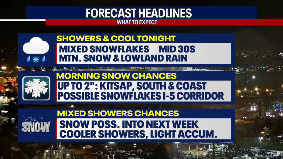
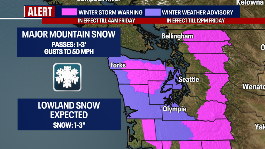
Winter weather alerts are in place for the Cascades and parts of Western Washington as snow accumulation is expected. Several more feet of snow for the Cascades and several inches for the lowlands.
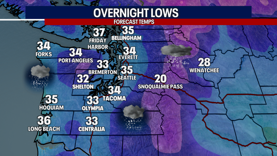
Overnight lows will drop into the low 30s, which will also cause snow to form and stick on some surfaces. Watch for slick spots in the morning.
The best chance of snow to accumulate will be early Friday morning between 5-7 a.m., which is also the coldest part of the day. Some models want to bring snow not only over areas west of Puget Sound, but parts of the I-5 corridor.
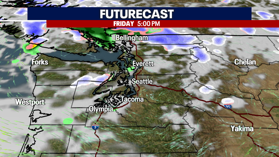
Skies will start to dry out for the evening as rain and snow chances start to decrease. We could even see a few sun breaks before the sun goes down.
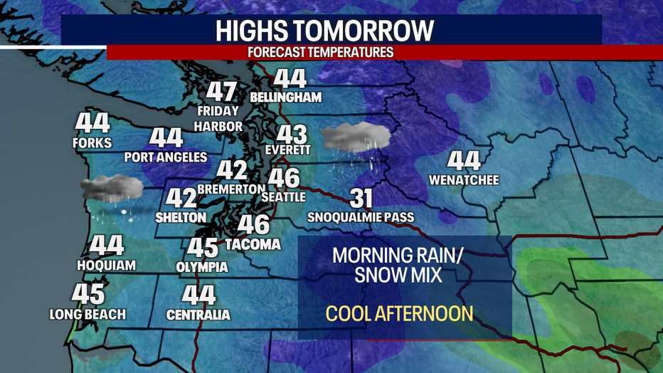
Highs Friday will be again below the seasonal average with temperatures only topping out in the low to mid 40s.
Cool and wet conditions will stay in the forecast through the weekend and into early next week. Mixed rain and snow showers will stay in the forecast, especially on Monday and possibly Tuesday as well. Stay tuned!