

Seattle weather: Mountain snow Saturday, flooding concerns ahead

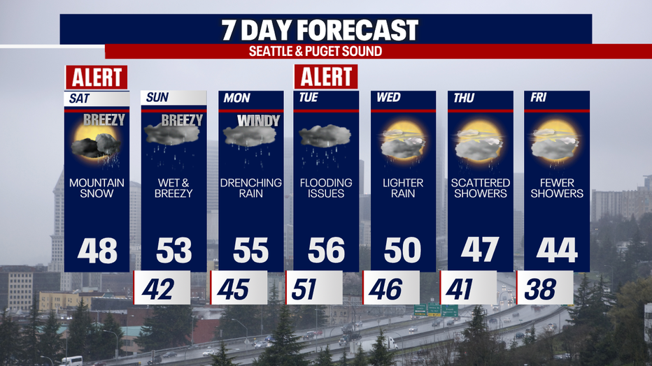
Heavy mountain snow, wet & breezy weekend conditions
Seattle weather: Heavy mountain snow, wet & breezy weekend conditions
After a windy morning, we're tracking on-and-off snow for the mountain passes today. As temperatures rise, thanks to the arrival of two atmospheric river events from Sunday to Tuesday, much of the recently-accumulated snow will melt. There's also a big concern over various flooding threats from Sunday into Wednesday.
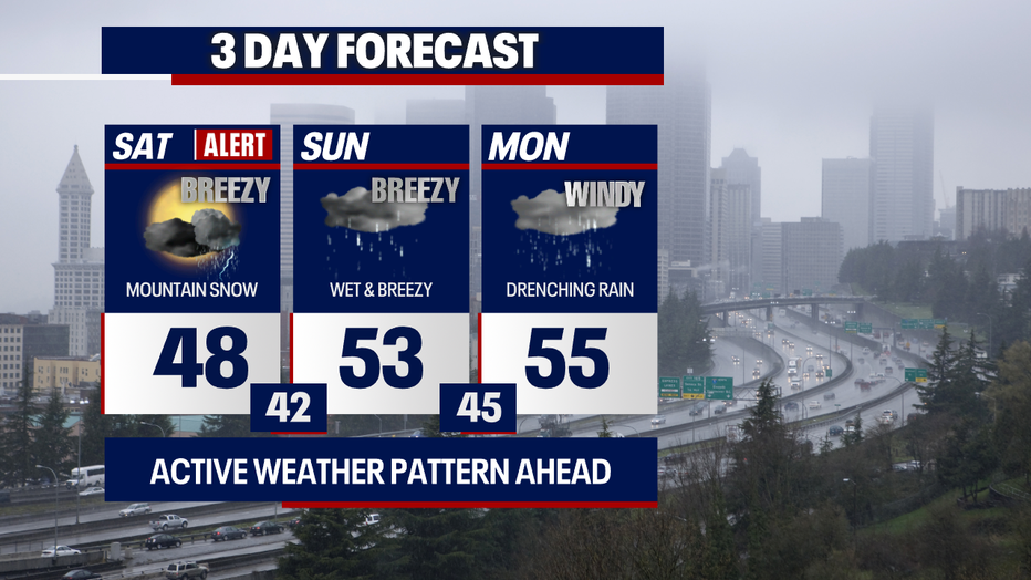
Highs today reach the upper 40s. A few neighborhoods could experience the low 50s. It will be slightly breezy with sunbreaks and showers.
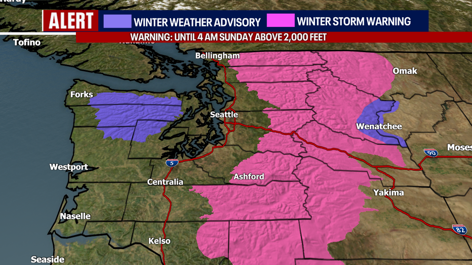
Travelers, make sure to check WSDOT conditions before driving over the passes today. Avalanche danger is also exceptionally high in the backcountry this weekend. A Winter Storm Warning remains in effect for the Cascades until 4 a.m. Sunday. A Winter Weather Advisory lingers for the Olympics until 4 p.m. today. Strong winds will create the blowing-snow effect, lowering visibility.
As warmer and wetter weather surges into Western Washington on Sunday, snow levels will rise dramatically. As rounds of rain whip the region in the days ahead, rivers, streams and creeks are particularly vulnerable to flooding. For the primary rivers around the region, minor to moderate flooding is expected in the days ahead. At this point, major flooding of local rivers looks like the exception rather than the rule. Stay tuned because this forecast has plenty of time to change. Right now, it looks like the river flooding (for most) will start around Monday. However, the Skokomish River could flood on Sunday.
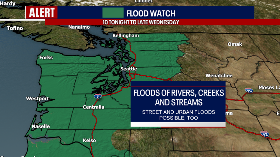
For this reason, a Flood Watch is in effect from tonight through Wednesday evening. Remember: flooding, along with many other weather events, is highly dependent on where the heaviest bands of precipitation develop. It also hinges on the timing of when snow in the mountains changes over to rain.
Up to 10 inches of rain could fall over the mountains from Sunday to early Wednesday with 6–8 inches for the foothills, 2–4 inches for the interior lowlands and 4–6 inches for the coast.
Urban and street flooding is a real possibility as well during this time. We'll need to monitor burn scars for potential debris flows, landslides and flooding, too. Stay tuned!
Wind will be a factor in our forecasts. Gusts will be most forceful late Monday to early Tuesday, but there's still some uncertainty about how strong the winds could be. We'll keep you posted on the latest.
Thanks so much for choosing FOX 13.
Take care,
Meteorologist Abby Acone
Follow me on Twitter @abbyacone, Instagram @abbyaconewx, TikTok @abbyaconetv and Facebook (Meteorologist Abby Acone)