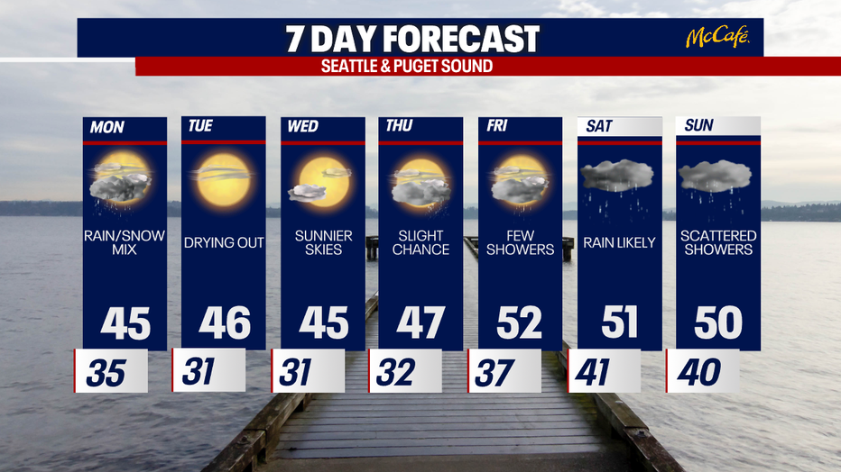
Seattle weather: Rain/snow showers taper tonight, dry and cool Tuesday

Seattle weather: Scattered mixed showers tonight, drier & cool Tuesday
Fox 13 Meteorologist Claire Anderson has your weather forecast for the greater Puget Sound area!
SEATTLE - We have seen some pretty good snowfall totals in the North Cascades over the last several days, with almost a foot of new snow for Mt. Baker. A few inches of snow fell this morning around the North Sound, from Arlington to the Canadian border.

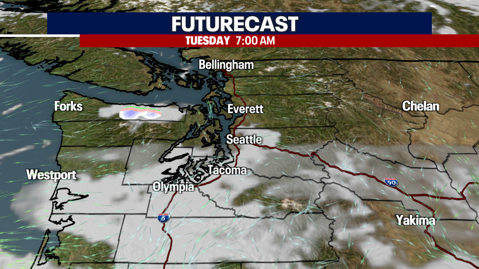
Tonight, we will still see a few scattered showers mixed in with snowflakes, but they will slowly decrease this evening. Temperatures will get chilly and areas of patchy fog develop into Tuesday morning.
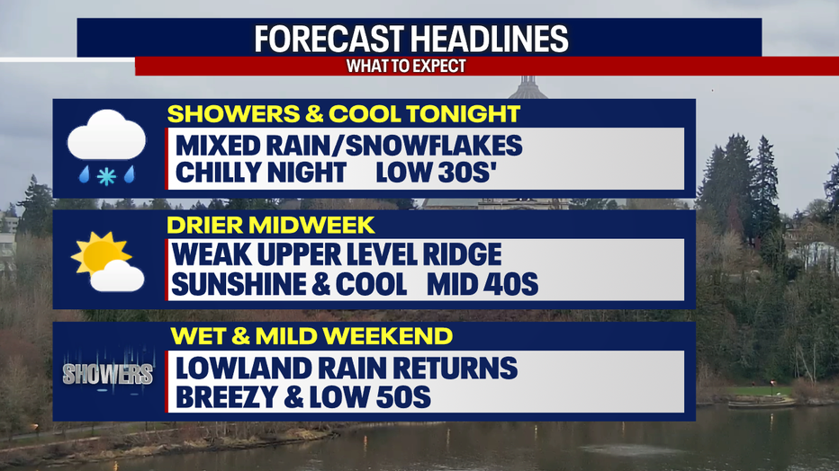
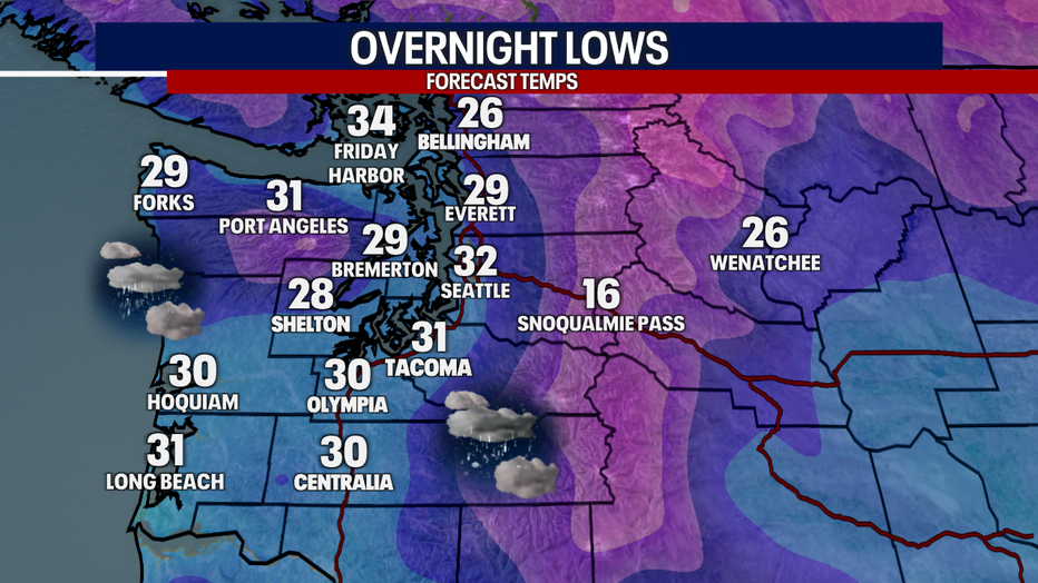
Lows tonight will drop into the upper 20s to low 30s, with drying skies. A few light snow flurries are possible due to lingering moisture, but it will mainly clear and dry.
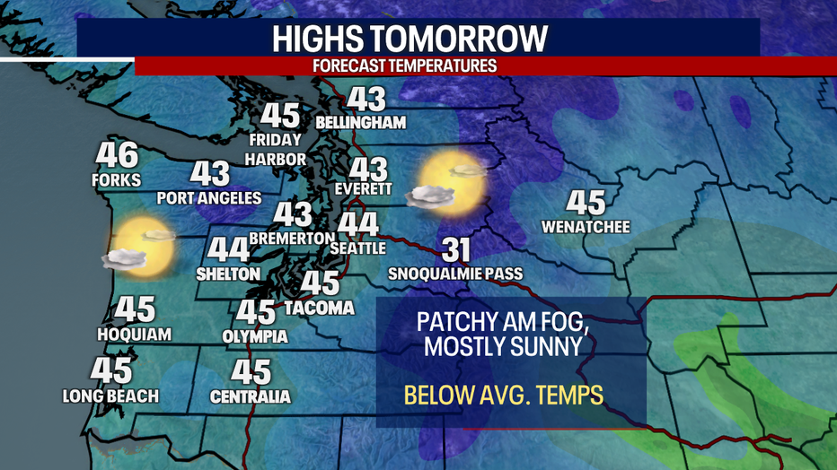
A few morning clouds and areas of patchy fog to wake up to Tuesday morning. More sunshine is expected north and into the afternoon.
High temperatures on Tuesday will be cooler again, only topping out in the mid to low 40s.
Skies will stay dry and temperatures will stay cooler through Thursday with a slight chance of mountain showers by the end of the week. Lowland rain and milder temperatures return for the weekend.